Jereka - Vodnikov razglednik
Starting point: Jereka (619 m)
| Latitude/Longitude: | 46,29670°N 13,96180°E |
| |
Walking time: 1 h 15 min
Difficulty: easy marked way
Elevation gain: 398 m
Elevation difference along the route: 400 m
Map: TNP 1:50.000
Recommended equipment (summer):
Recommended equipment (winter): crampons
Views: 10.810
 | 2 people like this post |
Access to starting point:
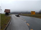
A) From the highway Ljubljana - Jesenice, we take the exit Lesce, then continue driving towards Bled and further to Bohinj. After the settlement Bitnje, which the main road bypasses on the left side, we continue sharply right in the direction of Jereka and Pokljuka. Further on, the road first steeply ascends, then after Korita gradually flattens and brings us to the intersection by the bus station, where we continue right in the direction of Pokljuka, Koprivnik and Jereka (straight Srednja vas). Immediately after the intersection, we arrive in Jereka, but from the intersection in front of the church we continue straight towards Pokljuka (left Podjelje). Through the village we drive past a few more houses, then we arrive at the bridge over Jerečica, where the described footpath starts. At the starting point there are no arranged parking places.
B) From Železniki or Podbrdo we drive to Bohinjska Bistrica, then continue driving in the direction of Bled. Soon after the Petrol gas station, which is located just a little after Bohinjska Bistrica, we continue driving left in the direction of Pokljuka and Jereka. Further on, the road first steeply ascends, then after Korita gradually flattens and brings us to the intersection by the bus station, where we continue right in the direction of Pokljuka, Koprivnik and Jereka (straight Srednja vas). Immediately after the intersection, we arrive in Jereka, but from the intersection in front of the church we continue straight towards Pokljuka (left Podjelje). Through the village we drive past a few more houses, then we arrive at the bridge over Jerečica, where the described footpath starts. At the starting point there are no arranged parking places.
Route description:
After the bridge over Jerečica we notice the first signs for Vodnikov razglednik, which direct us left onto the path that quickly ascends to the next houses, where we cross two successive asphalt roads. The path continues on the old paved path from the 18th century and initially continues along a smaller stream. The path, which runs through the forest, soon turns slightly to the right, then crosses the asphalt road a few more times. Higher up, when we again reach the asphalt road, we walk for a short time on the road towards Vogar and Krniški Lom, but the signs for Vodnikov razglednik quickly direct us right onto the old paved path, which we follow at the junctions in the direction of the blazes. When the path flattens and brings us to the edge of the forest, a path from Koprivnik joins us from the left, and we continue right, back into the forest. There follow a few more minutes of a slightly steeper path, and the path, alongside which a wooden fence helps us, quickly brings us to the panoramic summit, on which there is a somewhat larger cross.
Description and pictures refer to the condition in the year 2016 (January).

Photos:
 1
1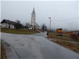 2
2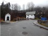 3
3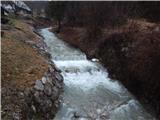 4
4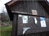 5
5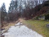 6
6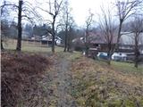 7
7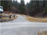 8
8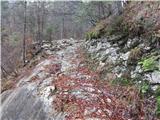 9
9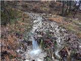 10
10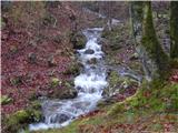 11
11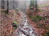 12
12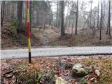 13
13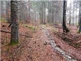 14
14 15
15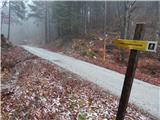 16
16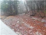 17
17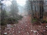 18
18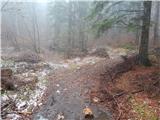 19
19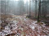 20
20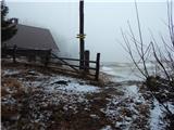 21
21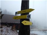 22
22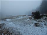 23
23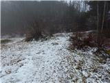 24
24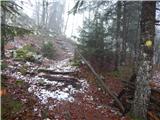 25
25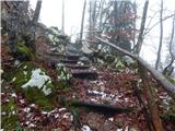 26
26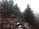 27
27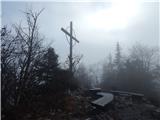 28
28 29
29
Discussion about the trip Jereka - Vodnikov razglednik
|
| J.P.14. 07. 2020 |
The start of the hiking trail is currently overgrown and a bit harder to "spot". You can park at the first sharp bend after the bridge. Space for about two cars. Otherwise, a nice short trip with a view of the glacial valley. Regards
|
|
|
|
| exwannabe25. 04. 2021 17:16:59 |
The path is very nicely arranged and well marked, since the Juliana Trail also runs along it. The start of the path is not hard to find at all, as the path goes left uphill right after the bridge (facing towards Pokljuka). It is true that there is no parking space at the starting point, so I don't know where to park the car in that case, luckily I was on two wheels. For such transport there is enough "parking" after the bridge.
|
|
|
To post a comment you must log in:
If you do not yet have a username, you must first
register.