Starting point: Jeršiče (650 m)
| Latitude/Longitude: | 45,77480°N 14,23050°E |
| |
Walking time: 20 min
Difficulty: easy marked way
Elevation gain: 113 m
Elevation difference along the route: 113 m
Map: Snežnik 1:50.000
Recommended equipment (summer):
Recommended equipment (winter):
Views: 10.229
 | 1 person like this post |
Access to starting point:
A) From the Koper - Ljubljana highway, take the Postojna exit, then drive towards the center of Postojna. In the mentioned place we will notice signs for Pečna reber and railway station, which point us to the right, then approximately 200 meters before the railway station we turn left (crossroad isn't marked) on the road which soon leads over the highway. On the other side of the highway we come to a crossroad, where a road towards Stara vas branches off to the right, and we continue in the direction of Javornik and Sveta Trojica. A little further, by the NOB monument, the road towards Pečna reber branches off to the left, and here on an appropriate place we park.
B) From the Ljubljana - Koper highway take the Unec exit, then continue driving towards Unec and Cerknica. In the settlement Unec leave the main road towards Cerknica and continue driving right in the direction of Postojna. Further, drive on a somewhat narrower road which continues parallel with the highway. When after a few kilometers through the underpass we arrive on the other side of the highway, at the first crossroad continue straight. When we return to the original side of the highway, at the crossroads continue left i.e. in the direction of Pečna reber and Sveta Trojica. When soon we arrive at the crossroad, where the road towards Pečna reber branches off to the left, and to the right the road continues towards Sveta Trojica, between both roads we will notice the NOB monument. Park at an appropriate place near the crossroad.
Route description:
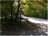
At the crossroad we notice signs for Pečna reber, which point us to the left on a footpath which starts moderately to steeply ascending through the forest. After a short ascent, we step on the road and follow it for a short time to the left, then on the right we notice a well-beaten footpath (straight Koča Mladika) on which we continue a gentle ascent on a more and more panoramic grassy slope. We soon get to the panoramic ridge and right below the top we continue left (right transmitters, and the ascent to the very top isn't possible) and we slightly descend to the nearby cross and a wish bell. Follows a light descent and the path brings us to the road, at the end of which there is mountain hut Koča na Pečni rebri (from the mountain hut is a nice view towards Postojna).
We can descend past the peak on an asphalt road which leads us past the information boards Natura 2000.
Photos:
 1
1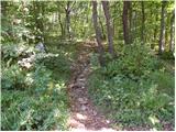 2
2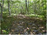 3
3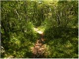 4
4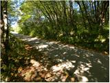 5
5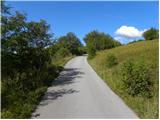 6
6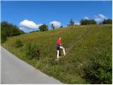 7
7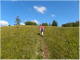 8
8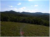 9
9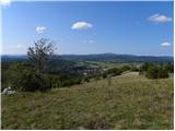 10
10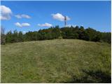 11
11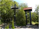 12
12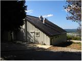 13
13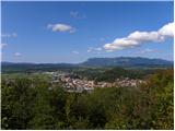 14
14
Discussion about the trip Jeršiče - Pečna reber
|
| bizgo9331. 03. 2021 |
Nice, short trip. I myself went to Pečna reber from the center of Postojna and left the road a bit before the described path (about 400 m below the Mladika hut). These last 400 m are quite steep, the rest is more or less a walk.
But from the top and from the hut there is a beautiful view of Javorniki, Pivka and Postojna with their basins and Nanos. Nice walk to rest the nerves a bit
At the hut there is also a stamp (under the logbook box) and a logbook.
|
|
|
|
| šoni2. 08. 2025 09:05:38 |
THE ONLY MARKING IS AT THE HUT ON THE BOX WITH THE LOGBOOK. YOU COME FROM THE TRAIN AND HAVE NO IDEA WHERE TO GO, AND YOU HAVE TO GO OVER/UNDER THE HIGHWAY AND RAILWAY. SO THE PATH IS ONLY FOR LOCALS. VERY POOR JOB BY PD POSTOJNA.
|
|
|
To post a comment you must log in:
If you do not yet have a username, you must first
register.