Jesenica - Porezen (via Dom na Poreznu)
Starting point: Jesenica (693 m)
| Latitude/Longitude: | 46,14940°N 13,95030°E |
| |
Route name: via Dom na Poreznu
Walking time: 3 h
Difficulty: easy marked way
Elevation gain: 937 m
Elevation difference along the route: 965 m
Map: Škofjeloško in Cerkljansko hribovje 1:50.000
Recommended equipment (summer):
Recommended equipment (winter): ice axe, crampons
Views: 2.450
 | 1 person like this post |
Access to starting point:
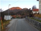
A) First, we drive to the center of Cerkno (to here from the road Idrija - Most na Soči, or from Gorenja vas and Žiri over the mountain pass Kladje, or from Zali Log through Davča...), and then we continue driving in the direction of Zakojca. Just a few meters after turning in the direction of Zakojca, a road branches off to the left towards the village Zakriž, through which a steep shortcut leads, and we continue on the road which continues along the stream Zapoška. Higher up, the road leads through the villages Trebenče and Gorje, and then after crossing the slopes, we bypass the village Zakriž on the upper side, where the aforementioned shortcut joins. A little further ahead, the road turns even more to the right, and then after a few kilometers of traversing we arrive at the beginning of the village Jesenica, where we notice the first signs for the saddle Vrh Ravni, Kojca and Porezen, which point to the right, and we continue left towards the central part of the village, where we park in a suitable spot by the ecological island. At the starting point, there is also a bus stop and a memorial plaque.
B) From Most na Soči or Bača pri Modreju we drive towards Idrija, and then past the settlement Reka, right before crossing the stream Jesenica we continue sharply left, and at the next intersection sharply right in the direction of Orehovška grapa. After a few kilometers of a relatively steep road we arrive at the small village Orehek, a little above the village we join the transverse road below Kojca, which we follow to the right. When we arrive at the village Jesenica, we park in a suitable spot by the ecological island. At the starting point, there is also a bus stop and a memorial plaque.
C) From Bača pri Modreju we drive towards Podbrdo or vice versa, and then in the settlement Grahovo ob Bači we turn in the direction of Zakojca and Bukovo. We then drive for quite some time on a winding and ascending road, and at the marked intersection we continue right in the direction of Cerkno (left Zakojca). This is followed by traversing Kojca, and then when we arrive at the village Jesenica, we park in a suitable spot by the ecological island. At the starting point, there is also a bus stop and a memorial plaque.
Route description:
A few steps southeast of the starting point we notice signs for Kojca and Porezen, which direct us left onto an asphalt road that begins to ascend steeply through the village. With views of Kojca we ascend past a few houses, then the asphalt ends and the path continues past individual houses. Behind the last house the road turns into a cart track, along which in a few minutes of further walking we ascend to the saddle Vrh Ravni, where numerous paths intersect.
From the saddle Vrh Ravni we continue right in the direction of Porezen and the alpine pasture Otavnik (sharply left Košena, left Kojca, slightly left Čemažar, straight Zakojca, slightly right Podčrnovrhar and sharply right the access road to Jesenica) and continue along the ascending macadam road, which further leads along the slopes of the peak Na krogu (1050 m). Higher up the road passes to the northern slopes of Ritovščica (1156 m), where at a small quarry it changes into a wide cart track. This is followed by a traverse ascent through the forest, which takes us above the bed of Otavnik, then we exit the forest, where we spot a hunting hut ahead, to which we ascend in two hairpin turns.
From the hunting hut we continue along the cart track, which climbs to the southern ridge of Otavnik. We soon leave the mentioned partly forested ridge, as the path turns slightly left, then ascends diagonally across an increasingly panoramic pasture. After a few minutes of diagonal ascent we arrive at the upper part of the alpine pasture Otavnik, where on the left we notice a hunting observation post, straight ahead across the ridge a shepherd's hut.
From the alpine pasture we continue towards Porezen, thus bypassing the nearby shepherd's hut on the upper right side. Behind the shepherd's hut the path enters a strip of forest and continues in a gentle descent along the northwestern slopes of Otavnik. When the descent ends we arrive at the saddle between Porezen and Otavnik, the path a little higher turns left and begins a diagonal ascent along the steeper slope of Porezen. The wide path, which when dry poses no major danger, with fine views of Zakojška grapa and the surrounding mountains, brings us in a few minutes to the junction on the western ridge of Porezen.
From the junction, where paths from Hudajužna and Podbrdo join, we continue slightly right in the direction of Dom na Poreznu and Petrovo Brdo (the sign otherwise points in the same direction as the summit of Porezen, but we continue slightly more left). The path ahead leads past a solitary spruce, behind which we continue the gentle diagonal ascent below the summit part of Porezen. A little further on we cross a grazing fence, then with fine views of the Julian Alps in a few minutes of traversing we arrive at the bivouac and a few steps further to the Mountain Hut Dom na Poreznu (the last section of the path to Dom na Poreznu is dangerous for slipping in snow).
At the hut we continue sharply right and ascend to the panoramic summit of Porezen in about 5 minutes of diagonal ascent.
The description and photos refer to conditions in 2015 (May and December).

Photos:
 1
1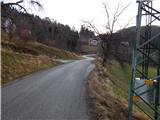 2
2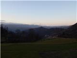 3
3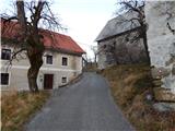 4
4 5
5 6
6 7
7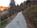 8
8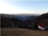 9
9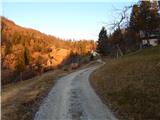 10
10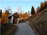 11
11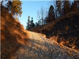 12
12 13
13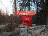 14
14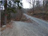 15
15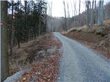 16
16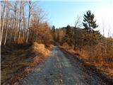 17
17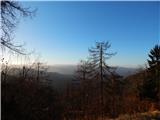 18
18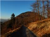 19
19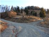 20
20 21
21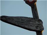 22
22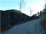 23
23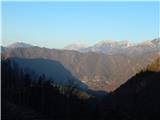 24
24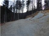 25
25 26
26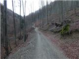 27
27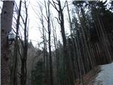 28
28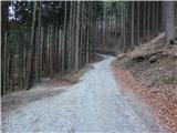 29
29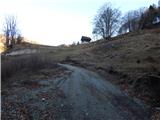 30
30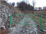 31
31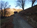 32
32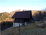 33
33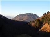 34
34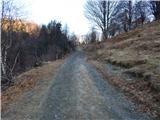 35
35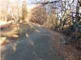 36
36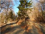 37
37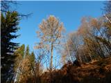 38
38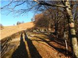 39
39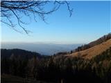 40
40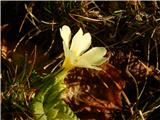 41
41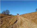 42
42 43
43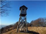 44
44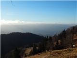 45
45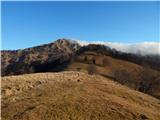 46
46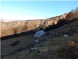 47
47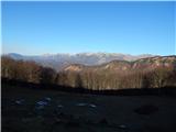 48
48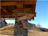 49
49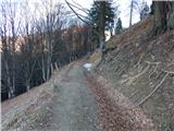 50
50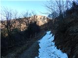 51
51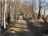 52
52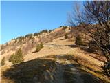 53
53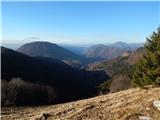 54
54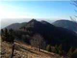 55
55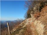 56
56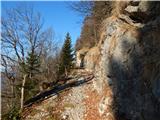 57
57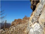 58
58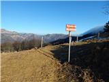 59
59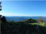 60
60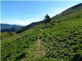 61
61 62
62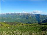 63
63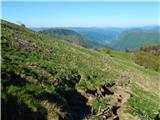 64
64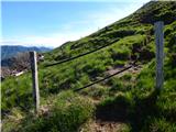 65
65 66
66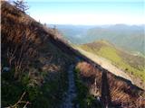 67
67 68
68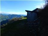 69
69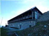 70
70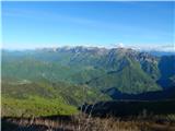 71
71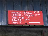 72
72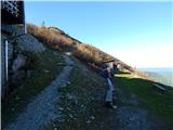 73
73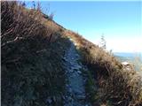 74
74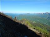 75
75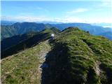 76
76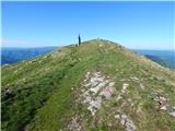 77
77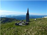 78
78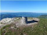 79
79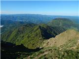 80
80 81
81
Discussion about the trip Jesenica - Porezen (via Dom na Poreznu)
To post a comment you must log in:
If you do not yet have a username, you must first
register.