Jesenice (Ukova) - Španov vrh
Starting point: Jesenice (Ukova) (600 m)
| Latitude/Longitude: | 46,43620°N 14,06480°E |
| |
Walking time: 2 h
Difficulty: easy unmarked way
Elevation gain: 734 m
Elevation difference along the route: 736 m
Map: Karavanke - osrednji del 1 : 50.000
Recommended equipment (summer):
Recommended equipment (winter): ice axe, crampons
Views: 8.925
 | 4 people like this post |
Access to starting point:
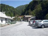
From the Ljubljana - Jesenice highway, take the Lipce exit, where we drive right towards Jesenice. In the settlement Slovenski Javornik at the intersection with traffic lights, we turn left towards the center of the town. At the second traffic-light intersection (by the gymnasium), we drive right back towards Tomšičeva cesta past the primary school on the left. Behind the school, we cross the pedestrian crossing and immediately turn into the first (narrower) street on the left. When we ascend it for some 10 m, on the right we see the marked parking lot. Here is our starting point.
Route description:
From the parking lot, we continue on the road uphill, after which after some 10 m on the left we notice the Ukova outdoor swimming pool, and on the right the road which branches off uphill towards the north into the forest.
We step onto the latter and follow it for a short time, i.e. to the right turn before which there is on the same side a fenced water intake. On the other - left side we step onto the path which cuts the double turn of the road which we left. Here we encounter the first blazes of the path Ukova - Dom Pristava. Quite quickly we again cross the road, and step onto the path which begins to ascend towards the north. When it begins to turn left, it joins the cart track along which we notice a signpost. Here we turn right onto the cart track, which quickly brings us to a small bridge over the Ukova stream. Already immediately after we have crossed it, on the left we spot the trail which leads uphill towards the north. By stepping onto it, we leave the marked path, and on the right by the stream we notice a bench. After some steps uphill, it seems to us that the path peters out or ends in the stream bed, but in reality at this spot it turns sharply left, steeper uphill. While we gain elevation metres, on our right we hear the rushing of the left branch of the Ukova stream, which occasionally winds deep below us. After a while, when the path widens somewhat, the steepness eases, on the tree by the path on the left we encounter a small sign (cross). Soon after that, when we have noticed a smaller waterfall and a larger rock on the right, the path brings us near the old water intake, past which our path continues in the same direction. Somewhat higher, two smaller, old and therefore also less reliable wooden small bridges await us. Soon after the second, even before the indicated path directs us again to the bed of the main stream, by the smaller stream we turn left uphill. Over partly wet terrain the path soon again brings us near the main stream, along which we ascend to the forest road in the immediate vicinity of Jeseniški Rovt on our right, which we can also visit in passing. When we step onto the mentioned road, we turn left along it, which soon brings us to the surfaced forest road Prihodi - Križovec. We turn right and walk along it for 10 - 15 min, after which on its left side we notice a cart track which turns sharply left uphill through a shorter stretch of forest. When we step onto it, it quickly brings us to an open clearing, where after some 10 m it turns first right and soon (near the weekend hut) also left. Then we miss the right branch and continue along the cart track across the clearings in the NW direction. On a very long right bend we miss also the left branch, where we turn into the other - eastern direction. When we have crossed a shorter stretch of forest, we again find ourselves on an open meadow or pasture, where the path turns left in the northern direction. Our cart track on the pasture almost disappears, in the mentioned direction but uphill we notice yet another ascending cart track or path. While we approached it, we imperceptibly crossed the marked path Smučarski dom Črni Vrh - Dom Pristava. Along this cart track, although it soon disappears, we reach the saddle on the ski slope below the summit itself, or the upper station of the Španov Vrh chairlift, which is located on our right, distant only a few minutes' walk uphill.

Photos:
 1
1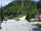 2
2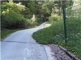 3
3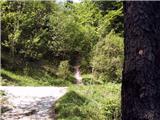 4
4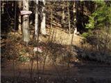 5
5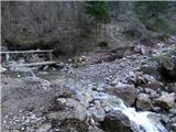 6
6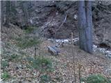 7
7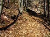 8
8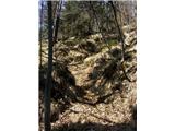 9
9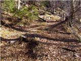 10
10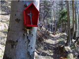 11
11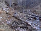 12
12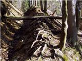 13
13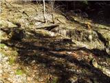 14
14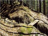 15
15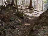 16
16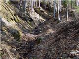 17
17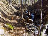 18
18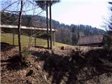 19
19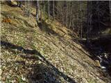 20
20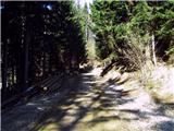 21
21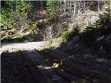 22
22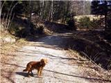 23
23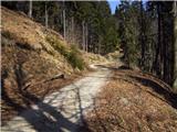 24
24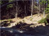 25
25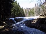 26
26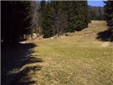 27
27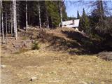 28
28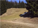 29
29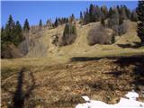 30
30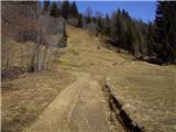 31
31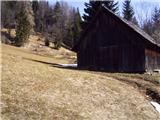 32
32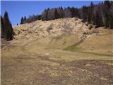 33
33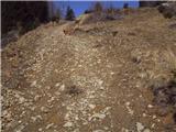 34
34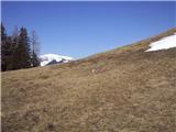 35
35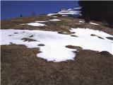 36
36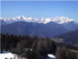 37
37 38
38
Discussion about the trip Jesenice (Ukova) - Španov vrh
|
| milenula2. 01. 2011 |
Today some members of PD Šmarna gora from Lj. participated in the trip. Very picturesque and interesting tour, especially admired the frozen water figures in the Ukova stream.
With the help of a really good path description, we completed the path easily. Unfortunately the weather was foggy, so no promised views. We'll come back when the weather is better.
|
|
|
|
| heinz24. 03. 2017 |
Today marks exactly 5 years since these two little bridges were "renovated". It happened on 24.3.2012 when a cleanup action took place in the Jesenice area.
|
|
|
|
| Majdag24. 03. 2017 |
..It's been a long time since I was up there. But can this be corrected in the trail description?
|
|
|
|
| heinz2. 04. 2017 |
Corrections to descriptions are in the hands of the administrator. Otherwise, this (small) change in the trail condition is also evident from the above comments..
All the best on the trails Majda!
|
|
|
|
| Majdag2. 04. 2017 |
All the best to you too Heinz.
|
|
|
|
| Jusk3. 12. 2019 |
Nice path, today mostly dry, just here and there a bit muddy.. otherwise I only went to Jeseniški rovt, then back by road part of the path towards Prihode and down through the forest to Pejce and Jesenice. Just before Jeseniški rovt water washed away part of the path, but the path is still passable
|
|
|
|
| Jusk4. 12. 2019 |
Before the water intake in picture 13 there is another path, the path in this description starts after the first bridge over Ukova in picture 7, the other path starts about 20-30 meters further when we cross the second bridge, at the tree where there is a marker for the path to Jelenkamen and Pristava an unmarked path is noticeable. This path follows the pipeline from the intake in picture 13, but it's more overgrown and steep, sometimes harder to follow. We can also orient by the pipe that comes to the surface here and there
|
|
|
|
| Jusk9. 05. 2020 |
Today the path Ukova-planina Dole-Lenčkov špik-Španov vrh. A bit below planina Dole there are quite a few narcissus, also Španov vrh is already a bit white, and it will be even more soon I returned via Planina pod Golico to Plavški rovt where there are still quite a few narcissus, down towards Hrušica and along the cycling path to the starting point. Good circular path Regards
|
|
|
|
| Jusk6. 11. 2020 |
Again a hike on my variant of the path before pl.Dole today very muddy and slippery, ice rink further all ok, to Španov vrh via unmarked path around. Back down to Prihode and Rudno pot. Lp further all ok, to Španov vrh via unmarked path around. Back down to Prihode and Rudno pot. Lp
|
|
|
To post a comment you must log in:
If you do not yet have a username, you must first
register.