Jesenovec - Krekova koča na Ratitovcu (via Razor)
Starting point: Jesenovec (485 m)
| Latitude/Longitude: | 46,21000°N 14,12610°E |
| |
Route name: via Razor
Walking time: 3 h
Difficulty: partly demanding marked way
Elevation gain: 1157 m
Elevation difference along the route: 1165 m
Map: Škofjeloško in Cerkljansko hribovje 1:50.000
Recommended equipment (summer):
Recommended equipment (winter): ice axe, crampons
Views: 11.613
 | 1 person like this post |
Access to starting point:
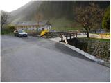
First, we drive to Škofja Loka, then we continue driving towards Železniki and further towards Zalem Log. Soon after Železniki (still before Zalem Log), we will arrive at a smaller crossroad, where the road to the hamlet Jesenovec branches off to the right over the bridge. On the bridge there is also a somewhat larger mountain signpost for Ratitovec. We park on the other side of the bridge, at a suitable place by the confluence of the stream Plenšak and the river Selščica (Selška Sora).
Route description:
From the starting point, we continue on the asphalt road that gently ascends along the stream Plenšak. After some 10 m, the blazes direct us to the right between two houses, behind which the path steeply ascends over a short grassy slope. The path soon enters the forest, where it turns left and then ascends transversely on a relatively steep and especially in wet slippery-dangerous slope. Poorly beaten and leaf-covered path higher crosses two gullies, over which the passage due to the destroyed path is quite arduous and consequently also exposed to slipping. The path ahead still crosses steep slopes for some time, then these transversely flatten somewhat. The path, which continues to ascend relatively steeply, higher brings us to the next somewhat more difficult passage, where along a slightly exposed ledge we cross a rocky ridge. After that, the path turns right and somewhat further begins to ascend even more steeply. Higher, the path turns left and visibly flattens, thereby crossing the last exposed spot. Further, the moderately steep path quickly brings us to a poor forest road, which past the hunting cottage, which we bypass on the right side, brings us to extensive grassy hay meadows, from which a nice view of Ratitovec opens up. A short descent follows and the path brings us to an asphalt road, along which we then ascend in a few minutes to the little church of Mary Help of Christians on Prtovč.
From the church, we continue along the road, which past the NOB monument brings us to a marked junction. We continue slightly right in the direction of Ratitovec via Razor (left Ratitovec via Po(v)den) along the road that past houses brings us to a wide and well-beaten path.
The marked path immediately enters the forest and begins to ascend transversely over relatively steep slopes. The path higher crosses a poor forest road, shortly after that the marked path from the hunting cottage joins from the right. We continue in the direction of Ratitovec along a gentle path that further crosses steep and in snow avalanche-dangerous slopes. Further, the path turns somewhat to the left and begins to ascend more steeply. The steepness soon eases and the path brings us to a small plain called Razor, where there is also a junction.
We continue straight ahead (right Kosmati vrh, mountain pasture Klom and Krekova koča via Vratca) along a wide path that soon turns left and begins to ascend steeply. The path ahead crosses a short stretch of forest, then brings us to panoramic grassy slopes of Ratitovec. Here the path flattens, turns somewhat to the right and along nice views brings us to Krekova koča on Ratitovec.
Jesenovec - Prtovč 1:30, Prtovč - Krekova koča 1:30.

Photos:
 1
1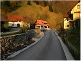 2
2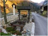 3
3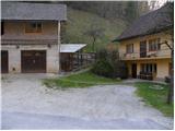 4
4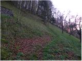 5
5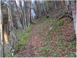 6
6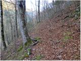 7
7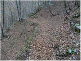 8
8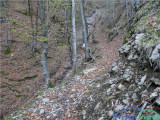 9
9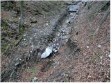 10
10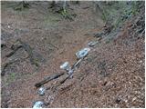 11
11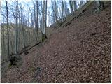 12
12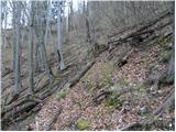 13
13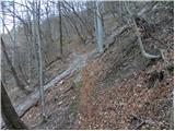 14
14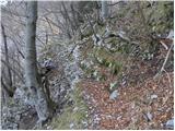 15
15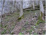 16
16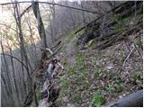 17
17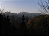 18
18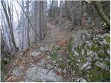 19
19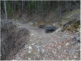 20
20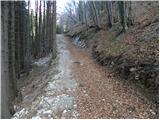 21
21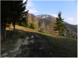 22
22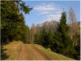 23
23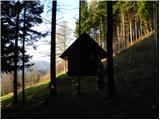 24
24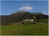 25
25 26
26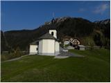 27
27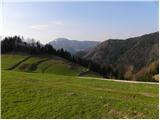 28
28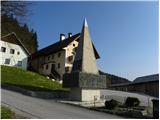 29
29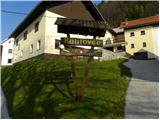 30
30 31
31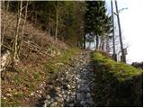 32
32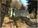 33
33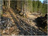 34
34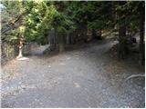 35
35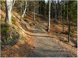 36
36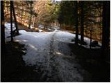 37
37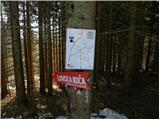 38
38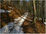 39
39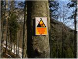 40
40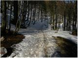 41
41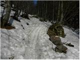 42
42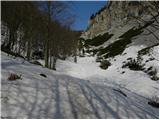 43
43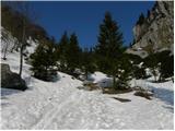 44
44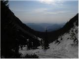 45
45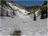 46
46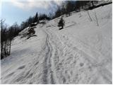 47
47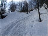 48
48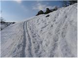 49
49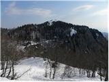 50
50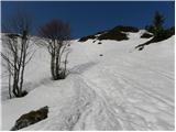 51
51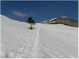 52
52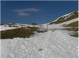 53
53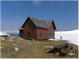 54
54
Discussion about the trip Jesenovec - Krekova koča na Ratitovcu (via Razor)
|
| pohodnik0122. 04. 2010 |
The timetable won't hold? From Prtovča to Ratitovec it's just under two hours of walking. So the path from Jesenovec to Ratitovec can't be 1 hour and 30 min. From Jesenovec to Prtovča is 1 hour and 30 min.
|
|
|
|
| Tadej22. 04. 2010 |
Usually the times listed on the Hribi.net portal are the same as those on the direction signs. At Prtovča there is a direction sign saying to Ratitovec 1:30, which is also written in the description above.
If in the description one considers that an average hiker covers 300 vertical meters in one hour and uses an additional 15 minutes for each km that is not ascending, then the time would be 4:15.
|
|
|
|
| viharnik22. 04. 2010 |
For comparison, on yesterday's ascent to Vrtaška planota 800m, where from the valley I took 1.30h and then to Vrtaški vrh 440m in 1.15h, then 600m to Ratitovec is more than enough to reach the top in 1.30h as Tadej says.
|
|
|
|
| Kriška22. 04. 2010 |
Hm, this is really unusual... First, the description says it's 1157 m elevation gain and that this elevation gain (+ distance) can be covered in 1 hour and 30 minutes. Hats off...
Then Tadej first replies that there is a direction sign at Prtovča saying to Ratitovec 1:30. But the start is not indicated at Prtovča, but in the settlement Jesenovec . Also Viharnik then writes about 600 m elevation gain. Here we're talking about almost twice the elevation gain . Also Viharnik then writes about 600 m elevation gain. Here we're talking about almost twice the elevation gain (1165). (1165).
|
|
|
|
| viharnik22. 04. 2010 |
No, no, it's all clear Kriška. From Jesenovec it's of course another hour and a half, so total around three hours. In 83 as one of my first ascents with PD Lj. Matica, we hiked like mad and even a little guy (me) among pensioners who kindly accepted me among them. That April we were already snowed in at Prtovča with a squall, then after a break we headed to Povden and along the western ridge to the summit. When crossing the steep snowfield I lent my new Stubai ice axe to the leader so he could set up a rope. So we safely arrived at the hut one by one. There almost a party, unaware that outside fog had enveloped us in which we couldn't see more than five meters ahead. After a long wait we finally managed to descend to the valley.
|
|
|
|
| Tadej22. 04. 2010 |
In the path description I wrote that it's 2 times 1.5 hours. But only now I noticed that in the basic information an incorrect time was given. I have corrected it, so the realistic time is around 3 hours and not 1.5 hours as it was written before.
|
|
|
|
| GregorC19. 04. 2011 |
The trail from Jesenovec is now changed at the beginning. Right after the bridge where you park, go straight up the hill. There are now steps made and further up a trail embedded in the slope, which joins a bit higher the one that is described.
|
|
|
To post a comment you must log in:
If you do not yet have a username, you must first
register.