Jezero - Sveti Tomaž (Planinca) (via Ledenica)
Starting point: Jezero (290 m)
| Latitude/Longitude: | 45,97116°N 14,43430°E |
| |
Route name: via Ledenica
Walking time: 1 h
Difficulty: easy marked way
Elevation gain: 282 m
Elevation difference along the route: 282 m
Map: Ljubljana - okolica 1:50.000
Recommended equipment (summer):
Recommended equipment (winter):
Views: 8.400
 | 1 person like this post |
Access to starting point:
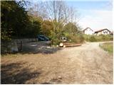
We drive to Podpeč, where we head towards Ig. We follow this road only briefly to the intersection, where we turn right towards the village of Jezero. The road quickly leads us to the next intersection at the fire station (PGD Jezero). Here we turn left onto the large arranged public parking area, where parking for hikers is permitted (payment possible via the EasyPark system).
Driving straight ahead to the parking area directly by Podpeško jezero is not allowed, as the larger arranged parking area by the road there is reserved exclusively for guests of the restaurant.
Route description:
From the public parking area at the fire station (PGD Jezero) we continue on foot along the road (in the direction of travel). After a few dozen meters, immediately after the fire station, at the intersection we turn right uphill onto the road that leads through the village of Jezero, where hiking signs for Krim soon appear.
We continue along the asphalt road that takes us uphill through the village. After a few minutes of walking, the asphalt ends and the road quickly turns into a cart track that leads us to a junction. We continue on the left path towards Ledena jama (Krim left and right). Further, we follow the cart track that moderately ascends through the forest and a little higher leads us to a path junction. If desired, we can make a short detour to Ledena jama, which takes about five minutes in each direction.
Otherwise we continue right on the path that soon leads us to a forest road which we follow uphill to a small hamlet. Here we also reach a path junction where we continue left towards Krim. The path then, after only a few meters, leads us to the church of Sveti Tomaž which we see ahead.

Along the route: Ledenica pri Planinci (480m)
Photos:
 1
1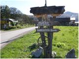 2
2 3
3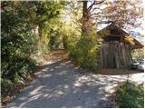 4
4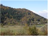 5
5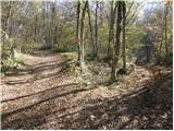 6
6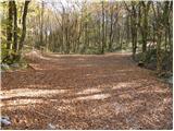 7
7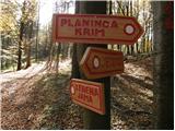 8
8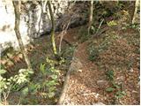 9
9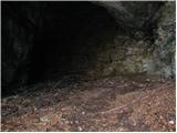 10
10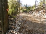 11
11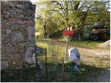 12
12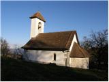 13
13
Discussion about the trip Jezero - Sveti Tomaž (Planinca) (via Ledenica)
To post a comment you must log in:
If you do not yet have a username, you must first
register.