Jezerska slatina - Virnikov Grintovec
Starting point: Jezerska slatina (907 m)
| Latitude/Longitude: | 46,40690°N 14,51270°E |
| |
Walking time: 2 h 30 min
Difficulty: easy unmarked way, easy marked way
Elevation gain: 747 m
Elevation difference along the route: 820 m
Map: Karavanke - osrednji del 1:50.000
Recommended equipment (summer):
Recommended equipment (winter): ice axe, crampons
Views: 2.920
 | 1 person like this post |
Access to starting point:
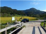
We drive to Zgornje Jezersko, where signs for Ankova slapova waterfalls and the source of mineral water direct us to the left (if we come from the direction of the border crossing Jezerski vrh, to the right). A few meters further over a small bridge we cross a smaller stream, and immediately after it we arrive at the "source" of Jezerska slatina, where the described path begins. We park near the trough; parking ahead of the trough is prohibited by a traffic sign (first a turning area, then a narrower macadam road). It is also possible to park higher along the road, near the partly abandoned hamlet.
Route description:
From Jezerska slatina we continue on a macadam road which leads us along the edge of a pleasant and panoramic meadow, from which, looking back, a nice view opens up on the highest peaks of the Kamniško-Savinjskih Alps. After a few minutes of barely noticeable ascent we arrive at Ankova homestead, beside which there is a chapel, and we continue the ascent on a somewhat narrower road in the direction of the source of mineral water and Ankov slapov. Behind the nearby holiday cottages the road turns into a cart track, along which we quickly arrive at a marked junction, where we continue on the left cart track in the direction of the source of mineral water (slightly right Ankova slapova).
The path ahead leads us through a small valley, along which we arrive at the source of Jezerska slatina, and beyond the source we continue on the left cart track, which begins to ascend more steeply and soon turns to the right. There follows an ascent along the cart track, which leads transversely across occasionally steeper slopes, from which we occasionally get a nice view of Pristovški Storžič. Higher up at a few smaller junctions we choose the wider cart track, which higher crosses a torrent ditch. On the other side of the ditch, through which a stream usually flows, we ascend transversely to the forested ridge, the cart track then passes to the other side of the ridge and begins to become overgrown. We follow the increasingly overgrown cart track for a few more minutes, then a nice passage opens to the left onto the ridge. After two or three minutes of easier pathless terrain we climb to the ridge, where we notice a faint path that continues along or beside the ridge, initially ascending quite steeply. A little higher the path turns slightly to the right, then leads us out of the forest, where on the left we notice an abandoned and collapsing hut, to which we climb in a few steps.
At the hut we step onto a side branch of the nearby forest road, along which, past the abandoned and collapsing JLA guard post, we walk to the access road that leads from the MP Jezerski vrh toward Roblekova planina.
We follow the mentioned road to the left, along which we quickly arrive at an unmarked junction, where we continue on the left road (the right road is an Austrian forest road and leads further toward Pristovnikova planina / Pristovnikalm, it also leads to the saddle between the peak Kepp (1631 m) and Pristovški Storžič / Kaerntner Storschitz (1759 m) - along the mentioned road it is not possible to reach the mentioned two peaks or even the pasture, as passage on part of the road is prohibited due to private land). The road we continue on then ascends slightly, offers a nice view of Pristovški Storžič and Kamniško Savinjske Alpe, after which it begins to descend more steeply toward Roblekova planina, which we reach after a few minutes of descent. Here we cross the state border and descend to the hut on Roblekova planina in a few dozen steps.
From the hut on Roblekova planina we continue left on the road, which begins to descend gently toward the western part of the planina. After a short descent the road splits into two parts, we continue straight ahead on the one that continues to descend gently to moderately. A little lower we will come to a yellow Austrian mountaineering sign with the inscription Kl. Grintoutz / Virnikov Grintovec, which directs us left upward onto a cart track.
At this point, where we join the marked path that leads from the village Korte / Trögern toward Virnikov Grintovec, the path enters the forest and begins to ascend moderately. The cart track brings us a little higher to a clearing, from which a view opens onto our goal and a little further also onto Obir, then it turns slightly to the right. There follows a little more walking along the wide cart track, then the marks direct us left onto a narrower and gradually also steeper cart track. A little higher another cart track joins from the left, we continue right and then after a few minutes of further walking arrive at the Žingerc saddle, where we step back onto the Slovenian side.
We continue in the direction of Virnikov Grintovec, on the path that goes into the forest, which then begins to ascend ever more steeply. The quite steep path brings us higher onto the main ridge, where it turns left. On the ridge, from which beautiful views open onto the surrounding peaks, the steepness also eases. We follow this occasionally very panoramic path, which is slippery in places (no major danger when dry), all the way to the summit of Virnikov Grintovec.
Jezerska slatina - Roblekova planina 1:20, Roblekova planina - Virnikov Grintovec 1:10.

Photos:
 1
1 2
2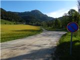 3
3 4
4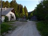 5
5 6
6 7
7 8
8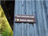 9
9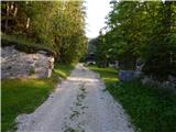 10
10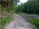 11
11 12
12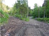 13
13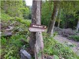 14
14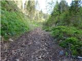 15
15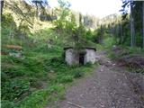 16
16 17
17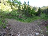 18
18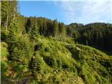 19
19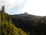 20
20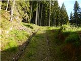 21
21 22
22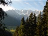 23
23 24
24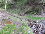 25
25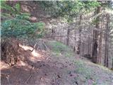 26
26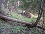 27
27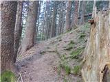 28
28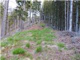 29
29 30
30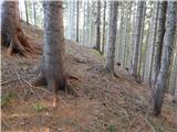 31
31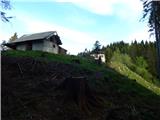 32
32 33
33 34
34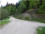 35
35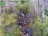 36
36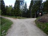 37
37 38
38 39
39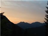 40
40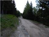 41
41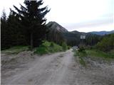 42
42 43
43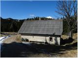 44
44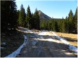 45
45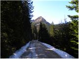 46
46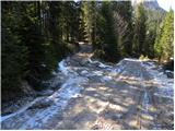 47
47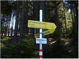 48
48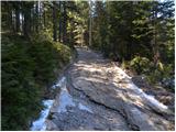 49
49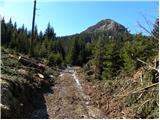 50
50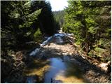 51
51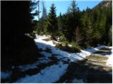 52
52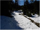 53
53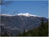 54
54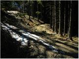 55
55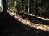 56
56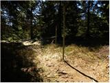 57
57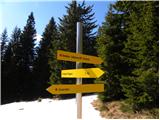 58
58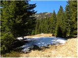 59
59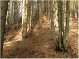 60
60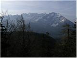 61
61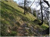 62
62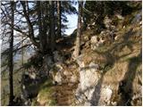 63
63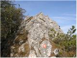 64
64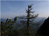 65
65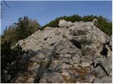 66
66 67
67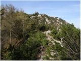 68
68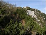 69
69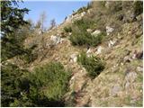 70
70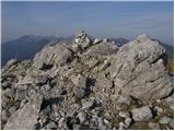 71
71 72
72
Discussion about the trip Jezerska slatina - Virnikov Grintovec
To post a comment you must log in:
If you do not yet have a username, you must first
register.