Jezerski vrh - Roblekova planina
Starting point: Jezerski vrh (1218 m)
| Latitude/Longitude: | 46,41880°N 14,52680°E |
| |
Walking time: 50 min
Difficulty: easy unmarked way
Elevation gain: 66 m
Elevation difference along the route: 125 m
Map: Karavanke - osrednji del 1:50.000
Recommended equipment (summer):
Recommended equipment (winter):
Views: 8.901
 | 2 people like this post |
Access to starting point:
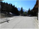
From the Ljubljana - Jesenice motorway, take the Kranj - east exit and follow the road ahead in the direction of Jezersko. From Zgornje Jezersko, we continue driving towards Austria, but we follow it to the border crossing Jezerski vrh, where we park on the marked parking lot on the Slovenian side.
Route description:
From the parking lot, we walk to the nearby macadam road which ascends north from the border crossing, and already after a few meters it brings us to Austrian signposts, where from the road to the right a marked path branches off to Pristovški Storžič. The mentioned turn-off to the right we "ignore" and continue on the macadam road which turns a little to the left and for some time gently to moderately ascends. From the road, which continues with some shorter ascents and descents, occasionally a nice view opens up on the chain of Kamnik Savinja Alps. Eventually, the road from the slopes of Pristovški Storžič brings us to an old JLA guardhouse on Ankova planina.
From here the road continues right, then turns semicircularly towards the left, where a little higher it brings us below the summit of Roblek. The road then starts to descend more steeply and after a short descent brings us to the national border between Slovenia and Austria. Here we cross the national border and in a few dozen steps descend to the hut on the mountain pasture Roblekova planina.

Photos:
 1
1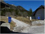 2
2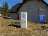 3
3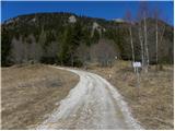 4
4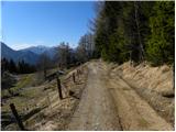 5
5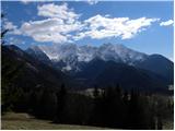 6
6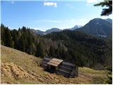 7
7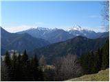 8
8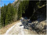 9
9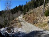 10
10 11
11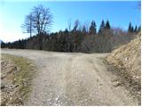 12
12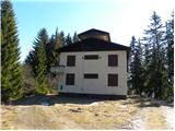 13
13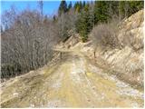 14
14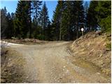 15
15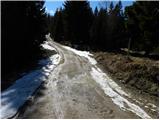 16
16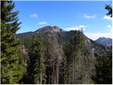 17
17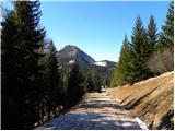 18
18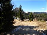 19
19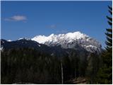 20
20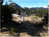 21
21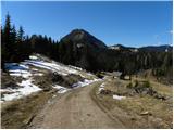 22
22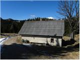 23
23
Discussion about the trip Jezerski vrh - Roblekova planina
|
| ločanka12. 01. 2020 |
Today on this trail. What a nice walk, in this time even a bit nicer than in these pictures. This description has been inviting me to this trail for many years. If there were more snow, it could be even nicer. Above the pasture you can see Hochobir, Kravji vrh, Setiče too. Otherwise the pasture itself is in Austria. Sometimes they weren't allowed to go there.
|
|
|
To post a comment you must log in:
If you do not yet have a username, you must first
register.