Jochalm - Reißkofel (path 235)
Starting point: Jochalm (1496 m)
| Latitude/Longitude: | 46,67205°N 13,15819°E |
| |
Route name: path 235
Walking time: 3 h 25 min
Difficulty: difficult marked way
Elevation gain: 875 m
Elevation difference along the route: 900 m
Map:
Recommended equipment (summer): helmet
Recommended equipment (winter):
Views: 717
 | 1 person like this post |
Access to starting point:
Drive to the village of Reisach in Austria, either from Villach via Hermagor or from Lienz.
In the village where a road crosses a stream, turn right (if you are driving from Villach) and follow the signs for Reißkofelbad. After Reißkofelbad follow the signs for Jochalm.
You will continue on a gravel road and then soon turn right. At this point the road was damaged (as of 2018) but still open for traffic.
After this section the road is in good condition. From this point on, always follow the road that is better and wider than the alternative (i.e. four times left and then right).
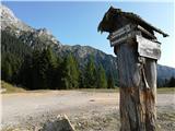
Park at the sharp right turn still near the forest border and 50 meters below the Jochalm mountain pasture, where a road branches off in the direction of Gregorihütte (see photo).
Route description:
From the starting point, walk a short section along the road past the Gregorihütte hut and then along the ascending road to the point where the footpath branches off to the left into the steep slope.
The path winds steeply through the forest, which becomes sparser, and then leads to a junction under the wall of Reißkofel mountain. To the left branches off a shorter steeper path, to the right a longer ridge path.
Turn right onto the path that crosses the slopes towards the east. In places the path is somewhat crumbly, soon it reaches a steeper section equipped with steel cables. After the cables the path is gentler and soon arrives at the Köfele Törl saddle, 2129 m.
At the saddle, to the left towards the west branches off the path to Reißkofel mountain, to the right towards the east to Kleiner Reißkofel.
Towards the west the path then ascends steeply on a crumbly path to the ridge. Follow the ridge towards the west. Soon the direct path 325-1 joins from the left.
The path in places descends and ascends along the ridge and then bypasses the summit on the northern side. Here a very difficult path past the bivouac joins us. The path then ascends to the summit in the last meters from the northwest direction.
The path along the ridge is exposed and in places crumbly, therefore it requires careful steps.
On the summit stands a cross, there is a summit book and a stamp (transversale Vrhovi prijateljstva). The summit is an excellent viewpoint.

Photos:
 1
1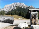 2
2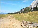 3
3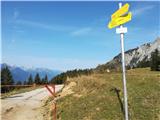 4
4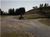 5
5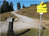 6
6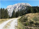 7
7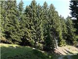 8
8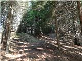 9
9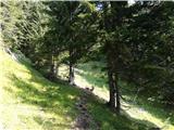 10
10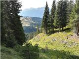 11
11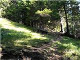 12
12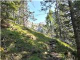 13
13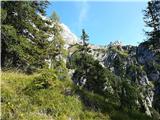 14
14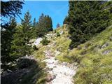 15
15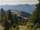 16
16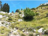 17
17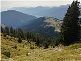 18
18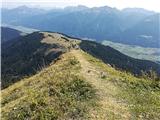 19
19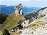 20
20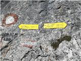 21
21 22
22 23
23 24
24 25
25 26
26 27
27 28
28 29
29 30
30 31
31 32
32 33
33 34
34 35
35 36
36 37
37 38
38 39
39 40
40 41
41 42
42 43
43 44
44 45
45 46
46 47
47 48
48 49
49 50
50 51
51 52
52 53
53 54
54 55
55 56
56 57
57 58
58 59
59 60
60 61
61 62
62 63
63 64
64 65
65
Discussion about the trip Jochalm - Reißkofel (path 235)
To post a comment you must log in:
If you do not yet have a username, you must first
register.