Starting point: Juršče (704 m)
| Latitude/Longitude: | 45,66420°N 14,29500°E |
| |
Walking time: 1 h 30 min
Difficulty: easy marked way
Elevation gain: 387 m
Elevation difference along the route: 387 m
Map: Snežnik 1:50.000
Recommended equipment (summer):
Recommended equipment (winter):
Views: 22.300
 | 1 person like this post |
Access to starting point:
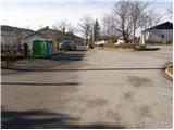
From the Ljubljana - Koper motorway we take the Postojna exit and continue following the road towards Pivka. In Pivka we leave the main road leading towards Ilirska Bistrica and continue driving towards Knežak. We follow this road to the village of Parje, where we turn left towards the villages of Palčje and Juršče (sometimes Jurišče). We then follow the mostly gently ascending road to the village of Jurišče, where we park near the information board.
Route description:
From the parking lot we continue past a small memorial park along the road towards Kršičevec. The road, which soon loses its asphalt surface, quickly takes us to a small intersection, where we continue on the lower left road (a small cross is located along the right road), which continues on the left side of the fence. A little further on we reach a well-marked junction, where the path to Bele stene branches off to the left, but we continue straight on the increasingly poor road, which continues along the fence. At the next cross the road finally turns into a cart track, which gently ascends across extensive grassy slopes. The well-marked cart track, which has a few smaller junctions, takes us higher into a belt of forest, where it begins to ascend somewhat more steeply.
Higher up we cross a forest road and continue the ascent along the cart track, which soon takes us to a linden tree (a tree with numerous trunks). The cart track, which is becoming ever narrower, soon takes us out of the forest onto increasingly scenic slopes. We leave this cart track at a bench, where a directional sign directs us left upwards. The path, which becomes steeper ahead, takes us just a few steps higher to a small junction, where a barely visible trail branches off to the right towards Mrzla jama. Here we continue straight on the increasingly scenic path, which through a belt of low forest and a short scree slope takes us to the summit grassy slope of the mountain. The pleasant trail, on which the steepness quickly eases, then takes us to a scenic plaque from which a wonderful view opens up.
From here we continue along a gentle path, which in less than 5 minutes of further walking takes us to the summit of Kršičevec.

Photos:
 1
1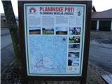 2
2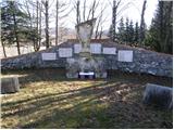 3
3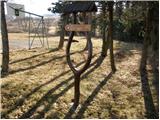 4
4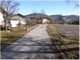 5
5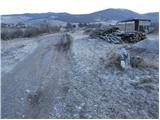 6
6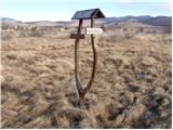 7
7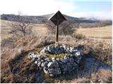 8
8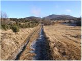 9
9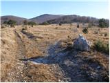 10
10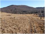 11
11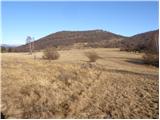 12
12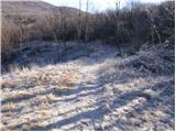 13
13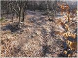 14
14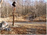 15
15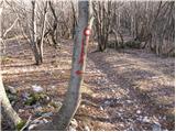 16
16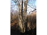 17
17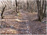 18
18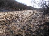 19
19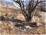 20
20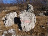 21
21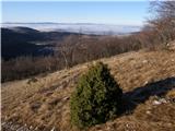 22
22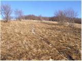 23
23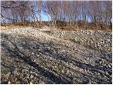 24
24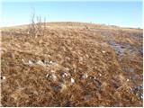 25
25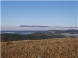 26
26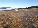 27
27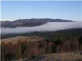 28
28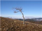 29
29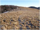 30
30 31
31
Discussion about the trip Juršče - Kršičevec
|
| Tadej24. 01. 2009 |
If you climb to Kršičevec you will be rewarded with a very nice view that stretches from Snežnik, Vremščica, Dolomites, Julian Alps to Kamnik-Savinja Alps. Since the path is easy, it is also suitable for small children. There is no really steep section on the path.
|
|
|
|
| pohodnik012. 03. 2009 |
On Saturday 28.02.09 my wife and I were on Kršičevec. It really is a beautiful and not at all demanding path. The right path for recreation and the weather was excellent too.
To that barbarian who stole both stamps at the top, I would cut off both hands!
Does anyone know which PD Kršičevec belongs to?
Regards
|
|
|
|
| marco5. 03. 2009 |
Ask at Postojna PD for Marjot - he is the "father" of this path.
|
|
|
|
| Lj5. 04. 2009 |
Really pleasant hike through beautiful, wild landscape and extremely panoramic summit. The stamp is in its place, praise to PD Postojna for the nicely marked path, benches in the right places, nicely arranged viewpoint and originally decorated box at the top.
|
|
|
|
| Biser gora6. 04. 2009 |
Where is this summit? I can't find it on the map. Thanks
|
|
|
|
| Lj6. 04. 2009 |
We found it by the above description. I don't have the Snežnik map mentioned in the description.
|
|
|
|
| Biser gora7. 04. 2009 |
Thanks for such a detailed answer.
|
|
|
|
| grega_p12. 11. 2009 |
Beautiful warm autumn day on Kršičevec. Apart from pronouncing the peak's name, nothing difficult on this trip:-) Praise for the well-marked path!
If you have time, also check out Bele stene, Mrzlo jamo, drop by the local tavern and drive to Palško jezero (currently it's dry, but probably fills in spring)...
Take time for this corner of heaven!
p.s. I'd attach pics but can't figure out how?
|
|
|
|
| grega_p13. 11. 2009 |
Thanks anyway Tadej, but I can only post text stuff, I don't see the option to upload pictures in any browser..??
|
|
|
|
| m30. 12. 2009 |
Hello!
Kršičevec was yesterday in fog, and rain was also falling. No bears. (I only scared one roe deer.)
I recommend, but in better weather and at another time of year e.g. early summer, then (starts to) bloom goldenroot or in September, when there are praying mantises along the path and autumn helleborine blooms.
|
|
|
|
| sopvcedi16. 05. 2011 |
Hello!
The ascent to Kršičevec is interesting to visit in mid-May, when the meadows and clearings towards the summit glow in thousands of colors of spring flowers. Here are daffodils or as the locals say bedenica, wonderful golden roots, intoxicating scents of lilies of the valley. You can also find Trieste fritillaries, Austrian fritillary, mountain hairy hawkweed, flax and some other flowers.
Vinko
|
|
|
|
| brinta12. 03. 2012 |
I'm wondering if it's necessary to descend from the top of Kršičevec into the valley and then climb to Bele stene, and if anything is marked?
|
|
|
|
| klavdipo17. 01. 2013 |
How is this path now in these winter conditions? Is it trodden at all? Is the path traceable? LP
|
|
|
|
| žerjavček10. 04. 2014 |
Has anyone hiked this trail recently? Is it passable or not?
|
|
|
|
| bizgo9315. 02. 2021 |
The path itself, apart from a few minor steep sections, is not particularly demanding (according to locals, it is most idyllic in spring when everything blooms). My partner and I did this path at the beginning of January when there was quite a bit of snow, and especially below the summit we were surprised by quite deep snowdrifts (even meter-deep) through which we waded first, which took some strength and slightly lengthened the path. But the view from the top is exceptionally beautiful (Julijci, Kamniške, surrounding hills and ranges, Učka below the summit too...). In normal conditions, recommended even for small children. Also recommended is a visit to the nearby summit of Bela stena and Mrzla jama.
|
|
|
|
| G3424. 04. 2023 14:01:19 |
Just on Saturday 22.4. I was on Kršičevec. The view was somewhat worse due to clouds. You won't believe who followed us the whole way. A dog followed us to the top and back to the village the whole way. Unbelievable, isn't it?
|
|
|
To post a comment you must log in:
If you do not yet have a username, you must first
register.