Kamnik - Sveta Ana (Tunjice)
Starting point: Kamnik (378 m)
| Latitude/Longitude: | 46,22930°N 14,60960°E |
| |
Walking time: 1 h
Difficulty: easy marked way
Elevation gain: 97 m
Elevation difference along the route: 130 m
Map:
Recommended equipment (summer):
Recommended equipment (winter):
Views: 8.270
 | 2 people like this post |
Access to starting point:
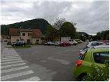
A) From Komenda, Trzin or Domžale we drive towards Kamnik, then continue driving on the Kamnik bypass towards Gornji Grad, Kamniška Bistrica and Tuhinjska dolina. Still before the end of Kamnik we leave the main road towards Tuhinjska dolina and continue left in the direction of Kamniška Bistrica. At the next crossroad a few 100 m ahead we continue left on the priority road (straight Mekinje and Godič), on which we drive to the nearby roundabout. From the roundabout we continue driving towards the center of Kamnik, and we follow Medvedova ulica (now a one-way street) to the crossroad with Tunjiška cesta. Here we continue right and then after approximately 50 m of additional driving we park on the parking lot by the railway tracks.
B) From Gornji Grad over the Črnivec pass we drive to Kamnik. From the roundabout at the start we continue driving towards the center of Kamnik, and we follow Medvedova ulica (now a one-way street) to the crossroad with Tunjiška cesta. Here we continue right and then after approximately 50 m of additional driving we park on the parking lot by the railway tracks.
C) From the motorway Maribor - Ljubljana we take the exit Vransko, then continue driving towards Tuhinj and Kamnik. When we arrive in Kamnik we continue right in the direction of Kamniška Bistrica. At the next crossroad a few 100 m ahead we continue left on the priority road (straight Mekinje and Godič), on which we drive to the nearby roundabout. From the roundabout we continue driving towards the center of Kamnik, and we follow Medvedova ulica (now a one-way street) to the crossroad with Tunjiška cesta. Here we continue right and then after approximately 50 m of additional driving we park on the parking lot by the railway tracks.
Route description:
From the parking lot we first walk to the railway track, cross it, then start moderately ascending on the sidewalk which runs along Tunjiška cesta. The sidewalk ends higher up, and the road narrows and levels out somewhat. A few-minute descent through the village Košiše follows, then we arrive at Tunjiška Mlaka, where there is a small crossroad. From the crossroad we continue straight in the direction of the natural healing grove (right Sidraž and Laniše), where we first cross the stream Tunjščica, then start moderately ascending among residential houses. Higher we arrive at the beginning of the settlement Tunjice, where at the crossroad we continue left and then after 50 m at the transformer left again. Further the well-marked and marked road leads through panoramic hay meadows and past several fruit trees, then we arrive at the forest belt, where in a few minutes we ascend to the large parking lot.
Just before the parking lot we continue right onto the stairs, on which we ascend to the church of St. Ana.
From the church we can descend past the stamping box to the road, from there across the meadow to the top of panoramic Vinski vrh.

Along the route: Košiše (395m), Tunjiška Mlaka (374m), Tunjice (405m)
Photos:
 1
1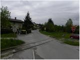 2
2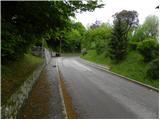 3
3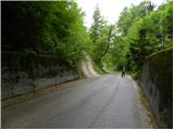 4
4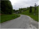 5
5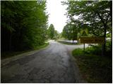 6
6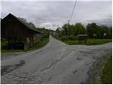 7
7 8
8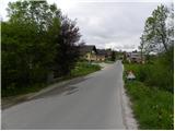 9
9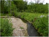 10
10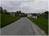 11
11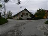 12
12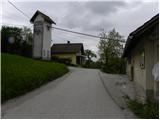 13
13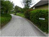 14
14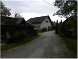 15
15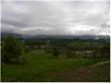 16
16 17
17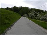 18
18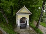 19
19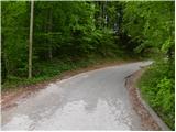 20
20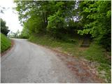 21
21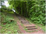 22
22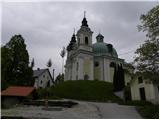 23
23 24
24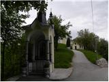 25
25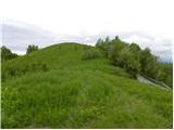 26
26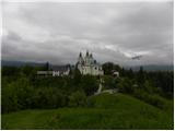 27
27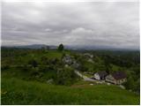 28
28
Discussion about the trip Kamnik - Sveta Ana (Tunjice)
To post a comment you must log in:
If you do not yet have a username, you must first
register.