Kampelc - Javornik (above Črni Vrh)
Starting point: Kampelc (850 m)
| Latitude/Longitude: | 45,91490°N 14,03270°E |
| |
Walking time: 2 h 15 min
Difficulty: easy marked way
Elevation gain: 390 m
Elevation difference along the route: 475 m
Map: Nanos 1:50.000
Recommended equipment (summer):
Recommended equipment (winter):
Views: 11.840
 | 2 people like this post |
Access to starting point:
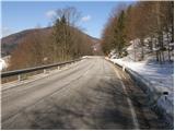
From the road Logatec - Idrija at settlement Godovič we go on the road in the direction of Črni vrh and Ajdovščina. After Črni vrh the road starts ascending in a few hairpin turns, after that it flattens a little. On this less winding part we will notice on the left side of the road red signposts for direction Javornik and Čelkov vrh (starting point is located at the road sign approx. 4.5 km). We park on one of the parking lots by the road.
To the starting point, we can also come from Vipava Valley over Col.
Route description:
The marked footpath immediately leads us into the forest, where it first ascends transversely, then the ascent continues in a smaller, in places more overgrown valley. Higher up, the path turns left and after a short ascent brings us to a forest road, along which we continue ascending. The road then exits the forest, and ahead of us we spot Čelkov vrh. A short descent follows to the place where the blazes direct us right onto a wide cart track, along which we ascend to some houses.
Behind the houses, the path goes into the forest, where it ascends somewhat more steeply and higher joins the road that we left shortly before. We continue the ascent past the barrier to a well-marked junction, where the marked path to Čelkov vrh branches off to the left. We continue straight along the road, which at the solitary bajta turns into a wide cart track. The cart track goes immediately into the forest and begins to descend moderately. After approximately 10 minutes of descent, we step out of the forest onto expansive grassy slopes, across which we walk to the mountain signposts that we can see from afar (in fog, we will find the signposts with more difficulty).
Here, where the path from Črni vrh joins from the left, we continue along the marked path towards Javornik. Further on, we ascend through the forest, then the path crosses a larger, partly panoramic clearing and continues with a few shorter ascents and descents. The path, which soon returns to the forest, brings us higher from the northern slopes to the southern slopes. Here the path turns somewhat to the left and continues along a cart track that leads us across numerous grassy slopes. After a while we reach a marked junction, where we continue left uphill towards Javornik (straight to Pirnatova koča) along an increasingly steep path. We follow this path, which in its final section runs through the forest, to the summit of Javornik, on which stands a lookout tower.
From the summit we can descend to the mountain hut in 5 minutes.

Photos:
 1
1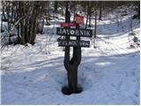 2
2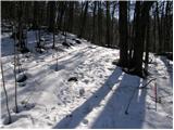 3
3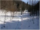 4
4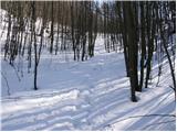 5
5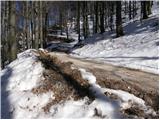 6
6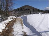 7
7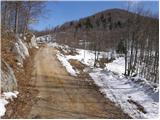 8
8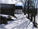 9
9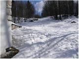 10
10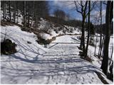 11
11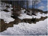 12
12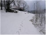 13
13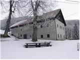 14
14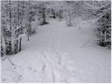 15
15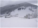 16
16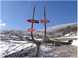 17
17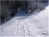 18
18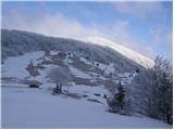 19
19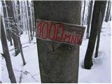 20
20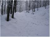 21
21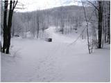 22
22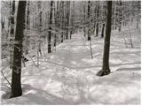 23
23 24
24 25
25 26
26 27
27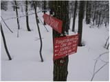 28
28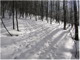 29
29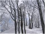 30
30 31
31
Discussion about the trip Kampelc - Javornik (above Črni Vrh)
|
| D0men13. 09. 2022 12:30:14 |
The tower at the summit is no longer intact and is closed.
A new structure is needed. 
|
|
|
|
| di24. 11. 2024 14:13:44 |
During the hike, we also summited the nearby peaks: Strmec, Lucijanov grič, Vrh Kapele.
We were probably the only ones that weekend.
|
|
|
To post a comment you must log in:
If you do not yet have a username, you must first
register.