Kandrše (Trata) - Dom Ušte - Žerenk
Starting point: Kandrše (Trata) (473 m)
| Latitude/Longitude: | 46,13310°N 14,83950°E |
| |
Walking time: 2 h 35 min
Difficulty: easy marked way
Elevation gain: 185 m
Elevation difference along the route: 340 m
Map:
Recommended equipment (summer):
Recommended equipment (winter):
Views: 973
 | 1 person like this post |
Access to starting point:
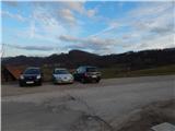
A) We leave the Štajerska motorway at exit Krtina, then we follow the signs for Moravče and Zagorje ob Savi. Just a short way after the road sign that marks the beginning of the settlement Kandrše, we arrive at a saddle by the hamlet Trata, where we turn left and park on a macadam parking lot opposite the company Strip's, elektrotehnika - elektronika, d.o.o.
B) We drive to Izlake (to here from Trojane or Zagorje ob Savi), then we continue driving in the direction of Moravče. In the settlement Kandrše, at the company Strip's, elektrotehnika - elektronika, d.o.o., we turn right and park on a macadam parking lot next to the hiking signposts.
Route description:
From the parking lot, we first carefully cross the main road and continue on a side road in the direction of GEOSS and Vače. The path ahead leads us past the fire station PGD Kandrše and Napoleon's stone, at the sign for the beginning of the municipality Litija we go from the asphalt road left onto a cart track. On the cart track we walk to the entrance into the forest, then the markers direct us to the right (straight ahead unmarked path to Slemšek), where we ascend through a strip of forest. After a short ascent, we return to the asphalt road, on which we ascend to the nearby crossroads, where we leave the road towards Vače and GEOSS and continue right on a side road, by which we arrive at a smaller hamlet where the road ends. We bypass all the houses on the left side and continue on the cart track, which first lightly descends, then across a meadow we lightly ascend to the hamlet Strmec. Here we step back onto the road and past houses and a religious symbol ascend to a poorly marked crossroads, where we go right downhill (by the left road we can arrive at Slivna and GEOSS). Some descent follows and we arrive in the municipality Moravče, from the path a nice view opens up that reaches to the Kamnik-Savinja Alps. A little further we arrive at the settlement Gora pri Pečah, where from the crossroads we continue slightly left in the direction of the hamlet Zgornja Gora.
Next follows a traverse ascent, then we go slightly left again (slightly right hamlet Dolina), a few minutes higher we already arrive at the hamlet Zgornja Gora, where there is a junction of marked paths.
Sharply left a marked path leads towards GEOSS, we continue straight and follow the signs for the path around Slivna. Above the hamlet the road becomes steeper and brings us to the church of St. Florian in a few minutes, from which a nice view opens up onto Posavsko hribovje, with good visibility the view reaches all the way to the Alps.
From the church we continue on the road, which gradually enters the forest and mostly ascends moderately. Higher we exit the forest and past the hunting observatory arrive at a junction, where we join the marked path that leads over or past Pivklj.
We continue further on the road, past a religious symbol we arrive at the hamlet Štance Laze, after which the road begins to descend more noticeably. Before the sharp right bend a nice view opens up onto the surrounding hills, the macadam road lower becomes asphalt. We continue the descent, at crossroads we continue straight. Lower the road levels out, then leads us past the ranch pr Oselet, after which we go slightly right onto the path that crosses a strip of forest and quickly brings us to the Planinski dom Ušte - Žerenk.
Kandrše - St. Florian 1:30, St. Florian - Dom Ušte - Žerenk 1:05.
Description and pictures refer to the condition in December 2018 and March 2020.

Along the route: Sveti Florjan (Zgornja Gora) (698m)
Photos:
 1
1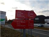 2
2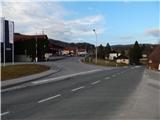 3
3 4
4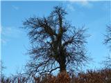 5
5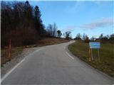 6
6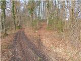 7
7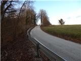 8
8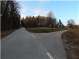 9
9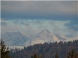 10
10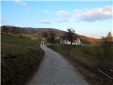 11
11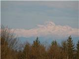 12
12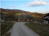 13
13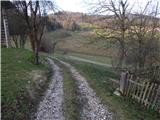 14
14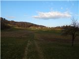 15
15 16
16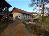 17
17 18
18 19
19 20
20 21
21 22
22 23
23 24
24 25
25 26
26 27
27 28
28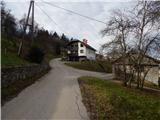 29
29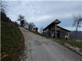 30
30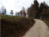 31
31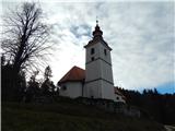 32
32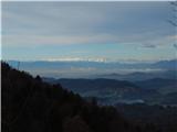 33
33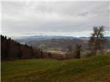 34
34 35
35 36
36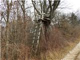 37
37 38
38 39
39 40
40 41
41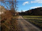 42
42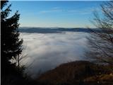 43
43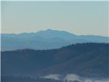 44
44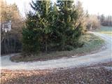 45
45 46
46 47
47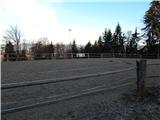 48
48 49
49 50
50 51
51 52
52
Discussion about the trip Kandrše (Trata) - Dom Ušte - Žerenk
To post a comment you must log in:
If you do not yet have a username, you must first
register.