Starting point: Kandrše (Trata) (473 m)
| Latitude/Longitude: | 46,13310°N 14,83950°E |
| |
Walking time: 3 h 20 min
Difficulty: easy marked way
Elevation gain: 217 m
Elevation difference along the route: 470 m
Map:
Recommended equipment (summer):
Recommended equipment (winter):
Views: 419
 | 2 people like this post |
Access to starting point:
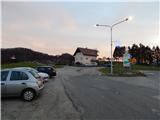
A) We leave the Štajerska motorway at the Krtina exit, then follow the signs for Moravče and Zagorje ob Savi. Just a little after the road sign marking the beginning of the settlement Kandrše, we arrive at the saddle by the hamlet Trata, where we turn left and park on the macadam parking lot opposite the company Strip's, elektrotehnika - elektronika, d.o.o.
B) We drive to Izlake (to here from Trojane or Zagorje ob Savi), then continue driving in the direction of Moravče. In the settlement Kandrše, at the company Strip's, elektrotehnika - elektronika, d.o.o., we turn right and park on a macadam parking lot next to hiking signposts.
Route description:
From the parking lot, we head on the road in the direction of Limbarska gora, Golčaj and Vrh pri Mlinšah. At first we walk on a gently sloping asphalt road which leads us through a meadow, at the hamlet of few houses the blazes direct us to the left side road, and from there we go immediately once again left (straight marked path to Limbarska gora) and ascend to the nearby church of St. Lenart, from which a beautiful view opens up, reaching all the way to Zasavska Sveta gora.
From the church, we quickly return to the marked path, then continue on the macadam road which ascends to the saddle between Jerščeva gorica (586 m) on the left and Kandrški grič on the right. On the saddle, we leave the road which leads to the nearby homestead and continue slightly right on a marked cart track which descends through the forest. The path soon flattens, then past a cross and an older chapel we arrive at an asphalt road, which we follow towards the north. We quickly arrive at the settlement of few houses, where at the chapel we go left downwards to the nearby church, which we have already seen for a few minutes from our path. After a short descent we arrive at the church of St. Michael, which was renovated in 2015.
From the church, we return to the chapel, then arrive at the settlement Dolgo Brdo Kandrše - part, where at the crossroads we follow the blazes. In the upper part of the settlement we go from the main road left, where asphalt is quickly replaced by a cart track. For a few minutes we ascend the cart track with occasional views, then reach the settlement Vrh pri Mlinšah, where we first still ascend, at the end of the settlement slightly descend.
Follows a longer walk on at first still panoramic macadam road, which mostly continues through the forest and here and there beautiful views open up. At a poorly marked junction, located somewhat before the quarry which we can already sense left below us, we continue on the slightly left upper road. The road leads us briefly above the quarry, from where a beautiful view opens up, then gradually we arrive at the settlement Tlačnica, where there is a marked junction.
We continue in the direction of Golčaj, Kal and Limbarska gora (left downwards Peče and Zgornje Koseze) and continue walking on the forest road which at first gently to moderately ascends, then flattens and occasionally also slightly descends. When we leave the forest we arrive at the first houses or holiday cottages in the hamlet Kal. Here the road becomes asphalt, we leave it at the end of the settlement and at the hayrack continue right where the blazes direct us. Just a few 10 steps ahead the path ends, we continue left downwards, where through a meadow we descend to the edge of the forest, where the marked path appears again. Follows a steeper descent through the forest, lower at the edge of the meadow we reach the marked junction.
From the junction we continue sharply right in the direction of Golčaj (slightly left Limbarska gora) and continue the path on a gentle cart track. The path ahead leads us past a cross (here from the right joins an unmarked shortcut from the hamlet Kal), then from the slope we gradually pass to a forested ridge. Follows some more ascent, then we reach the marked junction, where the path from Blagovica also joins us.
We continue in the direction of the summit Golčaj and the NOB monument, the summit Golčaj we reach after 3 minutes of further walking.
From the summit we continue slightly right and after a short descent arrive at the nearby church of St. Neža.
Trata - sv. Lenart 0:08, sv. Lenart - sv. Mihael 0:17, sv. Mihael - Vrh pri Mlinšah 0:30, Vrh pri Mlinšah - Tlačnica 0:55, Tlačnica - Kal 0:30, Kal - Golčaj 0:50.

Along the route: Sveti Lenart (Kandrše) (508m), Sveti Mihael (Križate) (491m), Vrh pri Mlinšah (641m), Tlačnica (703m), Kal (725m)
The trip can be extended to the following destinations: Limbarska gora
Photos:
 1
1 2
2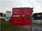 3
3 4
4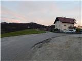 5
5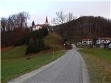 6
6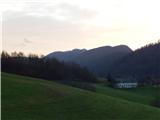 7
7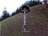 8
8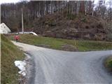 9
9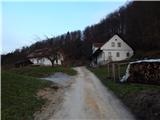 10
10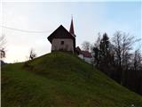 11
11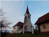 12
12 13
13 14
14 15
15 16
16 17
17 18
18 19
19 20
20 21
21 22
22 23
23 24
24 25
25 26
26 27
27 28
28 29
29 30
30 31
31 32
32 33
33 34
34 35
35 36
36 37
37 38
38 39
39 40
40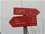 41
41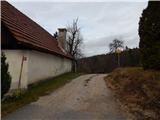 42
42 43
43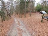 44
44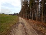 45
45 46
46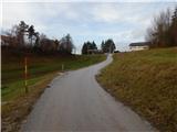 47
47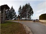 48
48 49
49 50
50 51
51 52
52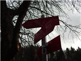 53
53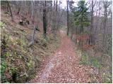 54
54 55
55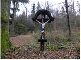 56
56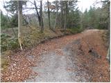 57
57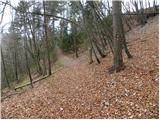 58
58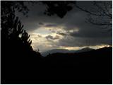 59
59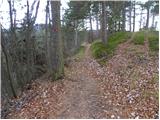 60
60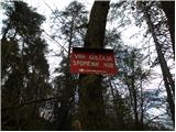 61
61 62
62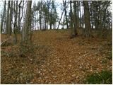 63
63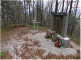 64
64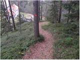 65
65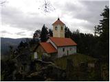 66
66
Discussion about the trip Kandrše (Trata) - Golčaj
To post a comment you must log in:
If you do not yet have a username, you must first
register.