Starting point: Kanonir (725 m)
| Latitude/Longitude: | 46,38010°N 14,46190°E |
| |
Walking time: 2 h 30 min
Difficulty: partly demanding marked way
Elevation gain: 903 m
Elevation difference along the route: 915 m
Map: Karavanke - osrednji del 1:50.000
Recommended equipment (summer):
Recommended equipment (winter): ice axe, crampons
Views: 38.493
 | 4 people like this post |
Access to starting point:
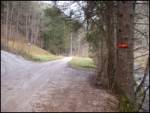
First, we drive to Preddvor or to the settlement Tupaliče (to here from the Gorenjska motorway or Kranj), then we continue driving in the direction of Jezersko. When we arrive in the municipality of Jezersko, we will soon notice the signs for Gostišče Kanonir. After the inn, we go left onto the road in the direction of Dol - Podstoržič and the Kovk farm. Further on, we drive on a somewhat narrower road, which leads us past more houses, and after a few 100 m of additional driving we arrive at an intersection, where a steep road branches off to the left, along which the marked path to Kozji vrh also continues. We park in a suitable place by the intersection.
Route description:
From the starting point, we continue on the left road in the direction of Kozji vrh, beside which we notice that from 20.7. to 20.10. further driving is forbidden. We walk for about 20 minutes on a fairly steep road, then we emerge from the forest onto the edge of the pasture Robci, from where a nice view opens towards the Kočna massif.
From Robci, which are located on the saddle between Macesnovec (1042 m) on the left and Kozji vrh (1628 m) on the right, we continue right onto the cart track in the direction of Kozji vrh. The cart track quickly takes us into the forest, through which we begin to ascend more steeply. At a few smaller junctions, we follow the blazes; higher up, the cart track turns into a mountain path, which then mostly ascends transversely to the right, crossing several gullies and steep slopes in the process. In wet conditions, there is a greater risk of slipping on some sections, and even in dry conditions, extra caution is needed in places. Higher up, some views open through the treetops, and the path takes us below the cliffs of Kozji vrh, where there is a greater probability of falling rocks, especially in springtime. Below the cliffs, the path leads across a small scree and mostly along a steep slope. When the traverse ends, the path brings us to an indistinct forested saddle between Kozji vrh on the left and Turni (1432 m) on the right.
Here, a "path" branches off to the right, which leads below Turni and continues along the ridge of Licjanovec (1733 m) to Mali Grintovec (1813 m); we continue left through dense forest on the marked path to Kozji vrh. For some time we ascend through thick forest, then the path runs along the edge of the northwestern ridge of Kozji vrh, where it becomes quite steep. With occasional views of the Karavanke (Košuta, Obir...), we ascend steeply for a while, then the occasionally slightly exposed path becomes less steep and, together with the ridge, turns slightly to the right. A few minutes of gentle ascent along the panoramic ridge follow, and the path brings us to the 1628 m high Kozji vrh.

Along the route: Sedlo Kozji vrh (1350m)
Photos:
 1
1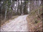 2
2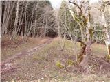 3
3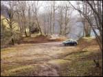 4
4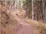 5
5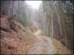 6
6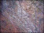 7
7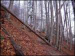 8
8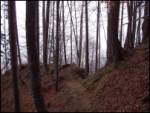 9
9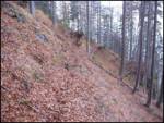 10
10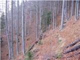 11
11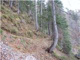 12
12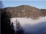 13
13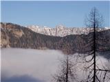 14
14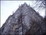 15
15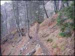 16
16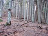 17
17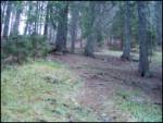 18
18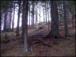 19
19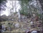 20
20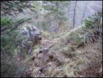 21
21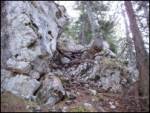 22
22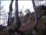 23
23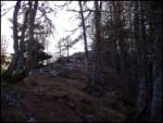 24
24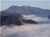 25
25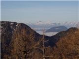 26
26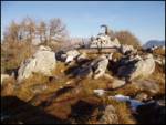 27
27
Discussion about the trip Kanonir - Kozji vrh
|
| Gost13. 09. 2006 |
Really, the path on some sections is a knee-killer. But at the top there is a large plateau and very nice. Worth the effort to go up.
|
|
|
|
| Gost20. 09. 2006 |
Little-known mountain, worth the effort!
|
|
|
|
| Gost25. 05. 2007 |
By car to the pasture, then path underfoot. You really make a proper loop to reach the summit. I took one and a half hours to the top. Pleasant, short, non-tiring tour.
|
|
|
|
| Gost28. 05. 2007 |
Pleasant hike in the shade, quite steep in places. The view from the top is fairy-tale from Storžič to Kočna. If you opt for a half-day tour, this is the right excursion.
|
|
|
|
| klavdy610. 01. 2009 |
long, not very interesting path
|
|
|
|
| lynx17. 05. 2009 |
The upper part is great. The lack of crowds is quite noticeable.
|
|
|
|
| klavdipo1. 06. 2010 |
Is there still any snow on the path?
Best regards
|
|
|
|
| Parkeljc23. 08. 2010 |
Nice little tour that really comes into its own only in the last 15 minutes. From the logbook it's evident that it's not very crowded. You can see that the path is not maintained, especially fallen trunks need to be removed,..
|
|
|
|
| abes29. 03. 2011 |
A few days ago I visited Kozji vrh. Very nice hike, especially for those who like peace and solitude in the mountains. I agree that the fallen trunks should be removed.
|
|
|
|
| Leon8129. 03. 2011 |
What's the path condition like? Snow?
|
|
|
|
| abes30. 03. 2011 |
The path is dry, only the last ascent just below the summit was still frozen in some sections, I put on crampons more for the feeling of safety, it could be done without too. Given the weather, the path condition probably hasn't worsened in recent days. Best regards.
|
|
|
|
| velkavrh4. 06. 2011 |
Today I started with Jezersko mountain path and among the peaks is also Kozji vrh. Still can't get used to some Jezersko peaks belonging to Karavanke. This time parked car already at first bend. Higher up to pasture quite muddy. On pasture they probably still have same ram, as sign still same as for vicious dog. Couple years ago already up there, only now realized it has real name. Can't quite share opinion it's easy path. Weather on return didn't hold. Path became slide. Not very pleasant. Up in one and a half hours. Now easier hikes next -Goli vrh and Veliki vrh.
|
|
|
|
| Lj4. 06. 2011 |
Hey, don't underestimate Veliki vrh, it's a real knee-grabber and slide, it seemed much more demanding to me than Kozji vrh.
|
|
|
|
| velkavrh5. 06. 2011 |
LJ, hey, then let's arrange some joint tour. In a month I plan to hike the Jezerski vrhovi. You can contact me via private message. Best regards.
|
|
|
|
| shellob17. 10. 2011 |
today while I was at the summit, a landslide occurred that buried the trail. It happened under the cliffs in the second half of the trail, just before you reach the small saddle. The trail is now harder to pass and dangerous there (due to loose ground and fallen trees). Local PD has been notified and I hope they will repair the trail as soon as possible
|
|
|
|
| abes2. 12. 2011 |
I agree with Lj, Veliki vrh was harder for me too, really knee-gnawing.
|
|
|
|
| Lunca19. 04. 2012 |
since only Kozji vrh remains for me from those mentioned, it's much easier for me now
|
|
|
|
| gorskarozica29. 04. 2012 |
Nice day, real balm today on top, light breeze, even a short nap wasn't too much!
|
|
|
|
| Sim7925. 08. 2012 |
This shady path was great for today's hot Saturday. Except for some sections, the path didn't seem overly steep to me. For the ascent I needed 1 h 45 min, and I went quite fast. From the top there's a very nice view of Storžič and Kočno.
|
|
|
|
| grega_p30. 12. 2012 |
Today on Kozji vrh. The pleasure started already when I came out of low clouds near Preddvor, then to Kanonir and along the road to the parking at the meadow. Car probably better left below, as the road is in very poor condition (especially the first climb). Since I was late, I pushed hard and was up in 1 hour 10 min. Still quite a few fallen trees, snow above about 1100m. Up top quite icy and steep.
Recommended, the path is trodden, view divine (especially Kočna, Veliki vrh, Goli Vrh and Babe give an unusual appearance). Careful on icy sections and the last summit slope.
|
|
|
|
| Rozcaa3. 05. 2013 |
Very nice view, it's worth going up. However, the path is quite dangerous in some sections, especially if it's wet and slippery.
|
|
|
|
| Lisica11. 08. 2013 |
Today there was quite a crowd at the summit. Beautiful views of the surrounding peaks. 
|
|
|
|
| serajko17. 06. 2014 |
Does anyone happen to know how the trail's passability is after this winter?
|
|
|
|
| Fulcrum21. 05. 2016 |
This morning a quick trip to the little-visited Kozji vrh. The trail is well marked and maintained. At the summit wonderful view of Storžič, Košuta and Kočna. In the valley timber harvesting is taking place, so forest roads are full of trucks.
|
|
|
|
| Darxta8. 04. 2024 09:20:52 |
The path condition is fine, but you can see it's not a frequently visited summit. The logbook is not even half full, and it's been there since 2018 
From Robcev to the saddle at over 1000 m.a.s.l. (according to pictures) there is a quite widened forest road. At this saddle from the forest road we follow the road along the ridge (no markers at this junction, first one seen after 200m road). At the end of the road, at about 1150 m.a.s.l., the path continues steeply upwards (missed marker here too). The rest is well marked.
|
|
|
|
| plaNinaPirsMajcen7. 01. 2026 21:16:37 |
This Kozji vrh is little-known and solitary, which probably attracted me. The trail mostly follows a traversing ascent on a locally narrow, slightly exposed path along shady slopes through forest, except initial and final steep parts. The final ascent especially is quite challenging in snow, running over very steep rocky terrain requiring much caution.
No views as reward. Fog got there first 😅 I suspect even in good weather the trees are quite tall and somewhat obstruct views.
The trail is otherwise exemplarily marked. Only at one wide junction of several roads markers are missing. There go straight ahead onto steep track uphill (1.20 min video).
Video:
https://youtu.be/WFZpclJWyjk?si=CkWk0Zk9LwRq3PW5
For all lovers of uncrowded trails ⛰️🐐
Best, Nina
|
|
|
To post a comment you must log in:
If you do not yet have a username, you must first
register.