Kanonir - Mali Grintovec (via Licjanovec)
Starting point: Kanonir (725 m)
| Latitude/Longitude: | 46,38010°N 14,46190°E |
| |
Route name: via Licjanovec
Walking time: 4 h 10 min
Difficulty: partly demanding marked way, partly demanding unmarked way
Elevation gain: 1088 m
Elevation difference along the route: 1250 m
Map: Karavanke - osrednji del 1:50.000
Recommended equipment (summer):
Recommended equipment (winter): ice axe, crampons
Views: 1.720
 | 1 person like this post |
Access to starting point:
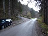
First, we drive to Preddvor or to the settlement Tupaliče (as far as here from the Gorenjska highway or Kranj), and then we continue driving in the direction of Jezersko. When we get to the municipality Jezersko, we will soon notice signs for Gostišče Kanonir inn. After the inn we go left on the road in the direction of Dol - Podstoržič and farm Kovk. Further, we drive on a somewhat narrower road which leads us past houses, and after a few 100 meters of additional driving, we get to a crossroad, where a steep road branches off to the left, on which the marked path to Kozji vrh also continues. We park on an appropriate place by the crossroad.
Route description:
From the starting point, we continue on the left road in the direction of Kozji vrh, by which we notice that from 20/7 to 20/10 further driving is forbidden. About 20 minutes we walk on a quite steep road, and then we come out of the forest, on the edge of the pasture Robci, from where a nice view opens up towards the massif of Kočna.
From Robci, which are situated on the saddle between Macesnovec (1042 meters) on the left and Kozji vrh (1628 meters) on the right, we continue right, on a cart track in the direction of Kozji vrh. Cart track quickly leads into the forest, through which we start ascending steeper. At a few smaller crossings we follow the blazes, cart track higher changes into a mountain path, which then mostly ascends diagonally towards the right, and in doing so it crosses several gullies and steep slopes. In wet there is on some parts greater danger of slipping, and also in dry in some parts more caution is needed. Higher through the treetops a view opens up a little, and the path brings us below the cliffs of Kozji vrh, where mainly in spring time there is greater probability of falling stones. Below cliffs path leads through smaller scree, and mostly on a steep slope. When the crossing ends path brings us on an indistinct forested small saddle between Kozji vrh on the left and Turni (1432 meters) on the right.
Here we leave the marked path, which turns left and leads further to Kozji vrh (to Kozji vrh is approximately 40 minutes) and we continue right, by an indistinct ridge, where we soon see an old footpath and wire fence. When we get below the peak of Turni footpath entirely vanishes, and we only cross slopes of Turni (if we go right uphill we can after a little less than 10 minutes get to the top of Turni).
On the other side of the highest peak of Turni we get to a smaller saddle, where we notice old border stone (border stone separated region Kranjska with region Koroška). From here follows a light descent towards the left and then we reach a newer cart track, on which we continue the descent to the lowest point in the ridge from Kozji vrh to Mali Grintovec (1299 meters). On the mentioned saddle cart track turns slightly to the left and continues to descend, and we continue slightly right, on a well visible footpath which continues on or slightly by the ridge. We continue through a dense forest and first slightly, then moderately ascending. During the ascent path leads past more old border stones, and we follow the easy-to-follow footpath to the spot, where it turns slightly to the left from the ridge and passes on a slope. On the mentioned spot, we leave the nice footpath and continue on the ridge, first on pathless terrain, then the footpath reappears (if we would continue left on the footpath, we would quickly find out that we are on the wrong path, as the mentioned footpath soon vanishes).
The path ahead leads us on the ridge, where for a few meters we steeply ascend a slightly exposed jump, then through a belt of dwarf pines we quickly reach a pleasant viewpoint, from where a nice view opens up on surrounding mountains, most beautiful is of course the view towards the massif of Kočna.
From the viewpoint a view also opens up on part of the path that is ahead of us, as the footpath through dwarf pines is well visible. Further, we ascend diagonally through dwarf pines, and path also leads us over a shorter, partly rocky and slightly exposed ledge. Higher we arrive at a side ridge, behind it into a sparse forest covered with grasses. We continue the path on a steep grassy slope, where the footpath quickly vanishes. Over the mentioned slope we ascend diagonally to the left (in wet there is danger of slipping on this part), then higher we again notice a followable footpath, which we follow to the right. Follows ascent through a belt of dwarf pines, then the path returns to the ridge, which we reach near two gullies. The passage above the gullies, which meet on the ridge, is not difficult, and the path after them passes into a longer belt of dwarf pines. The path through dwarf pines is relatively easy to pass, initially it also runs on a somewhat exposed ridge. After approximately 20 minutes of relatively steep ascent through dwarf pines, we reach the panoramic peak Licjanovec.
From Licjanovec we continue towards the south, where path leads us on and by the ridge. After a transient slight descent path passes onto the slope of Mali Grintovec, where it starts to ascend moderately through dense belt of dwarf pines, and the path is also somewhat overgrown in places. The ridge to the right western side soon becomes precipitous, path continues on the exposed ridge, where greater caution is needed due to dwarf pines growing over the ridge (caution is needed so that we do not trip over any of the branches). In the last part the ridge widens and path brings us to the summit of Mali Grintovec, where there is a pleasant bench, a few steps further also the summit logbook box.
We descend by the ascent path, or by the cart track onto which we step below Turni (cart track lower changes into a road and leads around Kozji vrh to the starting point, best is to descend by the marked path over Bašeljski vrh and Bašeljski preval saddle.
Description and pictures refer to the condition in the year 2015 (November).

Photos:
 1
1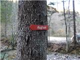 2
2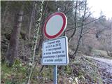 3
3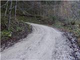 4
4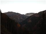 5
5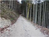 6
6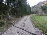 7
7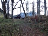 8
8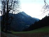 9
9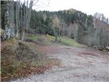 10
10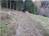 11
11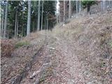 12
12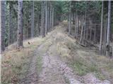 13
13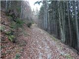 14
14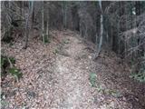 15
15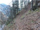 16
16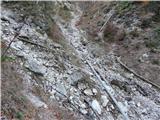 17
17 18
18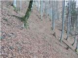 19
19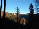 20
20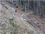 21
21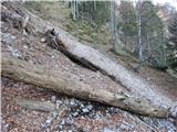 22
22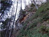 23
23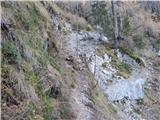 24
24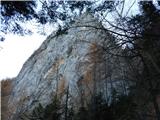 25
25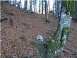 26
26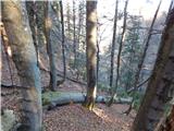 27
27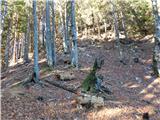 28
28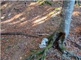 29
29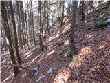 30
30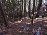 31
31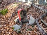 32
32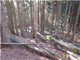 33
33 34
34 35
35 36
36 37
37 38
38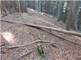 39
39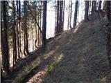 40
40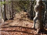 41
41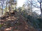 42
42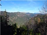 43
43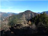 44
44 45
45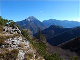 46
46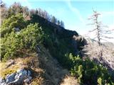 47
47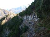 48
48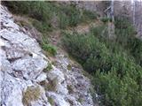 49
49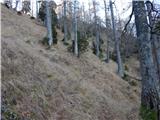 50
50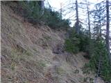 51
51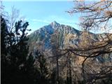 52
52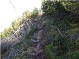 53
53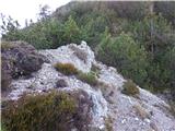 54
54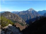 55
55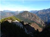 56
56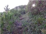 57
57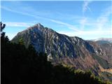 58
58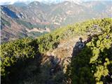 59
59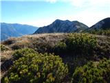 60
60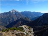 61
61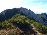 62
62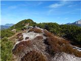 63
63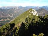 64
64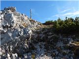 65
65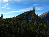 66
66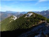 67
67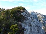 68
68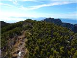 69
69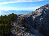 70
70 71
71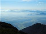 72
72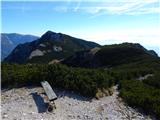 73
73
Discussion about the trip Kanonir - Mali Grintovec (via Licjanovec)
|
| tcankar13. 08. 2018 |
Today my colleague and I went to Mali Grintovec from Kanonir. The trail gets a bit lost from the point where we leave the trail to Kurji vrh parking in between, so map and compass are not superfluous. Nice trail for lovers of less crowded parts of our mountains. We descended pathless directly from Mačensko sedlo - minor caution needed on scree, otherwise no major dangers. At the spring, if we stick to the western side, we reach Praprotnikova koča.
|
|
|
|
| kozuc17. 06. 2023 15:40:29 |
Today I walked this tour. Without this description I would probably have strayed off the path several times, but this way it went quite smoothly. Only on the grassy slope do you need to watch to climb really high enough, otherwise you can take the wrong "path" which happened to me.
These are very beautiful and solitary corners, no living souls anywhere, at most wildlife.
|
|
|
To post a comment you must log in:
If you do not yet have a username, you must first
register.