Kanonir - Turni (at Kozji vrh)
Starting point: Kanonir (725 m)
| Latitude/Longitude: | 46,38010°N 14,46190°E |
| |
Walking time: 2 h
Difficulty: partly demanding marked way, easy pathless terrain
Elevation gain: 707 m
Elevation difference along the route: 715 m
Map: Karavanke - osrednji del 1:50.000
Recommended equipment (summer):
Recommended equipment (winter): ice axe, crampons
Views: 1.880
 | 1 person like this post |
Access to starting point:
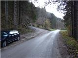
First, we drive to Preddvor or to the settlement Tupaliče (up to here from the Gorenjska motorway or Kranj), and then we continue driving in the direction of Jezersko. When we arrive in the municipality of Jezersko, we will soon notice signs for Gostišče Kanonir. Behind the inn we go left onto the road in the direction of Dol - Podstoržič and the Kovk farm. Further on, we drive on a somewhat narrower road that leads us past houses as well, and after a few hundred meters of further driving we reach a crossroads, where a steep road branches off to the left, along which the marked path to Kozji vrh also continues. We park in a suitable spot at the crossroads.
Route description:
From the starting point, we continue on the left road in the direction of Kozji vrh, along which we notice that from 20.7. to 20.10. further driving is forbidden. We walk for about 20 minutes on a quite steep road, then we come out of the forest onto the edge of the pasture Robci, from where a nice view opens up towards the massif of Kočna.
From Robci, which are situated on the saddle between Macesnovec (1042 m) on the left and Kozji vrh (1628 m) on the right, we continue right onto a cart track in the direction of Kozji vrh. The cart track quickly takes us into the forest, through which we begin to ascend more steeply. At a few smaller junctions we follow the blazes; higher up, the cart track turns into a mountain path, which then mostly ascends diagonally to the right, crossing several gullies and steep slopes in the process. In wet conditions there is a greater risk of slipping on some sections, and even in dry conditions greater caution is needed in places. Higher up, some views open through the treetops, and the path brings us below the cliffs of Kozji vrh, where especially in springtime there is a greater probability of falling rocks. Below the cliffs, the path leads across a smaller scree slope, mostly on a steep hillside. When the traverse ends, the path brings us to an indistinct forested saddle between Kozji vrh on the left and Turni (1432 m) on the right.
Here we leave the marked path, which turns left and leads further to Kozji vrh (to Kozji vrh it is still about 40 minutes), and continue right along an indistinct ridge, where we soon spot an old footpath and a wire fence. When we arrive below the summit of Turni, the footpath completely disappears, and we begin to ascend diagonally across the steep slope. The slope soon narrows into a forested and slightly overgrown ridge, along which we ascend to the panoramic and precipitous summit in a few minutes.
We descend along the ascent path, or alternatively along the forest road, initially the cart track that we reach south of the summit and that then continues around Kozji vrh.
The description and pictures refer to the conditions in 2015 (November).

Photos:
 1
1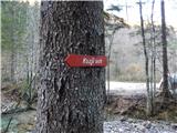 2
2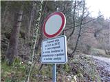 3
3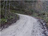 4
4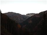 5
5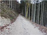 6
6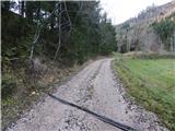 7
7 8
8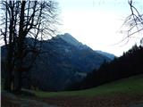 9
9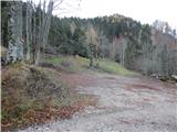 10
10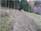 11
11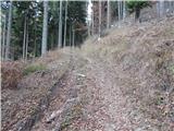 12
12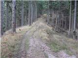 13
13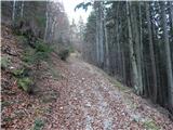 14
14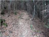 15
15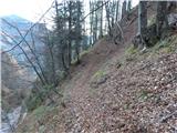 16
16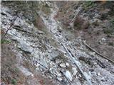 17
17 18
18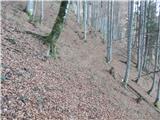 19
19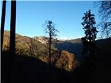 20
20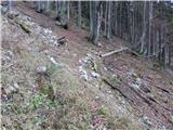 21
21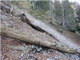 22
22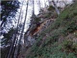 23
23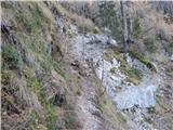 24
24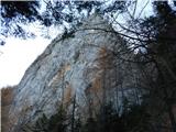 25
25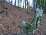 26
26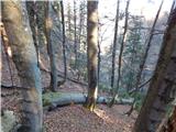 27
27 28
28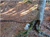 29
29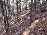 30
30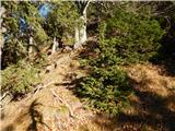 31
31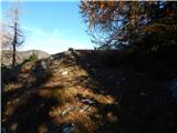 32
32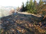 33
33 34
34
Discussion about the trip Kanonir - Turni (at Kozji vrh)
To post a comment you must log in:
If you do not yet have a username, you must first
register.