Starting point: Katarija (500 m)
| Latitude/Longitude: | 46,11890°N 14,74760°E |
| |
Walking time: 2 h 15 min
Difficulty: easy marked way
Elevation gain: 326 m
Elevation difference along the route: 450 m
Map: Ljubljana - okolica 1:50.000
Recommended equipment (summer):
Recommended equipment (winter):
Views: 4.707
 | 1 person like this post |
Access to starting point:
From the highway Ljubljana–Celje, we take the exit Krtina and Moravče. We follow the road ahead towards Moravče, where we turn right towards the village Ribče. The road towards Ribče first ascends and then descends. When it starts ascending again, it brings us into the forest, where after a time a macadam road branches off to the right. We park on the parking lot by the road near the crossroads. The parking lot is located on the Moravče side.
From Litija we drive towards Ljubljana but only to the village Ribče. Here we turn right and follow the road ahead towards Moravče. The road then runs over a 580m saddle (to it we return on foot) after which the road starts descending. After a short descent, we come to a crossroads, where we park on a parking lot by the road.
Route description:
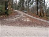
From the parking lot on the Moravče side of the road, we continue on the asphalt road upwards to the village Katarija, which we reach after just over five minutes of walking. Here we come to the crossroads, where we continue left in the direction of Slivna (right Miklavž, straight Ribče). The road soon behind the village becomes macadam. We follow the road, which is mostly slightly ascending, to a larger meadow over which a power line runs. Right at the spot where the road crosses the power line, we leave it and go left on a footpath that gently ascends through the meadow. The path through the meadow with nice views brings us to the mountain hut in two minutes.
From the hut we continue in the direction of Zgornja Slivna (Pivkelj) on the path, which soon brings us to a forest road. After a few minutes of walking from the hut, the road brings us to a crossroads, where we continue on the lower road. Only a few tens of meters ahead we come to the next crossroads, where we continue right in the direction of GEOSS. The road, which moderately ascends, brings us after a while to Štance Laze (smaller hamlet). A little further ahead, the signs for Slivna direct us right onto a cart track. Further we walk on the cart track, which goes from the meadow into the forest. The cart track running through the forest has several junctions, so we carefully follow the blazes. After a few descents and ascents, the path brings us to the next junction, where we continue right in the direction of Pivklja (Slivna). The path, which here ascends a bit more steeply, brings us in five minutes from the junction to a vegetated peak.
From the peak, we return to the junction and continue right (straight in the direction of arrival). After a few minutes' walk on the cart track, we come to an asphalt road, where we continue right. The road along which we walk brings us to the hut Dom na Slivni in a few minutes.

Photos:
 1
1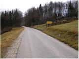 2
2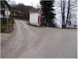 3
3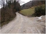 4
4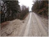 5
5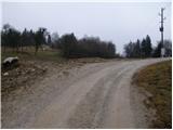 6
6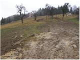 7
7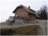 8
8 9
9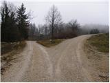 10
10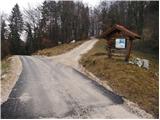 11
11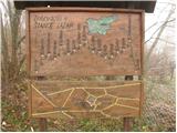 12
12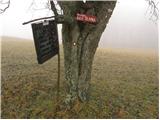 13
13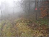 14
14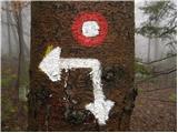 15
15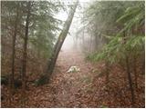 16
16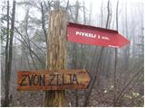 17
17 18
18 19
19 20
20 21
21 22
22
Discussion about the trip Katarija - Dom na Slivni
To post a comment you must log in:
If you do not yet have a username, you must first
register.