Klammbrückl - Weittalspitze (Allmaier Toni Weg)
Starting point: Klammbrückl (1092 m)
| Latitude/Longitude: | 46,79024°N 12,76478°E |
| |
Route name: Allmaier Toni Weg
Walking time: 4 h 30 min
Difficulty: very difficult marked way
Via ferrata: C
Elevation gain: 1447 m
Elevation difference along the route: 1500 m
Map:
Recommended equipment (summer): helmet, self belay set
Recommended equipment (winter): helmet, self belay set, ice axe, crampons
Views: 1.933
 | 2 people like this post |
Access to starting point:
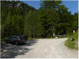
Through the Karawanks Tunnel, we drive into Austria, then continue driving towards Spittal and further towards Lienz (the highway ends a little after Spittal). Further, we drive on a relatively nice and wide road through the Drau Valley. In the center of Lienz, at the main roundabout, we continue "left" and continue driving towards Italy (exit from the roundabout in the direction of the villages Leisach, Anras and Silian). Soon after the village Leisach, we will notice signposts on the left side of the road, which direct us to a narrow wooden bridge over the river Drau (direction Kerschbaumer Alm, Klammbrückl). The road narrows a little after the bridge and starts to ascend steeply. We follow the mentioned road to the parking lot at Klammbrückl.
Route description:
From the parking lot, we continue on the road which is closed to traffic. Already after a few dozen meters, we come to a crossroads where we continue right following the signs "Kerschbaumer Alm". Further, we can follow the mountain road all the time or direct ourselves onto the footpath which runs through the forest and later joins the mountain road a few times for a short time.
When the road ends, we continue on the footpath which starts ascending on the right side of the valley. The path through a thin forest brings us to somewhat steeper slopes and then to the vantage point from where the waterfall Klapffall is nicely visible. The path then turns slightly to the left and approaches the mountain stream. Next follows an ascent along the stream and then the path brings us to the mountain pasture Kerschbaumer Alm. The path here runs on the left side of the mountain pasture and follows only a short ascent on a grassy slope past rare trees to the hut Schutzhaus.
At the hut where a junction is marked, we continue left following the signs "Weittalspitz Klettersteig". First, we cross a grassy slope and the bed of a torrent, then we come again to a path junction.
This time we continue right upwards following the signs "Zochenpaß, Weittalspitze"; left the path leads towards the saddle Kerschbaumer Törl and hut Karlsbader Hütte. From the junction, the path ascends along the larch forest and then turns somewhat to the left. Further, the path crosses the slopes towards the east in ascent and brings us to grassy slopes from which a beautiful view opens onto the nearby peaks. Here the path turns slightly to the right and brings us from the grassy slopes to scree fields where we soon come to a junction.
Left branches off another path towards the saddle Kerschbaumer Törl and hut Karlsbader Hütte, while we continue right towards the saddle Zochenpaß. From the junction, the path continues ascending over scree and soon brings us to the saddle Zochenpaß from which a view opens towards the south onto the Carnic Alps.
On the saddle, we continue right along the ridge following the signs "Weittalspitze Klettersteig". The path here is marked with red-blue blazes and initially runs on grassy terrain along the ridge, then ascends somewhat more steeply and brings us to the first fixed protections.
Further, the path runs for quite some time on and along the ridge and ascends and descends several times. The slopes on this section are quite crumbly, and there is a lot of scree on the path, so considerable caution is needed. On the more dangerous sections, a steel cable also helps us. Such a path then brings us below the slopes of the peak Weittalspitze where the more demanding climbing section of the path begins. On this section there is also considerable danger of falling rocks. The path turns to the left and then ascends almost vertically up the rocky ridge along the steel cable. Further, the path turns to the right and steeply ascends a few more times along the steel cable, bringing us to the summit logbook box. Here the path becomes a shade less demanding and with the help of protections we soon reach the panoramic summit.
We descend on the less demanding path which runs on the western side of the mountain over the saddle Weittalsattel and from there descends back towards the hut Schutzhaus on the mountain pasture Kerschbaumeralm.

Photos:
 1
1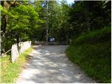 2
2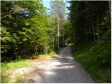 3
3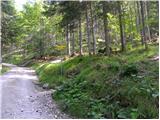 4
4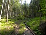 5
5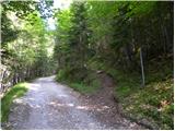 6
6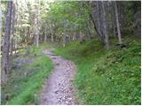 7
7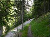 8
8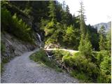 9
9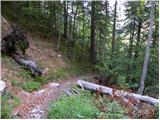 10
10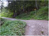 11
11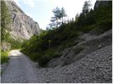 12
12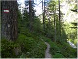 13
13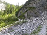 14
14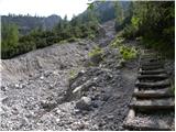 15
15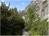 16
16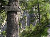 17
17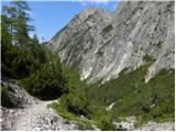 18
18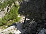 19
19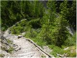 20
20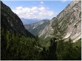 21
21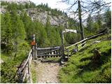 22
22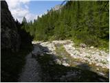 23
23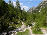 24
24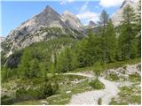 25
25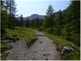 26
26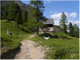 27
27 28
28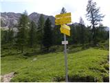 29
29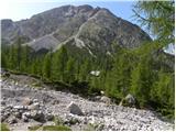 30
30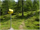 31
31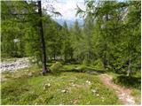 32
32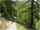 33
33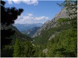 34
34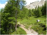 35
35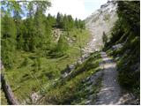 36
36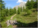 37
37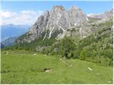 38
38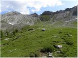 39
39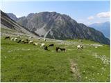 40
40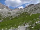 41
41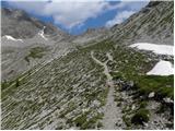 42
42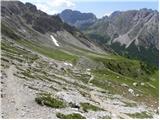 43
43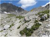 44
44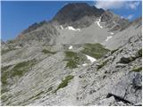 45
45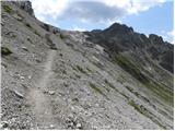 46
46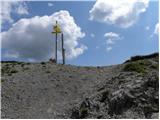 47
47 48
48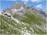 49
49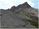 50
50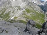 51
51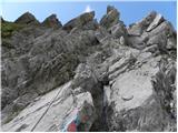 52
52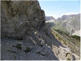 53
53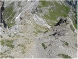 54
54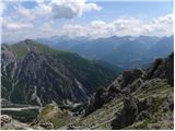 55
55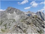 56
56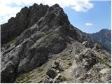 57
57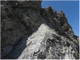 58
58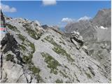 59
59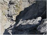 60
60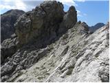 61
61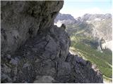 62
62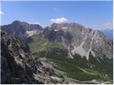 63
63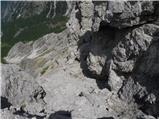 64
64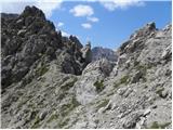 65
65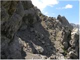 66
66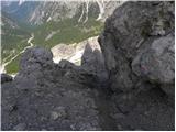 67
67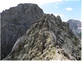 68
68 69
69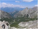 70
70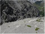 71
71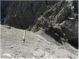 72
72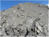 73
73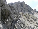 74
74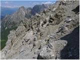 75
75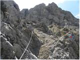 76
76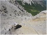 77
77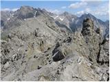 78
78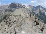 79
79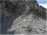 80
80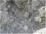 81
81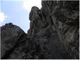 82
82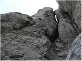 83
83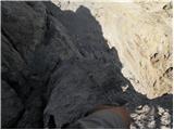 84
84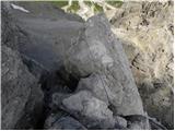 85
85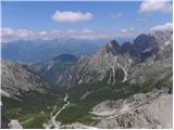 86
86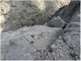 87
87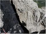 88
88 89
89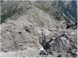 90
90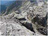 91
91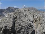 92
92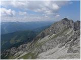 93
93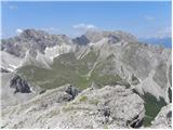 94
94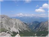 95
95 96
96
Discussion about the trip Klammbrückl - Weittalspitze (Allmaier Toni Weg)
To post a comment you must log in:
If you do not yet have a username, you must first
register.