Klippitztörl - Grünhütte (via Hohenwarthütte)
Starting point: Klippitztörl (1644 m)
| Latitude/Longitude: | 46,93637°N 14,67404°E |
| |
Route name: via Hohenwarthütte
Walking time: 1 h 35 min
Difficulty: easy marked way
Elevation gain: -27 m
Elevation difference along the route: 145 m
Map:
Recommended equipment (summer):
Recommended equipment (winter): ice axe, crampons
Views: 132
 | 1 person like this post |
Access to starting point:
a) Over the Ljubelj border crossing, we drive into Austria and follow the signs for Celovec by Lake Vrbsko jezero / Klagenfurt am Wörthersee. In Celovec, at McDonald's, we turn right onto the south bypass / Südring, and at the next major intersection, we turn right again towards Velikovec / Völkermarkt and Mostič / Brückl. We soon leave the road towards Velikovec, as shortly after the Obi store we turn right towards the highway and Mostič. We then pass the IKEA store, following the signs for Mostič and past the highway on-ramps. When we arrive in Mostič, we follow the signs for Svinec / Eberstein and Hüttenberg. Just before Hüttenberg, more precisely behind the settlement Mösel, we turn right towards the Klippitztörl pass and the settlement Lölling. We then begin to ascend more noticeably along the valley of the Löllingbach stream; higher up, behind the settlement Lölling, we gradually distance ourselves from the stream as well. We follow this road all the way to the Klippitztörl pass, where we turn right and park on the larger asphalt parking lot.
b) Over the Jezerski Vrh, Holmec or Vič border crossing, we drive into Austria, then follow the signs for Velikovec / Völkermarkt, from there the signs for Mostič / Brückl. When we arrive in Mostič, we follow the signs for Svinec / Eberstein and Hüttenberg. Just before Hüttenberg, more precisely behind the settlement Mösel, we turn right towards the Klippitztörl pass and the settlement Lölling. We then begin to ascend more noticeably along the valley of the Löllingbach stream; higher up, behind the settlement Lölling, we gradually distance ourselves from the stream as well. We follow this road all the way to the Klippitztörl pass, where we turn right and park on the larger asphalt parking lot.
c) We leave the motorway Klagenfurt am Wörthersee – Graz at the Šentlenart exit in Labotska dolina / Bad St. Leonhard im Lavanttal, then follow the signs for Zeltweg and Reichenfels. We continue along Obdacher Straße, which after about 2 km of driving we leave and continue left towards the Klippitztörl pass. This is followed by approximately 15 km of ascending asphalt road, which we follow past the Naturfreundehaus hut to the Klippitztörl pass, where we turn left onto the asphalt parking lot and park in a suitable spot.
Route description:
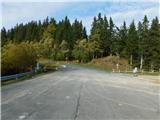
From the parking lot, we head north, where we first carefully cross the main road and then continue on the footpath following the signs for Zirbitzkogel and Hohenwart. At first, we ascend diagonally through the forest. When we reach a cart track, we gradually begin descending diagonally. Lower down, we reach a macadam road, which we follow to the right. A little further on, we turn right onto a footpath that climbs above the road. After a short ascent, we reach another cart track, which we follow to the right. Next follows some walking on a cart track, from which a view opens up several times towards Zirbitzkogel, then we gradually reach the slopes of the peak Hohenwart, where we turn right in the direction of the path over Hohenwart (straight ahead the normal path towards Zirbitzkogel).
We continue along a gently sloping path and a little further ahead we cross a pasture fence, and about a minute later the path splits.
Sharply left towards the wooden cross continues the path to Hohenwart, while we continue straight ahead towards the hut Hohenwarthütte and keep traversing the slopes to the right. A little further on, the path splits once again; this time we continue slightly left along a somewhat narrower cart track (the right cart track starts descending more noticeably), which a few minutes later crosses the line of the cable car and the summer toboggan run.
When we reach the ski slope we also arrive at a marked junction; we choose the path that continues along the road and begins to descend (left Zirbitzkogel and Hohenwart); after a short descent it brings us to the hut Hohenwarthütte.
We bypass the hut on its lower right side, then at the first junction we turn left and continue along a cart track that traverses the slopes to the right. Further on, the path enters a strip of forest; when we leave the forest we cross another ski slope. From here we begin to descend more noticeably; when the path turns left we reach a marked junction, from which we continue left (slightly right Šentlenart in Labotska dolina / Bad St. Leonhard im Lavanttal) and keep descending along a mostly grassy cart track that lower down widens into a macadam road. Lower down, at several junctions we follow the waymarks; later we cross yet another ski slope; when the road enters the forest we leave it and continue left onto a cart track that has signs for the hut Grünhütte. A short ascent through the forest follows, then with a few shorter ascents and descents we continue to the hut Grünhütte.
Starting point - Hohenwarthütte 1:00, Hohenwarthütte - Grünhütte 0:35.
The description refers to the conditions in November 2025; the photos are from October and November 2025.

Photos:
 1
1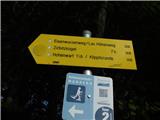 2
2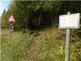 3
3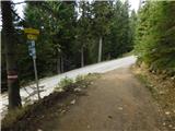 4
4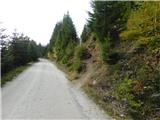 5
5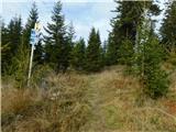 6
6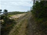 7
7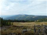 8
8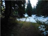 9
9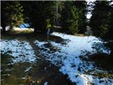 10
10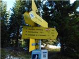 11
11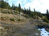 12
12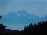 13
13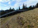 14
14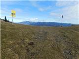 15
15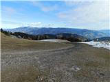 16
16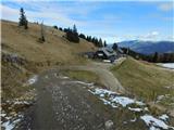 17
17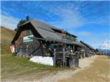 18
18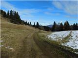 19
19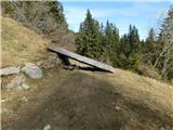 20
20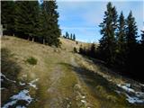 21
21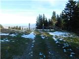 22
22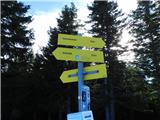 23
23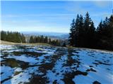 24
24 25
25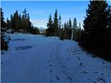 26
26 27
27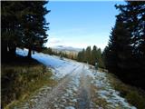 28
28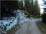 29
29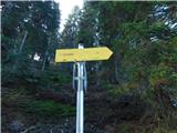 30
30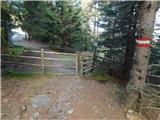 31
31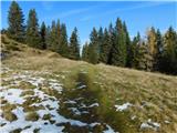 32
32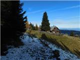 33
33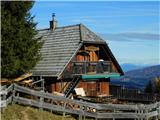 34
34
Discussion about the trip Klippitztörl - Grünhütte (via Hohenwarthütte)
To post a comment you must log in:
If you do not yet have a username, you must first
register.