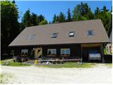
Koča na Klopnem vrhu - Dom na Osankarici
Starting point: Koča na Klopnem vrhu (1260 m)
| Latitude/Longitude: | 46,50180°N 15,39910°E |
| |
Walking time: 2 h 30 min
Difficulty: easy marked way
Elevation gain: -67 m
Elevation difference along the route: 300 m
Map: Pohorje 1:50.000
Recommended equipment (summer):
Recommended equipment (winter):
Views: 5.602
 | 1 person like this post |
Access to starting point:
A) First, we drive to Dravograd, and then we continue driving towards Maribor. Soon after the settlement Ožbalt we leave the main road and continue driving right over the bridge across the Drava River in the direction of the settlement Lovrenc na Pohorju. On the other side of the river, the road starts to ascend slightly and soon brings us to the next crossroad, where we continue left in the direction of the village Činžat (right Lovrenc na Pohorju). In Činžat, where the road from Ruše also joins, we continue right in the direction of the mountain hut Koča na Klopnem vrhu. Above the village, the road becomes macadam, which initially ascends along the Lamprehtov potok stream. Higher up, the road leads past the Lampreht farm, and we follow it at the crossroads in the direction of the mountain hut Koča na Klopnem vrhu. When we arrive at the mentioned mountain hut, we park in a suitable place nearby.
B) We drive to Ruše (to here from Maribor or Selnica ob Dravi) and then continue driving towards Lovrenc na Pohorju. When we arrive at the village Činžat, we leave the road leading towards Lovrenc na Pohorju and continue left on the initially still asphalt road in the direction of the mountain hut Koča na Klopnem vrhu. Above the village, the road becomes macadam, which initially ascends along the Lamprehtov potok stream. Higher up, the road leads past the Lampreht farm, and we follow it at the crossroads in the direction of the mountain hut Koča na Klopnem vrhu. When we arrive at the mentioned mountain hut, we park in a suitable place nearby.
C) From the Ljubljana - Maribor highway, we take the Slovenske Konjice exit and continue driving towards the mentioned place. From Slovenske Konjice, we continue towards Zreče, and further we follow the road in the direction of Rogla. When we arrive at Rogla, we continue driving on the main road, descending along it to the Koča na Pesku mountain hut. At the mentioned mountain hut, we continue right in the direction of Osankarica and the Koča na Klopnem vrhu mountain hut. Further along the macadam road, and at all subsequent crossroads, we follow the direction towards the Koča na Klopnem vrhu mountain hut. We park in a suitable place near the mentioned mountain hut.
Route description:
From the Koča na Klopnem vrhu mountain hut we continue along the road in the direction of Osankarica and Koča na Šumiku mountain hut. The road soon brings us to the first crossroad, where we continue straight ahead (right Koča na Pesku and Rogla). From the crossroad, we walk along the wide macadam road for only some 10 meters, then turn slightly right onto an initially wide cart track. The cart track first leads past the NOB monument, then brings us to a meadow, where it narrows. On the other side of the meadow, we cross a stream, then start ascending somewhat more steeply for a while. Higher up, the somewhat wider cart track levels out and after a few minutes of further walking brings us to a marked junction.
At the junction, we leave the wider cart track leading towards the Koča na Šumiku mountain hut and continue right onto a narrower cart track in the direction of Osankarica. From the junction onwards, we ascend for a few minutes, then gradually start descending. When the descent ends, we arrive at a macadam road, which we just cross (right Falski ribnik 3 minutes).
We continue across a shorter swampy area, then arrive in a belt of sparser forest. When the forest thins out even more, the path brings us to a marked junction, where we continue slightly left in the direction of Osankarica.
Further on, the path leads across Treh žebljev, then crosses a stream and enters dense forest. There follows walking through the forest, partly along forest paths, partly along numerous cart tracks that are usually quite muddy after rain. After a few ascents and descents, we leave the cart track and continue slightly right onto the path in the direction of Osankarica. From the mentioned mountain signposts, we ascend in a few minutes to the Pohorje battalion campsite, where several memorial plaques stand.
At the memorial plaques, the path from the Koča na Šumiku mountain hut also joins, and we continue straight ahead, initially still slightly uphill. After the ascent ends, the path levels out completely for a while, then gradually starts descending. A few more minutes of descent follow along a nicely arranged path, and the path quickly brings us to the Dom na Osankarici.

Along the route: Taborišče pohorskega bataljona (1210m)
Photos:
 1
1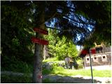 2
2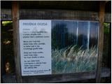 3
3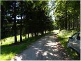 4
4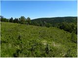 5
5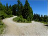 6
6 7
7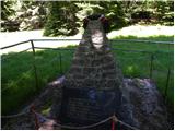 8
8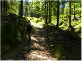 9
9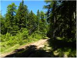 10
10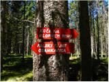 11
11 12
12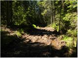 13
13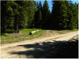 14
14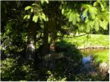 15
15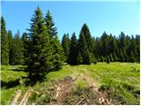 16
16 17
17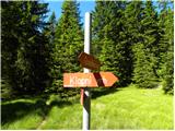 18
18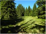 19
19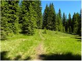 20
20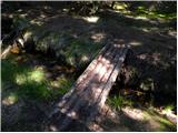 21
21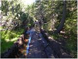 22
22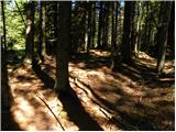 23
23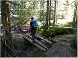 24
24 25
25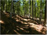 26
26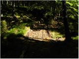 27
27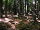 28
28 29
29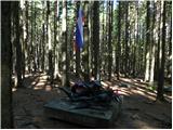 30
30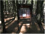 31
31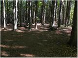 32
32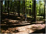 33
33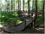 34
34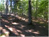 35
35 36
36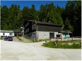 37
37
Discussion about the trip Koča na Klopnem vrhu - Dom na Osankarici
To post a comment you must log in:
If you do not yet have a username, you must first
register.