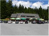
Starting point: Koča na Pesku (1386 m)
| Latitude/Longitude: | 46,46700°N 15,34410°E |
| |
Walking time: 1 h
Difficulty: easy marked way
Elevation gain: -164 m
Elevation difference along the route: 10 m
Map: Pohorje 1:50.000
Recommended equipment (summer):
Recommended equipment (winter):
Views: 7.674
 | 3 people like this post |
Access to starting point:
A) From the highway Ljubljana - Maribor, we take the exit Slovenske Konjice and continue driving towards the mentioned settlement. From Slovenske Konjice, we continue towards Zreče, and further we follow the road in the direction of Rogla. When we get to Rogla, we continue on the main road, which for some time continues without large changes in altitude, then turns to the left and gradually starts descending. We follow the mentioned road to the mountain hut Koča na Pesku, where we park on a parking lot near the mountain hut.
B) First, we drive to Lovrenc na Pohorju (to here from the road Maribor - Dravograd), and then we continue driving towards Rogla and Koča na Pesku. Further, the macadam road then first brings us to Mašinžaga and then also to the mountain hut Koča na Pesku. We park on a parking lot at the mountain hut Koča na Pesku.
Route description:
From the mountain hut Koča na Pesku we continue on the road in the direction of Mašin Žaga. The road first descends through a small valley between Rogla on the left and Pesek on the right, and then brings us to Mašin Žaga, where there is a smaller artificial lake.
At the lake, we go right (straight - Lovrenška jezera) and continue further on the macadam road, which descends moderately. Further, we descend along the stream Radoljna, and we follow the main road towards Lovrenc na Pohorju to the first crossroad, where a forest road branches off sharply to the left, which a little further crosses the aforementioned stream. Further, the road runs on the left bank of Radoljna and descends only gently. When the stream Radoljna is already more than 50 meters of altitude below us, the road, along which we notice some blazes, brings us to a larger artificial lake named Jezerc or Jezerska jama.
Along the route: Mašin Žaga (1338m)
Photos:
 1
1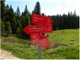 2
2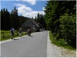 3
3 4
4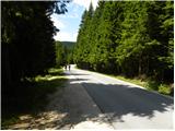 5
5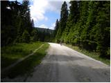 6
6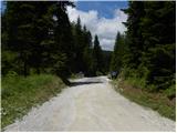 7
7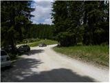 8
8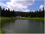 9
9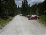 10
10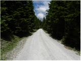 11
11 12
12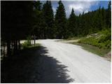 13
13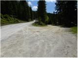 14
14 15
15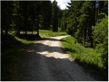 16
16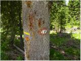 17
17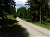 18
18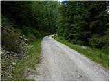 19
19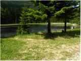 20
20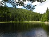 21
21
Discussion about the trip Koča na Pesku - Jezerc
To post a comment you must log in:
If you do not yet have a username, you must first
register.