Koča na Pikovem - Jesenik (Jesenikov vrh)
Starting point: Koča na Pikovem (992 m)
| Latitude/Longitude: | 46,48920°N 14,83640°E |
| |
Walking time: 1 h 5 min
Difficulty: easy unmarked way
Elevation gain: 207 m
Elevation difference along the route: 250 m
Map: Koroška 1:50.000
Recommended equipment (summer):
Recommended equipment (winter): ice axe, crampons
Views: 565
 | 1 person like this post |
Access to starting point:
We drive to Črna na Koroškem, and then we follow the signs for Podpeca and later Koča na Pikovem. We park on the parking lot near the mountain hut Koča na Pikovem.
Route description:
From the parking lot, we walk to the church of St. Helena and mountain hut Koča na Pikovem, after that behind the church we continue left on the path in the direction of Veliki vrh. The path ahead leads us on a worse macadam road which at first runs through the forest and then through meadows, from which a beautiful view opens up. Behind the homestead Pik the road changes into a cart track, and by the edge of the forest the path to Pikov vrh branches off to the right (also to Veliki vrh). There follows a shorter winding ascent through the forest and the path brings us to a religious symbol, where another path branches off to the right to Pikov vrh, and we continue on the path which gradually starts to descend lightly.
We quickly get to a smaller junction, where we continue left (straight one of the paths to Mežica), and at the nearby next junction we go right in the direction of Mežica (straight to the saddle Vrh šteng).
From the junction, we quickly ascend to a small saddle, where to the right downwards the path descends towards Mežica, and we continue straight on an unmarked footpath which starts ascending along the south ridge of Jesenik. Further, because of numerous fallen trees, which are the consequences of the windstorm in December 2017, it is harder to follow the path which mostly runs along the ridge. The path higher joins a cart track, where it also flattens.
The cart track at first leads along the ridge and then passes into a smaller valley, and when it ends we ascend to the nearby peak on a worse footpath.
The description and pictures refer to the condition in the year 2018 (May).

Along the route: Sveta Helena (992m)
Photos:
 1
1 2
2 3
3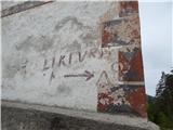 4
4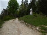 5
5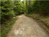 6
6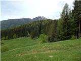 7
7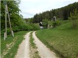 8
8 9
9 10
10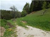 11
11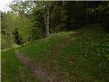 12
12 13
13 14
14 15
15 16
16 17
17 18
18 19
19 20
20 21
21 22
22 23
23 24
24 25
25 26
26 27
27 28
28 29
29
Discussion about the trip Koča na Pikovem - Jesenik (Jesenikov vrh)
To post a comment you must log in:
If you do not yet have a username, you must first
register.