Koča na Starem vrhu - Mladi vrh (via Stari vrh)
Starting point: Koča na Starem vrhu (1032 m)
| Latitude/Longitude: | 46,17130°N 14,18340°E |
| |
Route name: via Stari vrh
Walking time: 1 h 40 min
Difficulty: easy marked way
Elevation gain: 342 m
Elevation difference along the route: 550 m
Map: Škofjeloško in Cerkljansko hribovje, 1:50.000
Recommended equipment (summer):
Recommended equipment (winter): crampons
Views: 12.870
 | 2 people like this post |
Access to starting point:
We drive to Škofja Loka and turn in the direction of Železniki. In the village Praprotno, just after the inn »Pr Birt« we turn left onto a side road in the direction of STC Stari vrh and on a narrow, but all the time asphalt road through the settlement Zapreval we drive all the way to the parking place at the upper station of the 6-seater chairlift or to the inn and boarding house Gostišče in penzion Stari Vrh.
Route description:
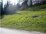
From the parking lot, we step a few meters back on the road by which we arrived, to a poorly visible footpath that rises steeply across the meadow (ski slope in winter) diagonally to the left upwards to the edge of the meadow (here the blazes begin) and then leads us very steeply upwards along the left edge of the meadow to the upper station of the ski lift, where we notice the start cabin and next to it a newer log cabin – snack bar »Na vrhu«.
We bypass the start cabin on the right side and soon behind it we see the blaze and caption on a wooden sign »razgledišče 10 min«. We follow a poorly visible footpath which soon quite steeply ascends and leads us mostly along the ridge, where it a few times very steeply ascends to an individual rocky peak and then from it again equally steeply descends, until it brings us to the previously mentioned vantage point, where there is a bench and inscription book. From this spot a nice view opens up on Poljanska dolina, which later from the path is no longer visible.
From the viewpoint the path steeply descends to the saddle between Stari vrh and Mladi vrh and then again equally steeply ascends mostly along the edge of the slope and on the wide ridge of Mladi vrh. A little above the saddle we run into some younger trees and branches thrown onto the path, and immediately after them we see a newly built bad forest road, which we only cross and continue with the steep ascent. About 500 m below the summit there is on a sign attached to a tree the warning »tišina, gamsi«. Because of the leaves unfortunately a completely quiet walk is not possible, as in many places we wade through leaves to the ankles and it is necessary to be very careful, as we do not see the ground (rocks, roots) or the edge of the path, an awkward step can cause a nasty fall or slip on considerable steepness.
On the summit of Mladi vrh there is a small, somewhat wobbly bench, inscription book and stamp, the view is due to the trees quite limited, completely open only towards the east. From the summit a marked footpath leads further in the direction of Blegoš.
We return along the same path to the saddle between Mladi vrh and Stari vrh, here we can decide either for the return along the approach path, or choose the easier (unmarked) path, which at the saddle barely visibly branches off to the left and leads along the northern slope of Stari vrh.
The branch-off is marked on a tree with a drawn large letter »S« and directional arrow, and again »S« on the next tree on the left side of this path. After some 10 meters of path the footpath widens and becomes nicely visible, to the left below us through sparse trees we see a forest road, which otherwise leads almost to the previously mentioned saddle. After a few minutes of walking the path narrows again and becomes barely visible and constantly leads us in moderate ascent along the steep slope. Later the path widens again, slowly changes into a wider, abandoned bad forest road or cart track, which becomes wider and better visible. Twice from our path other cart tracks branch off to the right upwards, which lead upwards, we moderately descend and soon notice below in front of us the upper station of the six-seater chairlift and the parking lot.
General impression of the path: Technically undemanding path, but strenuous due to the steepness and in fog locally orientationally difficult, in wet due to abundance of fallen leaves and steepness danger of slipping. The path is well marked with mountain trail blazes and signs of the European footpath, the path itself is (in autumn, due to abundance of fallen leaves) for the larger part more difficult to follow, occasionally practically invisible. All the time we walk in sparse beech forest, there are not many views neither on the path nor on the summit.

The trip can be extended to the following destinations: Koprivnik
Photos:
 1
1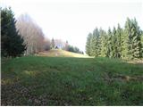 2
2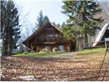 3
3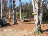 4
4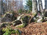 5
5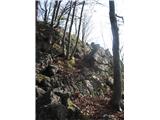 6
6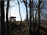 7
7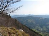 8
8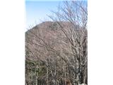 9
9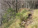 10
10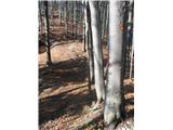 11
11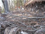 12
12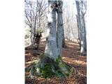 13
13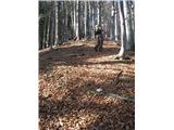 14
14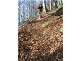 15
15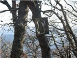 16
16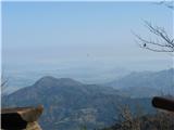 17
17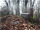 18
18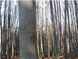 19
19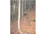 20
20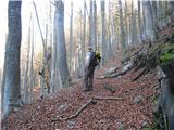 21
21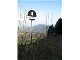 22
22 23
23
Discussion about the trip Koča na Starem vrhu - Mladi vrh (via Stari vrh)
|
| fpetel111. 12. 2008 |
Is this destination visited more in summer or winter?
|
|
|
|
| Kriška12. 12. 2008 |
I have to admit that I haven't been there in winter yet. In summer/autumn I haven't noticed any mass visits. A few more go from the inn below Stari Vrh to the saddle between the two peaks and then return via another path to make a loop.
|
|
|
|
| žl15. 12. 2008 |
This trip is also nice to do in winter. The path gets trodden quickly.
Nice autumn photos. Too bad that the same person keeps appearing on them, which belongs more in a family album.
|
|
|
|
| Kriška15. 12. 2008 |
This same person is always photographed from far enough away and only from behind, especially on paths where I think that with an additional human figure on the photo I better represent the path or the proportions of objects on the photo.
And I can't always tell him "come on, get out of my frame ...  ". ".
|
|
|
|
| fpetel125. 12. 2008 |
I went on Christmas Eve without skis to Stari and Mladi vrh. The road is closed at the farm above the lower parking lot (at about 700m asl), because it is crossed by the ski slope. I continued to Mladi vrh - before that, a well-trodden trail downhill to the south confused me. At the top of Mladi vrh, unlike the 200 meters lower saddle (about 10 cm), there is about a meter of snow, and from it only the top part of the dug-out bench peeks out. I wanted to dig out the logbook and stamp, but I didn't know where it was and gave up the idea . Sunshine and nice weather smiled at me only towards two o'clock in the afternoon, when the snow-covered Kamniški očaki appeared to me. Nice trip from Stari vrh - steeper sections can be avoided in winter.
|
|
|
|
| G3420. 11. 2022 16:51:41 |
Why does this peak even have such a name
|
|
|
|
| BorStenar4. 12. 2022 15:33:07 |
This is the second time you're asking...
|
|
|
|
| BorStenar4. 12. 2022 15:35:28 |
Check the comments under the path from Črni Kal
|
|
|
To post a comment you must log in:
If you do not yet have a username, you must first
register.