Koča na Šumiku - Klopni vrh (northern path)
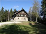
Starting point: Koča na Šumiku (1100 m)
| Latitude/Longitude: | 46,44900°N 15,41960°E |
| |
Route name: northern path
Walking time: 2 h
Difficulty: easy marked way
Elevation gain: 240 m
Elevation difference along the route: 315 m
Map: Pohorje 1:50.000
Recommended equipment (summer):
Recommended equipment (winter):
Views: 867
 | 1 person like this post |
Access to starting point:
A) From the Ljubljana–Maribor highway, take the Slovenske Konjice exit, then follow the road to the mentioned place. In Slovenske Konjice, turn right towards Oplotnica, which is a few kilometres of winding road away. In Oplotnica, where we join the road from Slovenska Bistrica, continue left in the direction of Osankarica. Further, for some time we ascend alongside the Oplotnica stream, then we arrive at a crossroads where the road splits into two parts. Here we can continue left in the direction of Osankarica, or right in the direction of the village Kebelj. If we continue on the left road, it soon changes into macadam, higher up it brings us to a somewhat larger crossroads, where we continue right in the direction of Osankarica (left Rogla). From the crossroads a few hairpin turns follow and the macadam road brings us to the parking lot below the mountain hut Dom na Osankarici, where there is a crossroads. We continue slightly left on the road, which initially continues towards the north. Further on, the road gradually starts to descend, and we continue left at the crossroads after a few kilometres. Further, we drive past the starting point of the path to the Šumik waterfall, where the road turns quite to the right. At the crossroads after the mentioned turn we continue left, then only a little further we park on a suitable place near the mountain hut Koča na Šumiku.
B) From the Maribor–Ljubljana highway, take the Slovenska Bistrica–Jug exit, then continue driving towards Oplotnica. In Oplotnica, where we notice signs for Osankarica, continue straight, then for some time we ascend alongside the Oplotnica stream, and after a shorter ascent we arrive at the place where the road splits into two parts. Here we can continue left in the direction of Osankarica, or right in the direction of the village Kebelj. If we continue on the left road, it soon changes into macadam, higher up it brings us to a somewhat larger crossroads, where we continue right in the direction of Osankarica (left Rogla). From the crossroads a few hairpin turns follow and the macadam road brings us to the parking lot below the mountain hut Dom na Osankarici, where there is a crossroads. We continue slightly left on the road, which initially continues towards the north. Further on, the road gradually starts to descend, and we continue left at the crossroads after a few kilometres. Further, we drive past the starting point of the path to the Šumik waterfall, where the road turns quite to the right. At the crossroads after the mentioned turn we continue left, then only a little further we park on a suitable place near the mountain hut Koča na Šumiku.
C) Drive to Ruše (to here from Maribor or Selnica ob Dravi), then continue driving towards Smolnik and higher to Šumik. At the crossroads where the road to Koča na Šumiku branches off to the right, continue right and then after some 10 metres of further driving park on a suitable place near the mountain hut Koča na Šumiku.
Route description:
From the starting point, head onto the footpath in the direction of Osankarica and Koča na Klopnem vrhu. Already after a few steps of ascent, reach the macadam road, which we follow to the left, but walk on it only to the nearby crossroads, where we turn onto the upper right road (straight on the lower road Osankarica). Walk on the mentioned road for a short time, then the mountaineering signs direct us left onto the marked footpath, which continues somewhat to the left of the road. Higher up, we temporarily return to the road, then leave it again for a short time. When we next return to the road, we follow it to its end.
From the end of the road, continue right following the signs for Klopni vrh, and continue on the cart track, which gradually starts to descend moderately. When the path levels out, a marked path from Dom na Osankarici joins us from the left.
Continue the path for some time on and alongside the cart track, then arrive at the NOB monument, behind which we soon step onto a wider macadam road.
When we step onto the road, continue straight, then at the nearby crossroads take the lower right road. From the crossroads, only a few minutes of easy walking follow and the path brings us to Koča na Klopnem vrhu.
Before the hut, the eastern path to Klopni vrh and the path to Koča na Pesku branch off to the left, while we bypass the hut on the right side along the road and continue another 10 m or so to the edge of the forest, where the signs for Klopni vrh direct us left onto a cart track that starts ascending through the forest. Follow this path, following the blazes at a few minor junctions, all the way to the nearby summit, which we reach after approximately 15 minutes of walking.
Koča na Šumiku - Koča na Klopnem vrhu 1:45, Koča na Klopnem vrhu - Klopni vrh 0:15.

Photos:
 1
1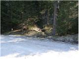 2
2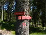 3
3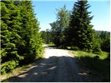 4
4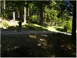 5
5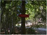 6
6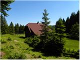 7
7 8
8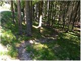 9
9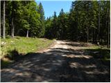 10
10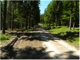 11
11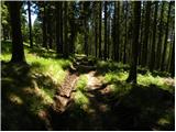 12
12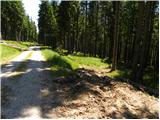 13
13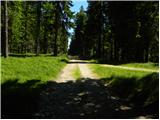 14
14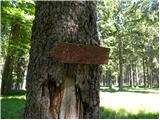 15
15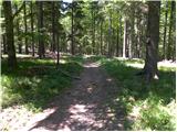 16
16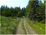 17
17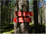 18
18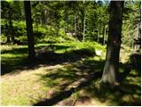 19
19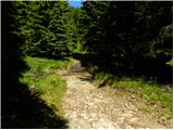 20
20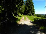 21
21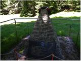 22
22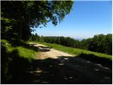 23
23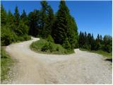 24
24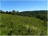 25
25 26
26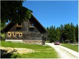 27
27 28
28 29
29 30
30 31
31 32
32 33
33 34
34 35
35 36
36 37
37 38
38
Discussion about the trip Koča na Šumiku - Klopni vrh (northern path)
To post a comment you must log in:
If you do not yet have a username, you must first
register.