Koča pri Jelenovem studencu - Slovenski vrh
Starting point: Koča pri Jelenovem studencu (850 m)
| Latitude/Longitude: | 45,61900°N 14,84700°E |
| |
Walking time: 3 h
Difficulty: easy marked way
Elevation gain: 191 m
Elevation difference along the route: 325 m
Map:
Recommended equipment (summer):
Recommended equipment (winter): ice axe, crampons
Views: 1.270
 | 2 people like this post |
Access to starting point:
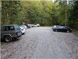
We drive to Kočevje, and then through the town we drive in the direction towards Croatia. When we get to the intersection with Podgorska ulica, we turn right in the direction of sports park Gaj, castle Fridrihštajn and the starting point of hiking paths. Further, we drive on Podgorska ulica, and after the dense part of the settlement, we get to a large marked parking lot, which we bypass on the right side. At the next intersection, we go slightly left and then twice right. From the last intersection onwards the road starts ascending diagonally, and in the next intersections, we follow it in the direction of the PD hut. Higher, the road flattens, and after a short descent brings us to the last intersection, where we continue slightly right in the direction of the parking lot and Ledene jame. When we get to the parking lot above the Koča pri Jelenovem studencu, we park.
Route description:
From the parking lot, we descend to the mountain hut, and from there we continue on a gently sloping road which leads us through a meadow. When the road passes into the forest it slightly ascends, and then it brings us to a marked junction, where the path from the valley joins, and we continue left, on the road which continues gently to moderately ascending. Higher, the road flattens, and then in a few steps descends to an intersection, where we continue straight (sharply left, we return to the starting point).
Further, we walk a few minutes on the road by which we came to the starting point, and then signs for Ledenik direct us left downwards, on a footpath which continues through the forest. The path quickly flattens, and then in a short ascent it brings us to another forest road, which we follow to the left. Next follow two successive intersections, and both times we continue on the right road, at the second intersection there are signs for Eleonorina jama. A few hundred meters further, the blazes direct us from the road which leads towards Eleonorina jama, to the right on a cart track which continues through the forest, and at the junctions we follow the blazes. After a few minutes, the blazes from the cart track direct us to the right, on the path which starts ascending towards the summit of Ledenik, and we reach it after approximately 10 minutes of additional walking.
From Ledenik we continue on the Kočevska mountain trail, which first descends along the ridge, then temporarily flattens. There follows some more descent, where we follow the blazes, and then we reach the end of the forest road, along which we continue the descent. When the road turns right, we continue left, on a marked path which continues through the forest. A little lower we again reach one of the forest roads, right at the stump with a shelter. Here we continue left, and then before the forestry hut Bivaki, the road turns right and starts to turn semicircularly towards the left. After the semicircle around the forestry hut the road turns slightly to the right, but the blazes lead us right, on the path which continues without major changes in elevation. A little further ahead we reach a cart track, along which we descend to the turning area of the next forest road. Further, we walk a few minutes on the road, from which occasionally a view opens towards the southwest, where we see Goteniška gora. After a few minutes, we go from the road again to the right, and after a gentle ascent we reach yet another road, which we just cross. There follows a few minutes of moderate ascent, and then we arrive below Slovenski vrh, where the path ascends more steeply. The steep ascent ends quickly, as the path quickly brings us to Slovenski vrh.
Starting point - Ledenik 1:15, Ledenik - Slovenski vrh 1:45.
Description and pictures refer to the condition in 2016 (September).

Along the route: Bivaki (900m)
The trip can be extended to the following destinations: Ledenik
Photos:
 1
1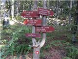 2
2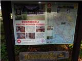 3
3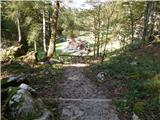 4
4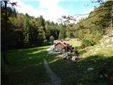 5
5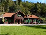 6
6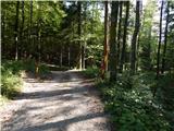 7
7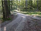 8
8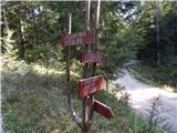 9
9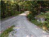 10
10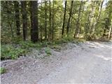 11
11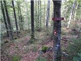 12
12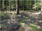 13
13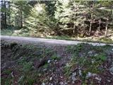 14
14 15
15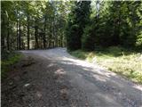 16
16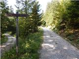 17
17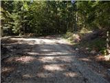 18
18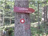 19
19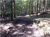 20
20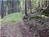 21
21 22
22 23
23 24
24 25
25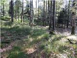 26
26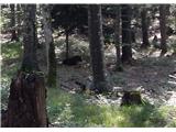 27
27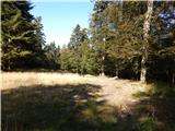 28
28 29
29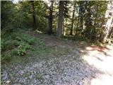 30
30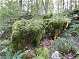 31
31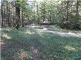 32
32 33
33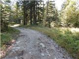 34
34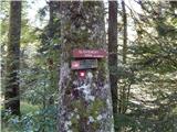 35
35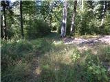 36
36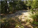 37
37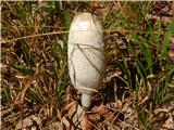 38
38 39
39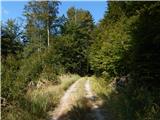 40
40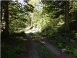 41
41 42
42 43
43 44
44 45
45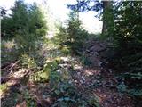 46
46 47
47
Discussion about the trip Koča pri Jelenovem studencu - Slovenski vrh
|
| calantha4. 11. 2016 |
hello my name is Calantha am really interested to be ur friend if
you feel so contact me back to my email address for my
picture and further communication
calanthacamara@gmail.com
|
|
|
To post a comment you must log in:
If you do not yet have a username, you must first
register.