Koča pri Savici - Glava za Bajto (via Komna)
Starting point: Koča pri Savici (653 m)
| Latitude/Longitude: | 46,28960°N 13,80220°E |
| |
Route name: via Komna
Walking time: 7 h 15 min
Difficulty: easy pathless terrain
Elevation gain: 1478 m
Elevation difference along the route: 1620 m
Map: Triglav 1:25.000
Recommended equipment (summer): helmet
Recommended equipment (winter): helmet, ice axe, crampons
Views: 571
 | 1 person like this post |
Access to starting point:
From the Ljubljana - Jesenice motorway, take the Lesce exit and follow the road towards Bled and further towards Bohinjska Bistrica. Continue driving towards Lake Bohinj (Ribčev Laz), where you reach a junction and continue straight on the left (southern) side of the lake in the direction of Ukanc and the Savica waterfall. Follow this increasingly narrow road to the large parking lot at the Koča pri Savici. Paid parking.
Route description:
From the parking lot, we head onto the wide footpath in the direction of the Savica Waterfall and Dom na Komni (right the path over Komarča). After a short gentle ascent, the path leads us to a marked junction, where the tourist path to the Savica Waterfall branches off to the right, while we continue slightly left or straight on the wide footpath towards Komna. The path ahead ascends briefly along the Savica, then leads us to the first of the marked 48 switchbacks. After one and a half hours of moderate ascent through the forest, the path brings us to the mentioned 48th switchback, from which a beautiful view opens onto Lake Bohinj. Here the path turns slightly right and enters the valley called Pekel, where it ascends gently for a while, then turns right and ascends somewhat steeper again. After just a few dozen steps, the path turns left again and continues ascending parallel to the valley. The gentle to moderately steep path ahead gradually transitions into sparser forest, from which we soon see Dom na Komni. The path ahead leads past a small interesting cave, higher up it brings us to a junction where the path to Črno jezero branches off to the right, while we continue left and proceed further on the wide path. Some traversing ascent follows; at the natural abyss, fenced for safety, the path turns right, then ascends to the next junction where the path from Črno jezero also joins.
A little further ahead, the path splits again; we choose the right path with signs for Koča pod Bogatinom and Koča pri Triglavskih jezerih (left Dom na Komni, five minutes) and after a few steps reach the next junction.
This time we continue right towards Koča pri Triglavskih jezerih (straight Koča pod Bogatinom, 15 minutes) and continue the ascent on a somewhat narrower but still well-trodden trail. The path ahead ascends and descends several times, then after about 30 minutes of further walking brings us to the spot where the path from Koča pod Bogatinom joins from the left.
Ahead, we almost imperceptibly cross the abandoned Planina Razor, where some ruins can be seen; behind it, the path gradually begins a moderate ascent. After a while, the path turns right and leads us to a scenic but indistinct saddle with old signs for Triglav National Park.
A short descent follows, and the path brings us to the marshy Planina na Kalu. The path then gradually enters sparse forest and continues with several shorter ascents and descents all the way to Planina Lopučnica.
At Planina Lopučnica there is a marked junction; we continue left towards Planina Za skalo (right Koča pri Triglavskih jezerih) on a less-trodden path that traverses the plateau slopes northwestward. The path, running through high grass (in summer months), a bit higher crosses a strip of sparse forest and then turns slightly left. The path ahead ascends steeply and after a few minutes of further walking brings us into the karst world of abysses and lapies. Here the path flattens and begins to disappear in the rocky terrain (follow markings carefully). In this section, a wonderful view opens onto the mountains surrounding the Valley of the Triglav Lakes. We then follow the marked path only to the Velika vrata pass, reaching it after a few more minutes of gentle ascent.
On the other side of Velika vrata, we leave the already sparsely visited path and continue right through pathless terrain. Initially, passages through scrub and lapies are relatively easy, as cairns help locate the “path,” though they are sparse. We continue the ascent generally northward, but direct routes are absent due to the karst terrain. Because of fissures, we occasionally make large detours. Once the “path” reaches the ridge, orientation issues end. We continue ascending the increasingly scenic ridge, and the “path” soon brings us to the indistinct summit of Glava za Bajto.
Starting point - junction to Črno jezero 2:15, junction to Črno jezero - Memorial plaque to Matej Koblar 0:10, Memorial plaque to Matej Koblar - Planina Razor 0:35, Planina Razor - Planina na Kalu 0:35, Planina na Kalu - Planina Lopučnica 0:50, Planina Lopučnica - Velika vrata 1:45, Glava za Bajto 1:05, Glava za Bajto - Čelo 0:25.

Along the route: Jama ob poti na Komno (1303m), Odcep k Črnemu jezeru (1411m), Brezno pod lovsko kočo na Komni (1430m), Spominska plošča Mateju Koblarju (1481m), Planina Razor (1550m), Planina na Kalu (1636m),
Planina Lopučnica (1558m), Velika vrata (1910m)
Photos:
 1
1 2
2 3
3 4
4 5
5 6
6 7
7 8
8 9
9 10
10 11
11 12
12 13
13 14
14 15
15 16
16 17
17 18
18 19
19 20
20 21
21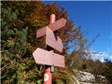 22
22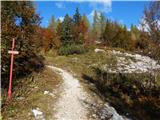 23
23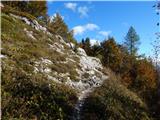 24
24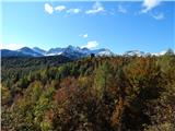 25
25 26
26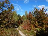 27
27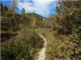 28
28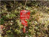 29
29 30
30 31
31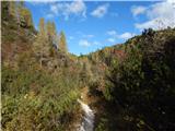 32
32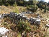 33
33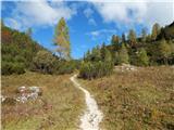 34
34 35
35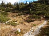 36
36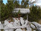 37
37 38
38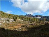 39
39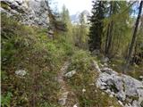 40
40 41
41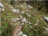 42
42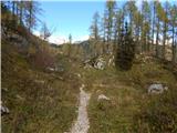 43
43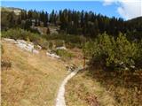 44
44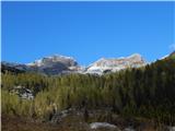 45
45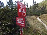 46
46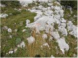 47
47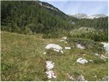 48
48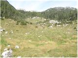 49
49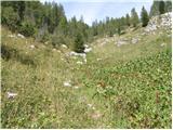 50
50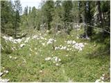 51
51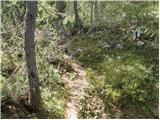 52
52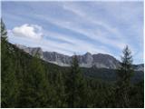 53
53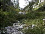 54
54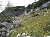 55
55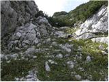 56
56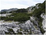 57
57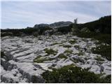 58
58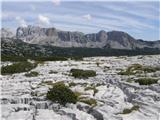 59
59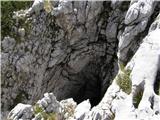 60
60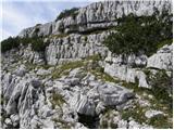 61
61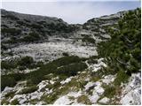 62
62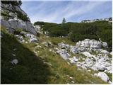 63
63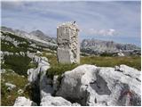 64
64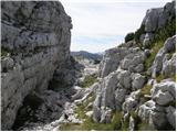 65
65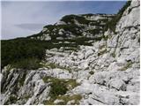 66
66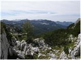 67
67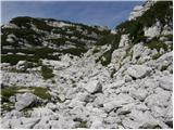 68
68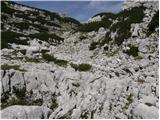 69
69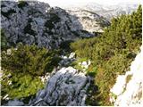 70
70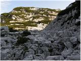 71
71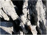 72
72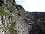 73
73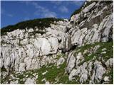 74
74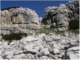 75
75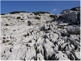 76
76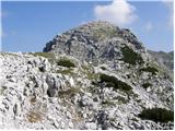 77
77
Discussion about the trip Koča pri Savici - Glava za Bajto (via Komna)
To post a comment you must log in:
If you do not yet have a username, you must first
register.