Koča pri Savici - Kal (above Komna) (via Lepa Komna)
Starting point: Koča pri Savici (653 m)
| Latitude/Longitude: | 46,28960°N 13,80220°E |
| |
Route name: via Lepa Komna
Walking time: 5 h 5 min
Difficulty: easy pathless terrain
Elevation gain: 1348 m
Elevation difference along the route: 1370 m
Map: TNP 1:50.000
Recommended equipment (summer):
Recommended equipment (winter): ice axe, crampons
Views: 12.359
 | 1 person like this post |
Access to starting point:
From the Ljubljana - Jesenice motorway, take the Lesce exit and follow the road towards Bled and further towards Bohinjska Bistrica. Continue driving towards Lake Bohinj (Ribčev Laz), where you reach a crossroads and continue straight on the left (southern) side of the lake towards Ukanc and the Savica waterfall. Follow this increasingly narrow road to the large parking lot at Koča pri Savici. The parking lot is paid.
Route description:
From the parking lot, head onto the wide path that ascends along the Savica river (direction Komna and Savica waterfall). After two minutes of easy walking, you reach a small hut (small kiosk), where the path to the waterfall branches off to the right, while you continue straight towards Dom na Komni. The path continues along the old military mule track and climbs in numerous switchbacks, constantly through the forest. After passing 48 switchbacks, the path leads into an indistinct small valley between Dobračeva glava and Pleša. This valley is called Pekel. The ascent continues on a less steep slope, where a cave can be seen on the right. Ten minutes before Dom na Komni, you reach a junction where you go left (right Črno jezero). Just a few steps further, you reach the next junction, where the path to Koča pri Triglavskih jezerih branches off to the right. Continue left and follow the somewhat steeper path all the way to Dom na Komni.
From here, continue behind the hut towards Koča pod Bogatinom. After 15 minutes of easy walking, you reach a pyramid, from which it is only a few steps of gentle descent to the hut.
From Koča pod Bogatinom, continue in the direction of Lanževice and Bogatina, but only a few metres. The path soon reaches another junction, where you continue slightly right towards Lanževice and Soče (straight Bogatinsko sedlo). The path first ascends gently, then moderately up a grassy slope surrounded by dwarf pine. After this ascent, the path leads over an indistinct threshold into a smaller valley.
The path then continues across the Lepa Komna plateau, ascending slightly only occasionally. After a series of small valleys, the path reaches the abandoned Planina Poljanica, where you leave the marked path and turn right (north) towards the saddle Mala Vrata. Shortly before the saddle, turn right and begin ascending the western slope of Kal towards the ridge. On the ridge, turn left and a short ascent to the summit follows.
The path across Lepa Komna and along the slopes of Kal is quite overgrown with dwarf pine, so the ascent to Kal is more suitable in winter, when the dwarf pine is covered with a sufficiently thick layer of snow.
Starting point - junction to Črno jezero 2:15, junction to Črno jezero - Memorial plaque to Matej Koblar 0:10, Memorial plaque to Matej Koblar - Dom na Komni 0:05, Dom na Komni - Koča pod Bogatinom 0:15, Koča pod Bogatinom - Turška vratca 0:20, Turška vratca - Poljanica 0:45, Poljanica - Mala vrata 0:45, Mala vrata - Kal 0:30.

Along the route: Jama ob poti na Komno (1303m), Odcep k Črnemu jezeru (1411m), Brezno pod lovsko kočo na Komni (1430m), Spominska plošča Mateju Koblarju (1481m), Pri Hubertu (1492m),
Dom na Komni (1520m),
Koča pod Bogatinom (1513m), Turška vratca (1607m), Poljanica (1641m), Mala vrata (1871m)
Photos:
 1
1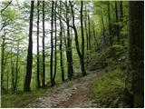 2
2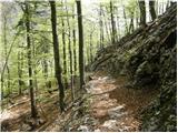 3
3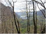 4
4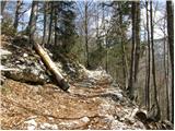 5
5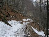 6
6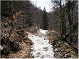 7
7 8
8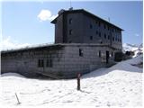 9
9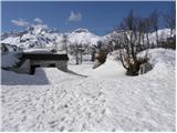 10
10 11
11 12
124444749.th.jpg) 13
13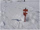 14
14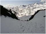 15
15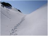 16
16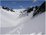 17
17 18
18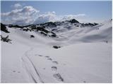 19
19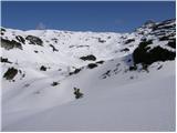 20
20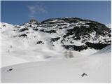 21
21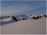 22
22 23
23 24
24 25
25 26
26 27
27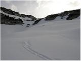 28
28 29
29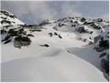 30
30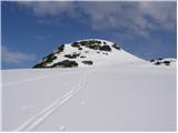 31
314444746.th.jpg) 32
324444747.th.jpg) 33
33
Discussion about the trip Koča pri Savici - Kal (above Komna) (via Lepa Komna)
|
| Hribuc30. 06. 2008 |
I was on Kal yesterday, from Poljanice pasture I climbed the unmarked path to Mala vrata and from there from the western side to the top of Kal. The path to Mala vrata is a bit harder to spot from the start, otherwise access to the summit itself is without issues. If you search a bit for nicer passages, the brush is nowhere obstructive. Really nice view from the top, I recommend. LP
|
|
|
|
| Loerst2. 07. 2018 |
Anyone who finds this path a bit too long can try from the other side, e.g. from Planina pod Skalo, then left towards Triglav Lakes (signposted, marked) to the Velika Vrata pass (1924 m), then right on an interesting but easy pathless terrain. From this direction there is also not so much brush to particularly obstruct the path, and it's a bit shorter with slightly less elevation gain. There are also other options.
|
|
|
|
| navdušena21. 08. 2018 |
I would like a bit more info. How far is it from Planina pod Skalo to the top of Kal? Thanks.
|
|
|
|
| darinka419. 10. 2022 10:40:59 |
We went yesterday from Vrsnik. The goal was to make a loop. Up via pathless terrain along what I can call the lower path. This little path is easily traceable. There are also some cairns in the last part to the summit. I think it's about 5 hours of walking. At least approximately. Since it was our first time everything was interesting. Then we decided for Osojni Kal and descended there, there was some climbing to Velike vrat and then to Vrsnik. We were surprised by the rocky world. With chasms that are quite deep. So don't go there in fog. We had the path marked in GPS. Otherwise you can also get lost.
|
|
|
To post a comment you must log in:
If you do not yet have a username, you must first
register.