Koča pri Savici - Kanjavec (via Triglavska jezera)
Starting point: Koča pri Savici (653 m)
| Latitude/Longitude: | 46,28960°N 13,80220°E |
| |
Route name: via Triglavska jezera
Walking time: 6 h 30 min
Difficulty: difficult marked way
Elevation gain: 1916 m
Elevation difference along the route: 2000 m
Map: Triglav 1:25.000
Recommended equipment (summer): helmet
Recommended equipment (winter): helmet, ice axe, crampons
Views: 46.608
 | 3 people like this post |
Access to starting point:
From the Ljubljana-Jesenice motorway, take the Lesce exit and follow the road towards Bled and further towards Bohinjska Bistrica. Continue the drive towards Lake Bohinj (Ribčev Laz), where you reach a crossroads, from which you continue straight along the left (southern) side of the lake in the direction of Ukanc and the Savica Waterfall. Then follow this increasingly narrow road to the large parking lot at the Savica Lodge. The parking lot is chargeable.
Route description:
From the parking lot, head right towards Black Lake, the Triglav Lakes Hut and the Zlatorog Hotel (straight to Savica Waterfall and the Dom na Komni). The path initially leads along a gravel road that crosses the Savica River via a bridge. Just a little after the bridge, the signs for Komarča direct us left (straight to Zlatorog Hotel) onto an initially quite wide and relatively gentle forest path. However, the path soon begins to ascend more steeply and brings us a bit higher to a point where the path to the source of the Savica and the Velika Savica Cave branches off to the left, while we continue right along the increasingly steep path.
The well-maintained and relatively wide mountain path soon transitions to the very steep and slippery slopes of Komarča, where there is also a high risk of falling rocks. The path continues steeply ascending through the mostly forested wall of Komarča, where safety features, especially wire cables, assist us at the more difficult sections.
Higher up, some views towards Bohinj open from the path, and it leads us to a short technically demanding section where, with the help of pegs and a wire cable, we cross a gully that is not particularly exposed. The path continues to ascend steeply for a while longer and, with the aid of some safety features, brings us to the edge of Komarča, from where a beautiful view opens to our starting point. A short moderately steep ascent follows, after which the path begins to descend gently towards Black Lake, which we reach in less than five minutes of further walking.
Near the lake, there is a marked junction where the path to Planina Viševnik and Pršivec branches off to the right, while we continue slightly left and proceed along the marked path that bypasses Black Lake on the right side. On the other side of the lake, the path from Dom na Komni joins from the left, and we continue along a relatively gentle path that runs along the edge of the Lopučniška Valley. Higher up, the path begins to ascend moderately and brings us along the edge of overhanging cliffs to a small spring, which dries up in dry periods.
We continue along the marked path, which near Bela Skala turns sharply right and ascends steeply. A few minutes of steep ascent follow, after which the path levels out and brings us to a marked junction where the path from Planina Blato via Prode joins from the right. We continue left towards the Triglav Lakes Hut and proceed along a relatively gentle path, arriving at Double Lake in ten minutes of further walking. The marked path bypasses the lake on the right side and brings us to a junction before reaching the other side, where the path to Štapci and Mali Tičarica branches off to the right.
Here we continue straight and arrive at the Triglav Lakes Hut in a few minutes of further walking.
From the hut, continue towards Triglav, Dolič, Hribarice, Prehodavci and Veliki Špič, where the path first leads past the dam and the artificial Močivec Lake. The path bypasses the lake on the right, eastern side and then ascends moderately through the Valley of Triglav Lakes, which is overgrown with increasingly sparse forest.
Still in the belt of sparse forest, the path forks, and we continue along the slightly right path towards Prehodavci and Hribarice (left path to Velika or Lepa Špičja via the Zgornje Komne plateau) which first leads through sparse larch forest, then under the scree of the mighty Kopica and later Male Zelnarice. Later, the path ascends a bit more and brings us to a small pass from which a beautiful view opens to the Lake in Ledvice.
The marked path bypasses the mentioned lake on the right side, continuing through extensive scree at the foot of both Zelnarice. After the lake, the path returns from the scree to the Valley of Triglav Lakes, along which we continue a relatively gentle ascent. The already fully alpine path ascends more steeply for a short time higher up, then levels out completely and brings us to Green Lake in a few minutes of further walking.
At Green Lake, continue right towards Triglav, Dolič and Hribarice (straight to Rjavo Lake and Prehodavci) and begin ascending towards the scree under Poprovec, where the path from Prehodavci joins from the left, leading past Rjavo Lake, while we continue right towards Hribarice.
A traverse ascent across the scree to the right follows; when we reach the valley below Hribarice, we join the path leading over the Vrata Pass (path along the Za Kopico valley or along the Zelnarice ridge).
Continue left towards Triglav, Dolič, Kanjavec and Hribarice (right to Vrata Pass) and begin ascending towards the Hribarice plateau. At the beginning of the Hribarice plateau, the first path towards Kanjavec branches off to the left.
Here we leave the path towards the Dolič Hut and Triglav and continue slightly left towards Kanjavec.
The path further leads us into a smaller and relatively steep valley located between the two peaks of Kanjavec. The increasingly scenic path continuing through the aforementioned valley levels out higher up and brings us to the saddle between the western and eastern peak of Kanjavec.
Here continue right (left to the western peak along an unmarked trail) and in a few minutes ascend to the scenic and precipitous summit.
Starting point - edge of Komarča 1:35, edge of Komarča - Black Lake 0:05, Black Lake - junction above Lopučniška Valley 1:15, junction above Lopučniška Valley - Double Lake 0:10, Double Lake - Triglav Lakes Hut 0:05, Triglav Lakes Hut - branch to Velika Špičja 0:25, branch to Velika Špičja - branch to Lake in Ledvice 0:30, branch to Lake in Ledvice - Green Lake 0:45, Green Lake - junction below Vršaki 0:30, junction below Vršaki - junction below Hribarice 0:10, junction below Hribarice - Kanjavec 1:00.

Along the route: Komarča (810m), Rob Komarče (1295m), Vrh Komarče (1313m),
Črno jezero (1294m), Bela skala (1575m), Razpotje nad Lopučniško dolino (1671m), Ruski grob (1686m), Dvojno jezero (1689m),
Koča pri Triglavskih jezerih (1685m), Močivec (1690m), Odcep za Veliko Špičje (1672m), Odcep k Jezeru v Ledvicah (1854m),
Lake Jezero v Ledvicah (1831m),
Lake Zeleno jezero (1988m), Razpotje nad Rjavim jezerom (2087m), Razpotje pod Vršaki (2192m), Razpotje pod Hribaricami (2292m), Sedlo med Kanjavcema (2529m)
Photos:
 1
1 2
2 3
3 4
4 5
5 6
6 7
7 8
8 9
9 10
10 11
11 12
12 13
13 14
14 15
15 16
16 17
17 18
18 19
19 20
20 21
21 22
22 23
23 24
24 25
25 26
26 27
27 28
28 29
29 30
30 31
31 32
32 33
33 34
34 35
35 36
36 37
37 38
38 39
39 40
40 41
41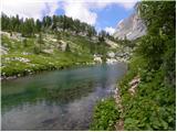 42
42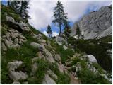 43
43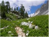 44
44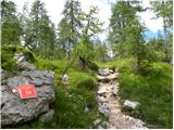 45
45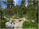 46
46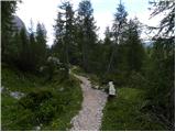 47
47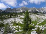 48
48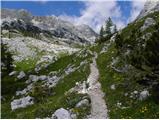 49
49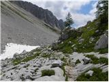 50
50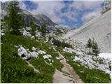 51
51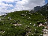 52
52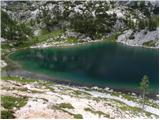 53
53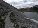 54
54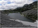 55
55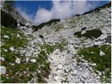 56
56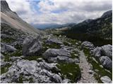 57
57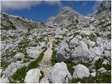 58
58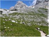 59
59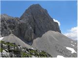 60
60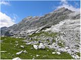 61
61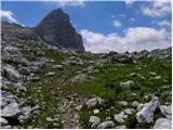 62
62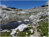 63
63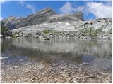 64
64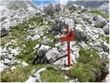 65
65 66
66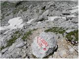 67
67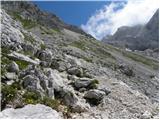 68
68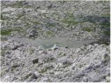 69
69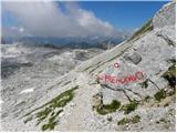 70
70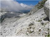 71
71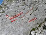 72
72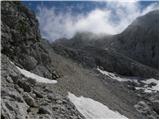 73
73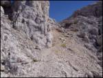 74
74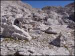 75
75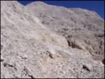 76
76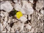 77
77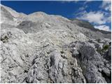 78
78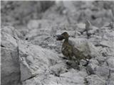 79
79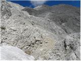 80
80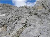 81
81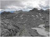 82
82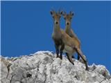 83
83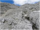 84
84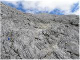 85
85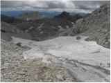 86
86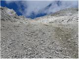 87
87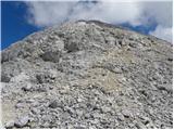 88
88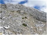 89
89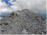 90
90 91
91
Discussion about the trip Koča pri Savici - Kanjavec (via Triglavska jezera)
|
| Gost10. 08. 2007 |
Nice idea for a trip!
The path is really full of beautiful surprises.
Lots of flowers, and also lots of animals you see.
P.S.
Did they also require you at the hut at 7 lakes to leave backpacks and poles outside the dining room?
|
|
|
|
| Gost11. 08. 2007 |
That's not bad at all - the hut at the seven lakes is very popular and if there's mountaineering gear in the dining room besides the guests, you have to step over backpacks and poles. I usually leave my backpack and poles outside, even though they've never required it from me anywhere. 
LpLj
|
|
|
|
| mkonci1. 07. 2008 |
I'm wondering if anyone went this path to Kranjavec (via Triglav Lakes)?
Is it possibly exposed?

|
|
|
|
| Tadej1. 07. 2008 |
On the mentioned path only Komarča is "exposed". Otherwise the path is relatively easy.
|
|
|
|
| jackman8. 07. 2010 |
On 7.7.2010 I went with a colleague on this path to Kanjavec.
The path is well marked all the way and not dangerous (except on the ascent to Komarča), but it's strenuous and long.
In places the vegetation on the path is too dense, and fallen trees obstruct the walk several times.
I noticed that the lake in front of the hut is full of algae and therefore green. The other lakes are clear.
In the section of the path between Hribarice and Kanjavec there is still a lot of snow. The ascent to the summit therefore mostly takes place on snow (ice axe and crampons are mandatory).
There is no snow on the summit itself.
|
|
|
|
| ljubitelj gora8. 08. 2010 |
Today did this path, it's very interesting, well marked, in the morning the rocks were slippery from dew...
|
|
|
|
| gornica11. 07. 2011 |
Hello all mountain lovers! I'm interested if someone recently did the ascent to Kanjavec from Koča pri Savici via Komarča and Triglav lakes. How is the path?
Best regards and thanks for the info.
|
|
|
|
| gribcsi26. 08. 2011 |
Yesterday we did this path. It's an exceptionally beautiful and varied path. But it's quite long, so there's not much time to enjoy the wonderful views. The last ascent to Kanjavec will take quite a bit of energy from those less fit, but the reward for the effort will be paid by the view from the top. It was quite hot, so take enough fluids with you. I used 6 liters myself and lost 3 kg on the whole path. The last descent from Komarča to the parking lot requires quite a bit of caution, especially due to tired legs after 11 hours of walking. But all that only for those a bit less prepared. Take advantage of the nice weather and enjoy this wonderful path to Kanjavec.
|
|
|
|
| marija14. 08. 2012 |
My husband and I want to go hiking next week from Kot to Rjavina, Staničev dom, Cmir, Spodnja Vrbanova špica. What do you recommend. We wanted to go to Debelega kamna, to the right to Spodnja Vrbanova špica, back to the junction and left to Rjavina then over Dovška vratca to Staničev dom. How many hours does this tour take? We are also considering continuing the path the next day to Kredarica, Dolič, Prehodavci to Koča pri Triglavskih jezerih... We are asking, from where is it best to ascend to Kanjavec as well. Thank you and many beautiful hiking experiences.
|
|
|
|
| Jure874. 08. 2012 |
A nice path to Kanjavec is from the hut at Dolič, back down towards the Triglav lakes. On the path from Kanjavec towards the Triglav lakes, I saw and photographed a group of ibex from very close up.
|
|
|
|
| seinfeld26. 08. 2016 |
We did this route from the hut onwards on 24 August. Beautiful route. However, I have a remark on the time: completing this route in three hours is almost impossible, especially from the Hribaric junction to Kanjavec half an hour is absolutely too little. The path is very steep and possibly crumbly. We from the Koča to the summit, with breaks, took 4h20min.
|
|
|
|
| garmont26. 08. 2016 |
The route description states walking time 6 hours...
|
|
|
|
| seinfeld26. 08. 2016 |
I apologize, I wrote unclearly. We overnighted and started in the morning from Koča pri Triglavskih jezerih. The previous day we came from Planina Blato.
|
|
|
|
| Zdenkob7. 08. 2017 |
I set off on this tour on Friday, 4.8. in the morning from the parking lot by the Koča pri Savici. It was still somehow okay to Hribarice, then due to the heat I started running out of water and preferred to turn towards the Koča na Prehodavcih. I overnighted at the Koča pri Sedmerih jezerih, where there was a slightly smaller crowd, and completed the tour the next day via Komna back to the valley.
What fascinated me most was the lake in Ledvička with its crystal-clear water of beautiful blue color, which some (younger) hikers couldn't resist and went to refresh themselves in it.
|
|
|
|
| AronBreitenberger28. 10. 2018 |
Does anyone perhaps know if there's any snow on Kanjavec? Regards
|
|
|
|
| michael6629. 10. 2018 |
In my opinion it's something similar to Kredarica (similar altitude), if you check the webcam. Currently it's plus 4 degrees and raining on Kredarica.
|
|
|
|
| PetraPetra23. 08. 2020 |
Has anyone hiked this path recently? I'm interested if there's any snow on the way to Kanjavec making it impassable... without crampons and ice axe (I don't have them).
|
|
|
|
| Vanč 17. 11. 2024 10:37:06 |
I'm wondering if you really only need 6h for this trail
it seems a bit unbelievable for so much elevation and km
Regards
|
|
|
|
| dprapr17. 11. 2024 20:49:15 |
That's about 333m per hour. With appropriate fitness it's not exaggerated. Compared to 6.5 hours to Triglav from Vrata via Plemenice, this is quite realistic. That one is exaggerated, at least 1 hour too much.
|
|
|
To post a comment you must log in:
If you do not yet have a username, you must first
register.