Koča pri Savici - Lake Rjavo jezero
Starting point: Koča pri Savici (653 m)
| Latitude/Longitude: | 46,28960°N 13,80220°E |
| |
Walking time: 5 h
Difficulty: difficult marked way
Elevation gain: 1353 m
Elevation difference along the route: 1400 m
Map: Triglav 1:25.000
Recommended equipment (summer): helmet
Recommended equipment (winter): helmet, ice axe, crampons
Views: 8.654
 | 2 people like this post |
Access to starting point:
From the Ljubljana-Jesenice motorway, take the Lesce exit and follow the road towards Bled and further towards Bohinjska Bistrica. Continue driving towards Lake Bohinj (Ribčev laz), where you reach a junction, continuing straight along the left (southern) side of the lake in the direction of Ukanc and the Savica waterfall. Then follow this increasingly narrow road to the large parking lot at the Koča pri Savici. The parking lot is paid.
Route description:
From the parking lot, head right towards Črno jezero, Koča pri Triglavskih jezerih and Hotel Zlatorog (straight to Slap Savica and Dom na Komni). The path initially leads along a gravel road that crosses the Savica River over a bridge. Just a little after the bridge, the signs for Komarča direct us left (straight to Hotel Zlatorog) onto an initially quite wide and relatively gentle forest path. The path soon begins to ascend more steeply and brings us somewhat higher to a place where the path to the source of Savica and the Velika Savica cave branches off to the left, while we continue right along the increasingly steep path.
The well-maintained and relatively wide mountain path soon transitions to very steep and slippery slopes of Komarča, where there is also a great risk of falling rocks. The path ahead ascends steeply through the mostly forested wall of Komarča, where safety equipment, especially steel cables, assists us at the more difficult spots.
Higher up, some views towards Bohinj open from the path, and the path brings us to a short technically demanding spot, where with the help of pegs and a steel cable we cross a gully that is otherwise not particularly exposed. The path continues to ascend steeply for some time and, with the aid of some safety devices, brings us to the edge of Komarča, from where a beautiful view of our starting point opens. A short moderately steep ascent follows, after which the path begins to descend gently towards Črno jezero, which we reach after less than five minutes of further walking.
Near the lake is a marked junction, where the path to Planina Viševnik and Pršivec branches off to the right, while we continue slightly left and proceed along the marked path that bypasses Črno jezero on its right side. On the other side of the lake, the path from Dom na Komni joins from the left, and we continue along a relatively gentle path that runs along the edge of Lopučniška dolina. Higher up, the path begins to ascend moderately and brings us, along the edge of overhanging cliffs, to a small spring that dries up in dry periods.
We continue along the marked path, which near Bela skala turns sharply right and ascends steeply. Several minutes of steep ascent follow, after which the path levels out and brings us to a marked junction, where the path from Planina Blato, specifically the path over Prode, joins from the right. We continue left towards Koča pri Triglavskih jezerih and proceed along a relatively gentle path, arriving at Dvojno jezero after ten minutes of further walking. The marked path bypasses the lake on the right side and brings us to a junction before we reach the other side, where the path to Štapci and Mali Tičarica branches off to the right.
Here we continue straight and arrive at Koča pri Triglavskih jezerih after a few minutes of further walking.
From the hut, we continue in the direction of Triglav, Dolič, Hribarice, Prehodavci and Veliki Špič, where the path first leads past the dam and the artificial lake Močivec. The path bypasses the lake on the right, eastern side and then moderately ascends through the Dolina Triglavskih jezer, which is overgrown with increasingly sparse forest.
Still in the zone of sparse forest, the path forks, and we continue along the slightly right path, which proceeds towards Prehodavci and Hribarice (left path to Veliko oz. Lepo Špičje over the Zgornje Komne plateau) and leads us first through sparse larch forest, then under the screes of the mighty Kopica and later Male Zelnarice. Later, the path temporarily ascends somewhat more and brings us to a small pass, from which a beautiful view of Jezero v Ledvicah opens.
The marked path bypasses the mentioned lake on the right side, continuing through extensive screes at the foot of both Zelnarice. After the lake, the path returns from the scree to the Dolina Triglavskih jezer, along which we continue a relatively gentle ascent. The already fully high-mountain path ascends more steeply for a short time higher up, then levels out completely and brings us to Zeleno jezero after a few minutes of further walking.
From Zeleno jezero, we continue straight in the direction of Prehodavci (right Hribarice, Dolič and Triglav), and the path soon forks again.
Again, we continue straight, this time in the direction of Rjavo jezero and Zasavska koča (left Veliko Špičje and Zasavska koča) and arrive at Rjavo jezero after a few minutes of further walking.
Starting point - edge of Komarča 1:35, edge of Komarča - Črno jezero 0:05, Črno jezero - junction above Lopučniška dolina 1:15, junction above Lopučniška dolina - Dvojno jezero 0:10, Dvojno jezero - Koča pri Triglavskih jezerih 0:05, Koča pri Triglavskih jezerih - branch for Veliko Špičje 0:25, branch for Veliko Špičje - branch to Jezero v Ledvicah 0:30, branch to Jezero v Ledvicah - Zeleno jezero 0:45, Zeleno jezero - Rjavo jezero 0:10.

Along the route: Komarča (810m), Rob Komarče (1295m), Vrh Komarče (1313m),
Črno jezero (1294m), Bela skala (1575m), Razpotje nad Lopučniško dolino (1671m), Ruski grob (1686m), Dvojno jezero (1689m),
Koča pri Triglavskih jezerih (1685m), Močivec (1690m), Odcep za Veliko Špičje (1762m), Odcep k Jezeru v Ledvicah (1854m),
Lake Jezero v Ledvicah (1831m),
Lake Zeleno jezero (1988m)
Photos:
 1
1 2
2 3
3 4
4 5
5 6
6 7
7 8
8 9
9 10
10 11
11 12
12 13
13 14
14 15
15 16
16 17
17 18
18 19
19 20
20 21
21 22
22 23
23 24
24 25
25 26
26 27
27 28
28 29
29 30
30 31
31 32
32 33
33 34
34 35
35 36
36 37
37 38
38 39
39 40
40 41
41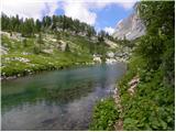 42
42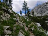 43
43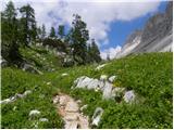 44
44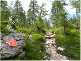 45
45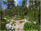 46
46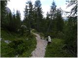 47
47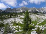 48
48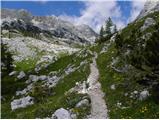 49
49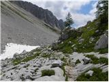 50
50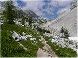 51
51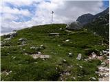 52
52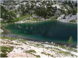 53
53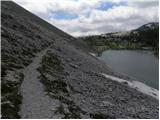 54
54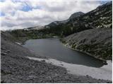 55
55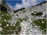 56
56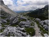 57
57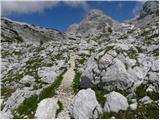 58
58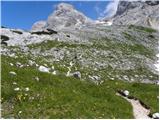 59
59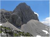 60
60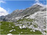 61
61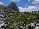 62
62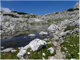 63
63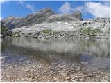 64
64 65
65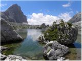 66
66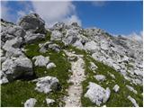 67
67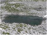 68
68
Discussion about the trip Koča pri Savici - Lake Rjavo jezero
|
| velkavrh25. 07. 2009 |
I was here yesterday on a tour to the hut on Prehodavci. I descended from the hut to it. Currently it is still completely surrounded by snow. For now it is a unique privilege. Romance in white, not in brown.
|
|
|
To post a comment you must log in:
If you do not yet have a username, you must first
register.