Koča pri Savici - Lanževica (via Lepa Komna)
Starting point: Koča pri Savici (653 m)
| Latitude/Longitude: | 46,28960°N 13,80220°E |
| |
Route name: via Lepa Komna
Walking time: 5 h
Difficulty: easy marked way
Elevation gain: 1350 m
Elevation difference along the route: 1400 m
Map: TNP 1:50.000
Recommended equipment (summer):
Recommended equipment (winter): ice axe, crampons
Views: 18.953
 | 5 people like this post |
Access to starting point:
From the motorway Ljubljana - Jesenice, we take the exit Lesce and follow the road towards Bled and further towards Bohinjska Bistrica. We continue driving towards Bohinjsko jezero (Ribčev laz), at which we arrive at an intersection, where we continue straight along the left (southern) side of the lake in the direction of Ukanc and Slap Savica. Then we follow this increasingly narrow road to the large parking lot at Koča Savica. The parking lot is paid.
Route description:
From the parking lot, we head onto the wide footpath in the direction of Slap Savica and Dom na Komni (right path over Komarča). After a short gentle ascent, the path leads us to a marked crossroads, where the tourist path to Slap Savica branches off to the right, but we continue slightly left or straight on the wide footpath in the direction of Komna. The path continues for a short time ascending along the Savica, then leads us to the first of the marked 48 switchbacks. After an hour and a half of moderate ascent through the forest, the path leads us to the aforementioned 48th switchback, from which a beautiful view of Bohinjsko jezero opens up. Here the path turns slightly to the right and enters the valley called Pekel, where it ascends gently for some time, then turns right and ascends somewhat steeper again. After just a few dozen steps, the path turns left again and continues ascending parallel to the valley. The further gentle to moderately steep path gradually enters a sparser forest, from which we soon see Dom na Komni. The path ahead leads us past a small interesting cave, higher up it leads us to a crossroads, where the path to Črno jezero branches off to the right, but we continue left and further on the wide path. There follows some traverse ascent; at the natural abyss, which is fenced for safety, the path turns right, then ascends to the next crossroads, where the path from Črno jezero joins us.
Just a little further, the path splits once more, but we choose the left path in the direction of Dom na Komni, or we can also take the slightly shorter path that continues straight and bypasses Dom na Komni (right Koča pri Triglavskih jezerih).
There follows an ascent past the hut Pri Hubertu and in a few minutes we reach Dom na Komni.
From Dom na Komni, we go past a small chapel and follow the signs for Koča pod Bogatinom (left Vogel, Tolminski Kuk and Planina Govnjač), but we soon merge with the aforementioned slightly shorter path.
We continue slightly left in the direction of Koča pod Bogatinom and along the wide and quite scenic path quickly arrive at Planina na Kraju, where past the pyramid (ossuary at Koča pod Bogatinom - mountain memorial) we reach Koča pod Bogatinom, which is located in the middle of the pasture.
We bypass the hut on the right side and quickly arrive at a marked crossroads, where we leave the wide path that continues towards Bogatinsko sedlo and continue the path to the right in the direction of Lanževica, Planina za Skalo and Soča. In the continuation, we first gently, then moderately ascend through the dwarf pines and after about 20 minutes of walking from Koča pod Bogatinom we arrive at Turška vratca, where the path flattens.
The path ahead leads us through a series of small valleys of the Lepa Komna plateau and only occasionally ascends slightly, otherwise the path is quite gentle. Later we arrive at the edge of the abandoned Planina Poljanica, where an unmarked path branches off to the right towards Mala vratca, but we continue on the marked path, which splits a few minutes further.
We continue left in the direction of Lanževica (right Soča and Planina za Skalo via Oslova škrbina) and continue the path on the old military mule track, which except for a few stone bridges or passages is already quite overgrown. In the continuation, we semi-circle around a grassy sinkhole, then begin ascending through the valley between Vrh nad Gracijo on the left and Lanževica on the right. In the lower part the still quite grassy valley higher becomes more rocky, when we leave the valley we merge with the path that leads over Bogatinsko sedlo, or Vratca.
We continue right towards Lanževica (on the left path we can return to the starting point via a partially circular path) and begin ascending along the increasingly scenic and quite wide southeastern ridge of Lanževica, whose summit we reach after about 20 minutes of further walking.
Starting point - branch to Črno jezero 2:15, branch to Črno jezero - Memorial plaque to Matej Koblar 0:10, Memorial plaque to Matej Koblar - Dom na Komni 0:05, Dom na Komni - Koča pod Bogatinom 0:15, Koča pod Bogatinom - Turška vratca 0:20, Turška vratca - Poljanica 0:45, Poljanica - crossroads on Lepa Komna 0:05, crossroads on Lepa Komna - saddle under Vrh nad Gracijo 0:45, saddle under Vrh nad Gracijo - Lanževica 0:20.

Along the route: Jama ob poti na Komno (1303m), Odcep k Črnemu jezeru (1411m), Brezno pod lovsko kočo na Komni (1430m), Spominska plošča Mateju Koblarju (1481m), Pri Hubertu (1492m),
Dom na Komni (1520m), Piramida (1520m),
Koča pod Bogatinom (1513m), Turška vratca (1607m), Poljanica (1641m), Razpotje na Lepi Komni (1681m), Sedlo pod Vrhom nad Gracijo (1878m)
Photos:
 1
1 2
2 3
3 4
4 5
5 6
6 7
7 8
8 9
9 10
10 11
11 12
12 13
13 14
14 15
15 16
16 17
17 18
18 19
19 20
20 21
21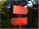 22
22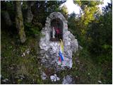 23
23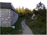 24
24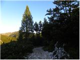 25
25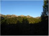 26
26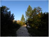 27
27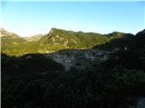 28
28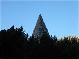 29
29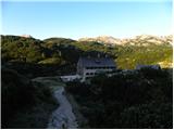 30
30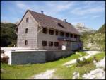 31
31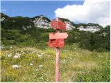 32
32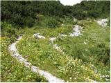 33
33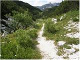 34
34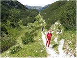 35
35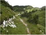 36
36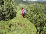 37
37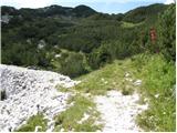 38
38 39
39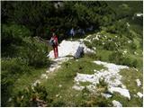 40
40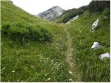 41
41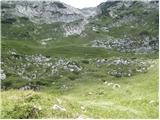 42
42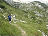 43
43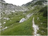 44
44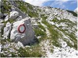 45
45 46
46 47
47 48
48 49
49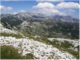 50
50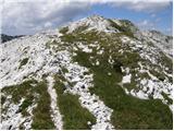 51
51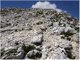 52
52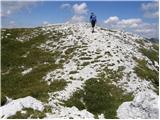 53
53 54
54
Discussion about the trip Koča pri Savici - Lanževica (via Lepa Komna)
|
| peterhaf18. 02. 2009 |
Can one go directly from Lanževica via Lepa Komna to Koča pri Sedmerih jezerih?
|
|
|
|
| triglavski18. 02. 2009 |
Of course one can get there. From Lanževica descend to Poljanica, then under Kal to pl. Na Kalu, where you pick up the marked trail to pl. Lopučnica.
|
|
|
|
| viharnik18. 02. 2009 |
Of course one can get there, now even easier because all the brush is under snow. From the top descend to Konto Poljanica (hut ruins), then under the left rocky slopes Kraj Kala 1854m, to Pl. na Kalu, then north up to Pl. Lopučnica and through a short ascent to Trigl. lakes. But you must have at least snowshoes, if not skis! The trail takes 3.5-4 hours in current conditions! Good luck.
|
|
|
|
| peterhaf19. 02. 2009 |
Thanks for the answers. I would head out on the trail when the snow melts. How difficult is it then and how long does it take from the top of Lanževica?
|
|
|
|
| viharnik19. 02. 2009 |
Regular pl. route from Triglavska jezera to Komna, takes 2.30h. From the top of Lanževica add about an hour more. The trail might be snow-free only in July this year?.
|
|
|
|
| katja8725. 06. 2014 |
On Sunday (22.6.2014) we did a nice circular tour around Komna: Koča pri Savici - Dom na Komni - Lanževica (via Lepo Komna) - Bogatinsko sedlo - Dom na Komni - Koča pri Savici.
The path via Lepo Komna is wonderful and offers beautiful views. There is still quite a bit of snow accumulated in the valleys, so orientation is difficult in places, as the path is under snow and can easily mislead you.
You can see pictures from the hike on the website of Planinsko društvo Matica Murska Sobota: http://www.mojalbum.com/pdmaticams/20140622-lanzevica-2003m/smerokaz-na-izhodiscu/21793748
|
|
|
|
| Zgembo30. 04. 2017 |
Does anyone know where one can get the stamp?
|
|
|
|
| mornar17. 08. 2019 |
Has anyone recently hiked from Komna to Lanževica, how passable is the path and how followable is the path through Lepa Komna. Lp.
|
|
|
|
| sh17. 08. 2019 |
The path through Lepa Komna runs along a mulatiera and no issues with followability. We hiked it two years ago and had no problems with marking. Return via Vratca.
|
|
|
|
| KarmenT1. 11. 2021 18:49:11 |
The path via Lepo Komno is traceable without problems. Nowhere overgrown and doesn't get lost. Overall nicely marked. Solitary places for the soul with wonderful views. 
|
|
|
To post a comment you must log in:
If you do not yet have a username, you must first
register.