Koča pri Savici - Mala Tičarica
Starting point: Koča pri Savici (653 m)
| Latitude/Longitude: | 46,28960°N 13,80220°E |
| |
Walking time: 4 h 10 min
Difficulty: difficult marked way
Elevation gain: 1418 m
Elevation difference along the route: 1445 m
Map: Triglav 1:25.000
Recommended equipment (summer): helmet
Recommended equipment (winter): helmet, ice axe, crampons
Views: 21.634
 | 3 people like this post |
Access to starting point:
From the Ljubljana - Jesenice highway, take the Lesce exit and follow the road towards Bled and further towards Bohinjska Bistrica. Continue driving towards Bohinj Lake (Ribčev Laz), where you reach an intersection; continue straight along the left (southern) side of the lake towards Ukanc and Savica Waterfall. Follow this increasingly narrow road to the large parking lot at Savica Hut. The parking lot is paid.
Route description:
From the parking lot, head right in the direction of Black Lake, Hut at Triglav Lakes, and Hotel Zlatorog (straight ahead Savica Waterfall and Komna Hut). The path initially leads along a gravel road that crosses the Savica River over a bridge. Just a little beyond the bridge, the signs for Komarča direct you left (straight ahead Hotel Zlatorog) onto an initially still quite wide and relatively gentle forest path. The path soon begins to climb more steeply and brings you a bit higher to a spot where a path branches left to the Savica source and Great Savica cave, but continue right on the increasingly steep path.
The well-maintained and relatively wide hiking path soon transitions to very steep and slippery-dangerous slopes of Komarča, where there is also a high risk of falling rocks. The path ahead climbs steeply along the mostly forested wall of Komarča, where safety devices, mainly steel cables, assist on the more difficult spots.
Higher up, some views towards Bohinj open from the path, and the path brings you to a short technically demanding spot, where with the help of staples and a steel cable you cross an otherwise not so very exposed gully. The path then continues to climb steeply for some time and, with the help of some safety devices, brings you to the edge of Komarča, from where a nice view opens to your starting point. This is followed by a short moderately steep ascent, then the path begins to descend gently towards Black Lake, which you reach after less than five minutes of further walking.
Near the lake, there is a marked intersection where the path to Planina Viševnik and Pršivec branches right, but continue slightly left and proceed on the marked path that bypasses Black Lake on the right side. On the other side of the lake, the path from Komna Hut joins from the left, but continue on the relatively gentle path that proceeds along the edge of Lopučnica Valley. Higher up, the path begins to climb moderately and brings you along the edge of overhanging cliffs to a small spring, which dries up in dry periods.
Continue on the marked path, which near Bela skala turns sharply right and climbs steeply. This is followed by a few minutes of steep ascent, then the path flattens and brings you to a marked intersection, where the path from Planina Blato joins from the right, namely the path over Prodi. Continue left in the direction of Hut at Triglav Lakes and proceed on the relatively gentle path, which in ten minutes of further walking brings you to Double Lake. The marked path bypasses the lake on the right side and before reaching the other side brings you to an intersection where the path to Štapce and Mala Tičarica branches right.
Continue right in the direction of Štapce and Mala Tičarica (straight ahead Hut at Triglav Lakes, five minutes) and climb through a belt of sparse forest that ends among dwarf pines. This is followed by a short ascent through dwarf pines, then the relatively steep path continues over scree. The increasingly scenic path quickly brings you below the walls of Štapce, where it turns right and becomes technically somewhat more demanding. With the help of a ladder and steel cable, climb transversely over a smaller wall, then the path brings you to a notch where it turns left. This is followed by a short secured steep ascent and the path flattens on the Štapce pass, where there is a marked intersection.
At Štapce, continue left in the direction of Tičarica and Zelnarica (right Planina Ovčarija and Hut on Planina pri Jezeru) and continue the ascent on the path that first climbs through a belt of dwarf pines, then brings you to a short steep and especially in wet conditions slippery-dangerous jump. Above the jump, the path flattens and transitions to moderately steep grassy slopes, on which in a few minutes of further walking you ascend to a small saddle, where the marked path to Mala Tičarica branches left.
Continue in the mentioned direction (straight ahead Mala Zelnarica) and climb across the grassy slope to the ridge of Mala Tičarica. Here the path turns right and continues along and on the ridge. Follow this increasingly scenic path, which just below the summit traverses a short slightly exposed slope, all the way to the summit, which you reach after a few steps of further walking.
Starting point - edge of Komarča 1:35, edge of Komarča - Black Lake 0:05, Black Lake - intersection above Lopučnica Valley 1:15, intersection above Lopučnica Valley - Double Lake 0:10, Double Lake - Štapce 0:30, Štapce - intersection below Mala Tičarica 0:25, intersection below Mala Tičarica - Mala Tičarica 0:10.

Along the route: Komarča (810m), Rob Komarče (1295m), Vrh Komarče (1313m),
Črno jezero (1294m), Bela skala (1575m), Razpotje nad Lopučniško dolino (1671m), Ruski grob (1686m), Dvojno jezero (1689m), Štapce (1851m), Razpotje pod Malo Tičarico (2008m)
Photos:
 1
1 2
2 3
3 4
4 5
5 6
6 7
7 8
8 9
9 10
10 11
11 12
12 13
13 14
14 15
15 16
16 17
17 18
18 19
19 20
20 21
21 22
22 23
23 24
24 25
25 26
26 27
27 28
28 29
29 30
30 31
31 32
32 33
33 34
34 35
35 36
36 37
37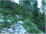 38
38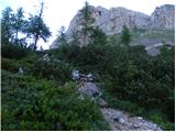 39
39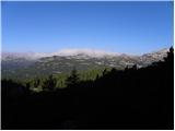 40
40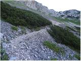 41
41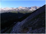 42
42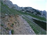 43
43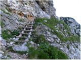 44
44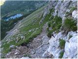 45
45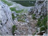 46
46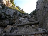 47
47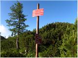 48
48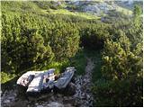 49
49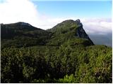 50
50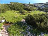 51
51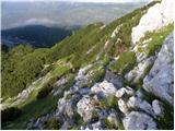 52
52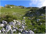 53
53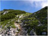 54
54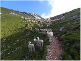 55
55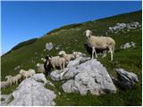 56
56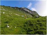 57
57 58
58 59
59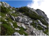 60
60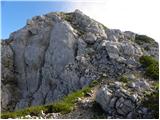 61
61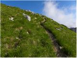 62
62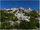 63
63 64
64
Discussion about the trip Koča pri Savici - Mala Tičarica
|
| mukl27. 07. 2013 |
Today we went on this trail with friends. Due to the terrible heat, we started from Ljubljana at 4 am and thus, upon arriving at Koča pri Savici, set off towards Komarča just after 5 am, right when it was visible enough. Whoever knows "auntie" Komarča surely knows it's a nice knee-burner and, when one would expect at least a bit of morning freshness in this area, we were completely soaked after the first steps, it was so hot already at such an early hour. Well, to not ramble, we forgot how much the path from Komarča drags on, past Črno jezero, then to Dvojno jezero, to Koča pri Triglavskih jezerih. There we refreshed a bit and enjoyed the morning coolness, our instruments showed no more than 13 degrees, but as soon as the sun peeked over the hill, the temperature jumped sharply. The path to Mala Tičarica is pleasant, on certain sections somewhat technically demanding depending on the person, no extreme difficulties, but the heat was mainly killing us and we agreed that we would never go mountaineering again on such hot days. The descent back via Komarča was classically tough, as those who know it well know, but before that the path from Dvojno to Črno jezero exhausted us thoroughly, dragging in today's heat like "chicken intestines". On the descent via Komarča it was around 13 o'clock. And the heat really unbearable, we couldn't marvel enough at the crowds of "hikers" who were trudging up Komarča at that time and in such heat. Despite all the complaining, a beautiful and unforgettable mountaineering day remained behind us. P.S. I STRONGLY ADVISE AGAINST VISITING THE MOUNTAINS IN SUCH EXTREME HEAT!
|
|
|
To post a comment you must log in:
If you do not yet have a username, you must first
register.