Koča pri Savici - Mala Zelnarica (via Štapce)
Starting point: Koča pri Savici (653 m)
| Latitude/Longitude: | 46,28960°N 13,80220°E |
| |
Route name: via Štapce
Walking time: 5 h 55 min
Difficulty: difficult marked way
Elevation gain: 1657 m
Elevation difference along the route: 1775 m
Map: Triglav 1:25.000
Recommended equipment (summer): helmet
Recommended equipment (winter): helmet, ice axe, crampons
Views: 7.220
 | 1 person like this post |
Access to starting point:
From the Ljubljana - Jesenice highway, take the Lesce exit and follow the road towards Bled and then towards Bohinjska Bistrica. Continue driving towards Bohinjsko jezero (Ribčev laz), where you reach an intersection; continue straight along the left (southern) side of the lake towards Ukanc and Slap Savica. Follow this increasingly narrow road to the large parking lot at Koča pri Savici. The parking lot is paid.
Route description:
From the parking lot, head right towards Črno jezero, Koča pri Triglavskih jezerih, and Hotel Zlatorog (straight to Slap Savica and Dom na Komni). The path initially follows a gravel road that crosses the Savica River over a bridge. Shortly after the bridge, signs for Komarča direct us left (straight to Hotel Zlatorog) onto an initially quite wide and relatively gentle forest path. The path soon begins to climb more steeply, leading us higher to a point where a path branches left to the source of the Savica and Velika Savica cave, we continue right on the increasingly steep path.
Well-maintained and relatively wide mountain path soon transitions to very steep and slippery slopes of Komarča, where there is also great danger of falling rocks. The path continues steeply up the mostly forested wall of Komarča, where on the difficult sections aids like cables help us.
Higher up, some views open towards Bohinj, the path leads to a short technically demanding section where we cross a not too exposed gorge with the help of pitons and a cable. The path continues to climb steeply with the aid of some protections to the edge of Komarča, from where we get a nice view of our starting point. Followed by a short moderately steep climb, then the path begins to gently descend towards Črno jezero, which we reach in less than five minutes of further walking.
Near the lake is a marked junction where a path branches right to Planina Viševnik and Pršivec, we continue slightly left and follow the marked path that circles the right side of Črno jezero. On the other side of the lake, a path from Dom na Komni joins from the left, we continue on a relatively gentle path that proceeds along the edge of Lopučniška dolina. Higher up, the path begins to climb moderately and leads us along the edge of overhanging cliffs to a small spring that dries up in dry periods.
We continue on the marked path, which near Bele skale turns sharply right and climbs steeply. Followed by a few minutes of steep climbing, then the path levels out and leads us to a marked junction where a path from Planina Blato joins from the right, namely the path over Prode. We continue left towards Koča pri Triglavskih jezerih and follow a relatively gentle path on which we reach Dvojno jezero in ten minutes of further walking. The marked path circles the lake on the right and leads us to a junction before we reach the other side, where a path branches right to Štapce and Mala Tičarica.
We continue right towards Štapce and Mala Tičarica (straight to Koča pri Triglavskih jezerih, five minutes) and climb through a strip of sparse forest that ends among bushes. Followed by a short climb through bushes, then a relatively steep path continues over scree. The increasingly panoramic path quickly leads us under the cliffs of Štapce, where it turns right and becomes somewhat more technically demanding. With the help of a ladder and cable, we cross a small wall diagonally, then the path leads us into a notch where it turns left. Followed by a short protected steep climb and the path levels out at the Štapce pass, where there is a marked junction.
At Štapce, we continue left towards Tičarica and Zelnarica (right to Planina Ovčarija and Koča na Planini pri Jezeru) and continue the climb on a path that first climbs through a strip of bushes, then leads us to a short steep and especially slippery jump in wet conditions. Above the jump, the path levels out and transitions to moderately steep grassy slopes, on which we climb in a few minutes to a small col where a marked path branches left to Mala Tičarica, about ten minutes of climb away.
We continue towards Zelnarica on a relatively gentle path that first crosses the slopes of Mala and then Velika Tičarica. Just a few dozen meters after the sign "Ne trgaj cvetja!" (sign on the rock), a passage opens left to Velika Tičarica, about 15 minutes of demanding climb away, but we continue straight on the marked path that reaches the main ridge north of Velika Tičarica.
Beyond Velika Tičarica, the path transitions to a wide grassy ridge on and along which we then climb. After a few minutes of easy walking, the path begins to climb steeply on partly grassy slopes. The steepness increases quickly, the path leads us to expansive meadows south of the sheer and overhanging Kopica. We cross the expansive meadows to the foot of the summit slopes of Kopica, then, upon reaching the edge of the cliff, the marked path turns right and climbs diagonally over a small scree. After the scree, the path turns left, then begins to climb steeply in a diagonal ascent. The marked path approaches a small indistinct hollow and turns slightly right.
At this point, a passage opens left to Kopica, whose summit is about five minutes away, but we continue on the marked path that approaches the ridge and turns right. The path ahead gradually transitions to very steep and slippery slopes, after about 30 meters of somewhat exposed section, the slope becomes slightly less steep. Followed by a diagonal ascent to the right, the path leads us slightly below the ridge, and a bit further we reach the summit slopes of Mala Zelnarica. Here the path begins to climb more steeply and leads us in about 15 minutes of increasingly panoramic walking to the summit of Mala Zelnarica, from where an exceptional view opens towards Dolina Triglavskih jezer.
Starting point - edge of Komarča 1:35, edge of Komarča - Črno jezero 0:05, Črno jezero - junction above Lopučniška dolina 1:15, junction above Lopučniška dolina - Dvojno jezero 0:10, Dvojno jezero - Štapce 0:30, Štapce - junction below Mala Tičarica 0:25, junction below Mala Tičarica - branch for Velika Tičarica 0:20, branch for Velika Tičarica - branch for Kopica 0:50, branch for Kopica - Mala Zelnarica 0:45.

Along the route: Komarča (810m), Rob Komarče (1295m), Vrh Komarče (1313m),
Črno jezero (1294m), Bela skala (1575m), Razpotje nad Lopučniško dolino (1671m), Ruski grob (1686m), Dvojno jezero (1689m), Štapce (1851m), Razpotje pod Malo Tičarico (2008m), Odcep za Veliko Tičarico (2020m), Odcep za Kopico (2168m)
Photos:
 1
1 2
2 3
3 4
4 5
5 6
6 7
7 8
8 9
9 10
10 11
11 12
12 13
13 14
14 15
15 16
16 17
17 18
18 19
19 20
20 21
21 22
22 23
23 24
24 25
25 26
26 27
27 28
28 29
29 30
30 31
31 32
32 33
33 34
34 35
35 36
36 37
37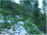 38
38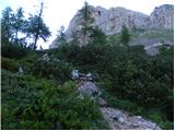 39
39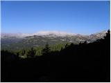 40
40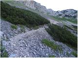 41
41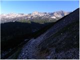 42
42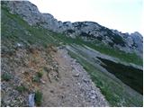 43
43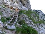 44
44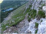 45
45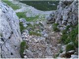 46
46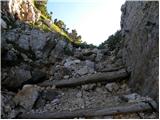 47
47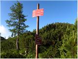 48
48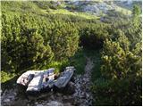 49
49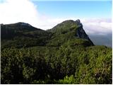 50
50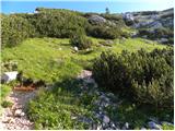 51
51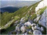 52
52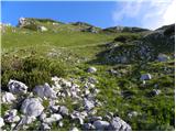 53
53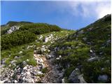 54
54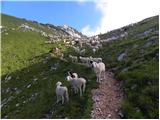 55
55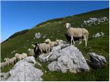 56
56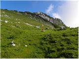 57
57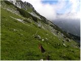 58
58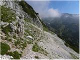 59
59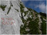 60
60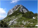 61
61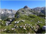 62
62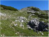 63
63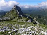 64
64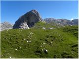 65
65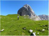 66
66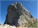 67
67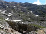 68
68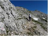 69
69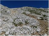 70
70 71
71 72
72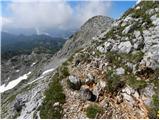 73
73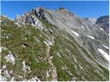 74
74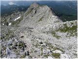 75
75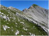 76
76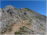 77
77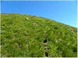 78
78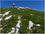 79
79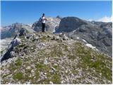 80
80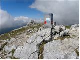 81
81 82
82
Discussion about the trip Koča pri Savici - Mala Zelnarica (via Štapce)
To post a comment you must log in:
If you do not yet have a username, you must first
register.