Koča pri Savici - Pršivec
Starting point: Koča pri Savici (653 m)
| Latitude/Longitude: | 46,28960°N 13,80220°E |
| |
Walking time: 4 h 10 min
Difficulty: difficult marked way
Elevation gain: 1108 m
Elevation difference along the route: 1140 m
Map: Triglav 1:25.000
Recommended equipment (summer): helmet
Recommended equipment (winter): helmet, ice axe, crampons
Views: 15.422
 | 2 people like this post |
Access to starting point:
From the Ljubljana - Jesenice motorway, take the Lesce exit and follow the road towards Bled and further towards Bohinjska Bistrica. Continue driving towards Lake Bohinj (Ribčev laz), where we reach a junction, continuing straight along the left (southern) side of the lake towards Ukanc and the Savica Waterfall. Follow this increasingly narrow road to the large parking lot at the Koča pri Savici. The parking lot is paid.
Route description:
From the parking lot, head right towards Črno jezero, Koča pri Triglavskih jezerih, and Hotel Zlatorog (straight to Slap Savica and Dom na Komni). The trail initially leads along a gravel road that crosses the Savica River over a bridge. Just a short way after the bridge, the signs for Komarča direct us left (straight to Hotel Zlatorog) onto an initially quite wide and relatively gentle forest path. The path soon begins to ascend more steeply and brings us a bit higher to a spot where a path branches off to the left to the source of the Savica and the Velika Savica cave, while we continue right along the increasingly steep path.
The well-maintained and relatively wide mountain trail soon transitions to the very steep and slippery slopes of Komarča, where there is also a high risk of falling rocks. The trail continues steeply ascending through the mostly forested wall of Komarča, where safety features, especially wire cables, assist us at the more difficult sections.
Higher up, some views towards Bohinj open from the path, and the trail takes us to a short technically demanding section where, with the help of pegs and a wire cable, we cross a gully that is not particularly exposed. The path continues steeply ascending for a while longer and, with the aid of some safety features, brings us to the edge of Komarča, from where a nice view of our starting point opens up. A short moderately steep ascent follows, after which the path begins to descend gently towards Črno jezero, which we reach after less than five minutes of further walking.
The marked path turns right just a few steps before the lake and quickly brings us to a junction, where we continue right towards Planina Viševnik and Pršivec (straight to Koča pri Triglavskih jezerih). The path ahead runs through dense forest for a while, then crosses a short scenic slope and returns to the forest. Here, on the right side, a few dozen meters below the path, we will hear an interesting karst spring that immediately after emerging descends across Komarča (if we have time and inclination, we can descend to the spring, but carefully as it ends with steep precipitous slopes).
The path, which runs through the little-visited area called Dol pod Stadorjem, levels out for a short time and brings us to a small valley where cold air often lingers at the bottom. The path continues, often quite damp, into the forest, where it begins to ascend more steeply. The very peaceful path emerges from the forest just a little before Planina Viševnik, which is only five minutes of easy walking away.
From Planina Viševnik, where there is a trail junction, head right southwest towards Pršivec (sharply left to Planina Ovčarija, straight and then left via Krištofojca to Planina Dedno polje or Planina pri Jezeru, straight to Planina pri Jezeru, slightly right to Planina Vogar) and ascend transversely to the southwestern part of the alpine pasture, where the path turns left and heads south. Some transverse ascent through the forest follows, after which the path flattens and even descends slightly to Majska jama (a shaft explored to a depth of 592 m), where we begin ascending again, this time along the northern slopes of Pršivec. Another approximately 15 minutes of ascent through increasingly sparse, mostly larch forest follows, and we arrive at the summit of Pršivec, from which a beautiful view of Bohinj and the surrounding mountains opens up.
Starting point - edge of Komarča 1:35, edge of Komarča - Črno jezero 0:05, Črno jezero - Planina Viševnik 1:30, Planina Viševnik - Majska jama 0:45, Majska jama - Pršivec 0:15.

Photos:
 1
1 2
2 3
3 4
4 5
5 6
6 7
7 8
8 9
9 10
10 11
11 12
12 13
13 14
14 15
15 16
16 17
17 18
18 19
19 20
20 21
21 22
22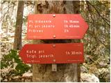 23
23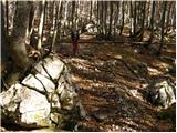 24
24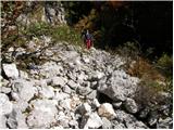 25
25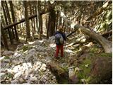 26
26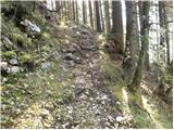 27
27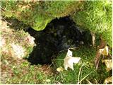 28
28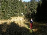 29
29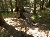 30
30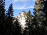 31
31 32
32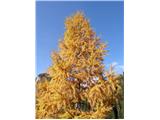 33
33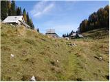 34
34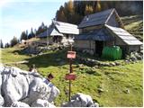 35
35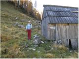 36
36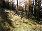 37
37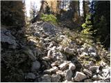 38
38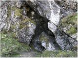 39
39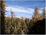 40
40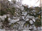 41
41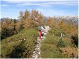 42
42 43
43
Discussion about the trip Koča pri Savici - Pršivec
|
| ajdaa7. 07. 2013 |
With PD Rašica camp  visited Pršivec starting at Koča pri Savici visited Pršivec starting at Koča pri Savici  , went through Komarča to Črno jezero where we had a snack. After snack we left the markings and reached an interesting hunting trail which quickly took us to Planina Viševnik , went through Komarča to Črno jezero where we had a snack. After snack we left the markings and reached an interesting hunting trail which quickly took us to Planina Viševnik  . From there after a long time on the trail we reached the summit. View was nice, weather too, temperature - too hot. Descent same way . From there after a long time on the trail we reached the summit. View was nice, weather too, temperature - too hot. Descent same way  . .
|
|
|
To post a comment you must log in:
If you do not yet have a username, you must first
register.