Koča pri Savici - Rušnata glava (via Štapce)
Starting point: Koča pri Savici (653 m)
| Latitude/Longitude: | 46,28960°N 13,80220°E |
| |
Route name: via Štapce
Walking time: 3 h 45 min
Difficulty: difficult marked way, easy pathless terrain
Elevation gain: 1246 m
Elevation difference along the route: 1280 m
Map: Triglav 1:25.000
Recommended equipment (summer): helmet
Recommended equipment (winter): helmet, ice axe, crampons
Views: 4.081
 | 2 people like this post |
Access to starting point:
From the Ljubljana - Jesenice highway, take the Lesce exit and follow the road towards Bled and further towards Bohinjska Bistrica. Continue driving towards Lake Bohinj (Ribčev laz), where you come to a junction, continuing straight along the left (southern) side of the lake in the direction of Ukanc and Savica Waterfall. Follow this increasingly narrow road to the large parking lot at Koča Savica. The parking lot is paid.
Route description:
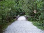
From the parking lot, head right towards Črno jezero, Koča pri Triglavskih jezerih and Hotel Zlatorog (straight Slap Savica and Dom na Komni). The path first leads along a gravel road that crosses the Savica River over a bridge. Just after the bridge, signs for Komarča direct us left (straight to Hotel Zlatorog) onto an initially quite wide and relatively gentle forest path. The path soon begins to ascend more steeply and somewhat higher brings us to a point where the path to the source of the Savica and Velika Savica Cave branches left; we continue right along the increasingly steep path.
A well-maintained and relatively wide mountain path soon transitions to very steep and slippery slopes of Komarča, where there is also a high risk of falling rocks. The path ahead ascends steeply mostly through the forested wall of Komarča, with fixed protections—mainly cables—assisting on the more difficult sections.
Higher up, some views towards Bohinj open from the path, and it leads us to a short technically demanding section where, with the aid of pegs and a cable, we cross a gully that is not particularly exposed. The path continues steeply ascending for a while longer and, with the help of some protections, brings us to the edge of Komarča, from where a nice view opens to our starting point. A short moderately steep ascent follows, then the path begins to descend gently towards Črno jezero, which we reach in less than five minutes of further walking.
Near the lake is a marked junction where the path to Planina Viševnik and Pršivec branches right; we continue slightly left along the marked path that bypasses Črno jezero on the right side. On the other side of the lake, the path from Dom na Komni joins from the left; we continue along the relatively gentle path along the edge of the Lopučniška Valley. Higher up, the path begins to ascend moderately along the edge of overhanging cliffs to a small spring that dries up in dry periods.
Continue along the marked path, which near Bela skala turns sharply right and ascends steeply. A few minutes of steep ascent follow, then the path levels out and leads to a marked junction where the path from Planina Blato via Prode joins from the right. Continue left towards Koča pri Triglavskih jezerih along the relatively gentle path, arriving at Dvojno jezero in ten minutes of further walking. The marked path bypasses the lake on the right and brings us to a junction before reaching the other side, where the path to Štapce and Mala Tičarica branches right.
Continue right towards Štapce and Mala Tičarica (straight to Koča pri Triglavskih jezerih, five minutes) ascending through a belt of sparse forest ending among dwarf pines. A short ascent through dwarf pines follows, then the relatively steep path continues over scree. The increasingly panoramic path quickly brings us below the walls of Štapce, where it turns right and becomes somewhat technically more demanding. With the aid of a ladder and cable, we ascend transversely over a small wall, then the path leads to a notch where it turns left. A short secured steep ascent follows, and the path levels out at the Štapce saddle, where there is a marked junction.
Continue right towards Planina Ovčarija and Koča na Planini pri Jezeru (left Mala Tičarica and Zelnarica ridge) and proceed for a few minutes without major elevation changes; when the marked path begins to descend noticeably, leave it and continue right onto an unmarked trail that is initially hard to find and difficult to follow further.
Follow the poor and quite overgrown trail leading through dwarf pines southwards; a little below the summit, go right towards the west along the trail or pathless terrain to quickly reach the mainly dwarf pine-covered panoramic summit.
Starting point - Komarča edge 1:35, Komarča edge - Črno jezero 0:05, Črno jezero - junction above Lopučniška dolina 1:15, junction above Lopučniška dolina - Dvojno jezero 0:10, Dvojno jezero - Štapce 0:30, Štapce - turnoff to Rušnata glava 0:05, turnoff to Rušnata glava - Rušnata glava 0:10.

Along the route: Komarča (810m), Rob Komarče (1295m), Vrh Komarče (1313m),
Črno jezero (1294m), Bela skala (1575m), Razpotje nad Lopučniško dolino (1671m), Ruski grob (1686m), Dvojno jezero (1689m), Štapce (1851m)
Photos:
 1
1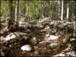 2
2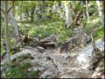 3
3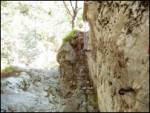 4
4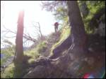 5
5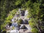 6
6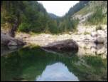 7
7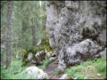 8
8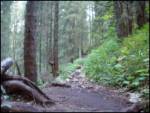 9
9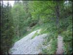 10
10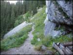 11
11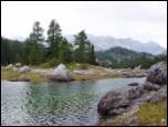 12
12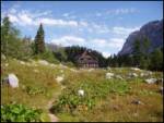 13
13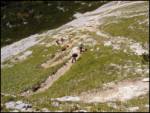 14
14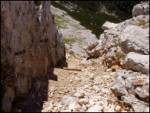 15
15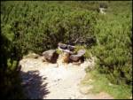 16
16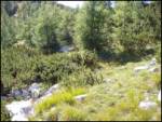 17
17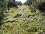 18
18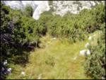 19
19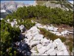 20
20
Discussion about the trip Koča pri Savici - Rušnata glava (via Štapce)
To post a comment you must log in:
If you do not yet have a username, you must first
register.