Koča pri Savici - Velika Baba (via Velika Montura)
Starting point: Koča pri Savici (653 m)
| Latitude/Longitude: | 46,28960°N 13,80220°E |
| |
Route name: via Velika Montura
Walking time: 5 h 35 min
Difficulty: easy unmarked way
Elevation gain: 1363 m
Elevation difference along the route: 1500 m
Map: TNP 1:50.000
Recommended equipment (summer):
Recommended equipment (winter): ice axe, crampons
Views: 2.720
 | 1 person like this post |
Access to starting point:
Drive to Bohinjska Bistrica, then continue driving towards Lake Bohinj. From Lake Bohinj, follow the signs to Savica Waterfall and park at the paid parking lot by Koča pri Savici.
Parking fee for a passenger car up to 3 hours is 3 EUR, more than 3 hours is 6 EUR (September 2018).
Route description:
From the parking lot, head onto the wide footpath towards Savica Waterfall and Dom na Komni (right path via Komarča). After a short gentle ascent, the path brings us to a marked junction, where the tourist path to Savica Waterfall branches off to the right; we continue slightly left or straight ahead on the wide footpath towards Komna. The path continues to ascend gently along the Savica for a short while, then leads to the first of the marked 48 serpentines. After one and a half hours of moderate ascent through the forest, the path reaches the mentioned 48th serpentine, from which a nice view of Lake Bohinj opens up. Here the path turns slightly right and enters the valley called Pekel, where it ascends gently for some time, then turns right and ascends somewhat steeper again. After just a few dozen steps, the path turns left again and continues ascending parallel to the valley. The further gentle to moderately steep path gradually enters thinner forest, from which we soon see Dom na Komni. The path leads past a small interesting cave, higher up to a junction where the path to Črno jezero branches right; we continue left and proceed further on the wide path. A short traverse ascent follows; at the natural chasm, which is fenced for safety, the path turns right, then ascends to the next junction, where the path from Črno jezero joins us.
A little further ahead, the path forks once more; we choose the left path towards Dom na Komni, or the somewhat shorter path that continues straight and bypasses Dom na Komni (right Koča pri Triglavskih jezerih).
Follows ascent past the hut Pri Hubertu and in a few minutes we reach Dom na Komni.
From Dom na Komni, go past a small chapel and follow the signs to Koča pod Bogatinom (left Vogel, Tolminski Kuk and Planina Govnjač); we soon join the previously mentioned somewhat shorter path.
Continue slightly left towards Koča pod Bogatinom and quickly arrive at Planina na Kraju on a wide and fairly panoramic path, where past the pyramid (ossuary at Koča pod Bogatinom - mountain memorial) we reach Koča pod Bogatinom, located in the middle of the pasture.
Bypass the hut on the right side and quickly reach a marked junction, where the path via Lepa Komna branches right, leading further to Lanževica or Oslova škrbina; we continue straight ahead on the wider gentle path towards Bogatinsko sedlo. On the western part of Planina na Kraju, another path branches left to Planina Govnjač; we continue for a few more minutes in easy ascent along the southern side of Kozlov rob. The path then levels out completely for a while and reaches the edge of the Gracije valley, where we begin traversing upwards, first on the slopes of Srednji vrh, later on the slopes of the forepeak Vrh nad Gracijo. Further on, the path becomes somewhat steeper and brings us with nice views to the point where it forks.
We can continue further on the mule track that makes a longer serpentine or on the somewhat shorter steep path that ascends directly to Bogatinsko sedlo, where both paths join.
From the junction at Bogatinsko sedlo, from where a nice view of Krn and the surrounding peaks opens up, head straight down towards Lepena, Prehodci, Krn, Krnsko jezero and Dom pri Krnskih jezerih (left Mahavšček and Bogatin, right Lanževica) on the path that gradually begins to descend.
The path continues on the old military mule track, which a few minutes lower brings us to slopes overgrown with dwarf pines, a bit lower the path levels out.
On the level section, on the right side we notice the sign Krn; when the small hill on the right ends, a sharp path branches right to the nearby cavern. Here we still continue on the marked path, but leave it a few dozen steps further, where a small cairn usually stands by the path.
From the marked path, at the mentioned spot go right, where we soon spot a faint trail that with the help of cairns leads towards an indistinct little valley located between Velika Montura and kot 1919, which is somewhat to the right of Velika Montura. When we reach the little valley, the trail becomes steeper, and we ascend it all the way to the saddle between the mentioned peaks.
From the saddle go right (left Velika Montura) and follow the trail and cairn to kot 1919, from there to the junction of unmarked trails below the summit of Predolina.
From the junction go slightly left (right one can reach Lanževica), traverse the slopes of Predolina, then approach the ridge that connects Predolina with Velika Baba. Continue slightly left and walk under the ridge, crossing occasionally dwarf pine-overgrown slopes. The trail through the dwarf pines is followable, but quite overgrown in a few places. The path then brings us to the ridge, a bit further we reach the marked path leading from Lepena towards Velika Baba.
Continue on the marked path, ascending on it for about ten minutes to the panoramic summit.
Starting point - junction to Črno jezero 2:15, junction to Črno jezero - Memorial plaque Matej Koblar 0:10, Memorial plaque Matej Koblar - Dom na Komni 0:05, Dom na Komni - Koča pod Bogatinom 0:15, Koča pod Bogatinom - Bogatinsko sedlo 1:15, Bogatinsko sedlo - junction for Baba 0:20, junction for Baba - Velika Baba 1:15.

Along the route: Pekel (1256m), Jama ob poti na Komno (1303m), Odcep k Črnemu jezeru (1411m), Brezno pod lovsko kočo na Komni (1430m), Spominska plošča Mateju Koblarju (1481m), Pri Hubertu (1492m),
Dom na Komni (1520m), Piramida (1520m),
Koča pod Bogatinom (1513m), Bogatinsko sedlo (1803m), Odcep za Veliko Babo (1712m)
Photos:
 1
1 2
2 3
3 4
4 5
5 6
6 7
7 8
8 9
9 10
10 11
11 12
12 13
13 14
14 15
15 16
16 17
17 18
18 19
19 20
20 21
21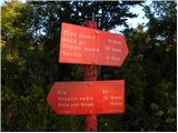 22
22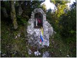 23
23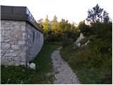 24
24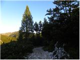 25
25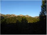 26
26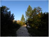 27
27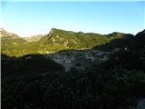 28
28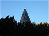 29
29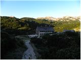 30
30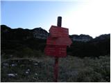 31
31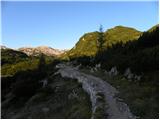 32
32 33
33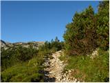 34
34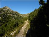 35
35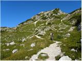 36
36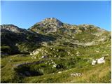 37
37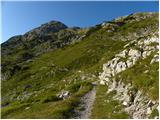 38
38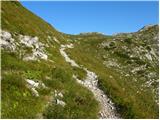 39
39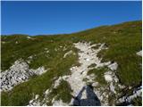 40
40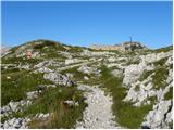 41
41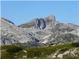 42
42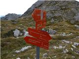 43
43 44
44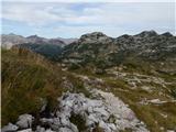 45
45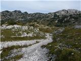 46
46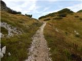 47
47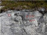 48
48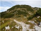 49
49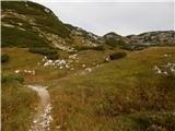 50
50 51
51 52
52 53
53 54
54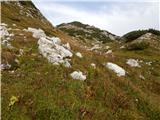 55
55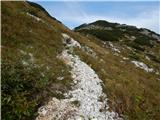 56
56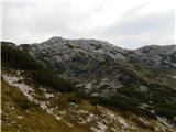 57
57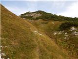 58
58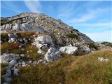 59
59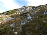 60
60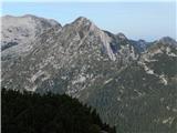 61
61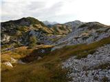 62
62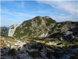 63
63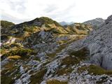 64
64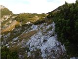 65
65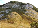 66
66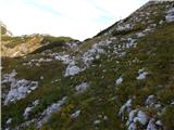 67
67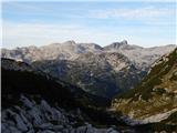 68
68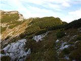 69
69 70
70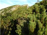 71
71 72
72 73
73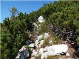 74
74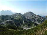 75
75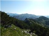 76
76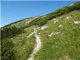 77
77 78
78 79
79 80
80 81
81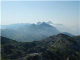 82
82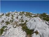 83
83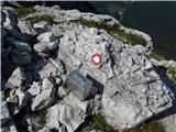 84
84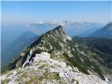 85
85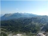 86
86
Discussion about the trip Koča pri Savici - Velika Baba (via Velika Montura)
|
| velkavrh10. 10. 2018 |
Interesting variant to Baba. A few years ago I went to Baba via Lanževec from Lanževec along pathless terrain. But there must be no fog.
|
|
|
To post a comment you must log in:
If you do not yet have a username, you must first
register.