Kočna - Vrše (by ski slope)
Starting point: Kočna (660 m)
| Latitude/Longitude: | 46,41790°N 14,08310°E |
| |
Route name: by ski slope
Walking time: 45 min
Difficulty: easy unmarked way
Elevation gain: 190 m
Elevation difference along the route: 190 m
Map: TNP 1:50.000
Recommended equipment (summer):
Recommended equipment (winter): ice axe, crampons
Views: 2.094
 | 3 people like this post |
Access to starting point:
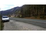
From the highway Ljubljana - Jesenice we go to the exit Lipce, where we turn left in the direction of Blejska Dobrava and Spodnje Gorje. Soon, when we drive past the railway underpass, we are at the next crossroad, where we turn right - Bled, Kočna. At first, the zig-zag road ascends straight towards the west and soon in the left turn reaches the top or settlement Kočna. Our starting point is located on the left side of the road, a few meters before the settlement sign. Because of the continuous line we drive ahead past the first houses, where on the right we notice a bus stop. Here we turn around and return back, almost to the turn, where we would descend back into the valley. We stop on a macadam parking lot.
Route description:
From the starting point, we go back on the road towards the settlement. After 250 m, a few meters before the bus stop on the right we go on a narrower side asphalt road on our left, which takes us past a few houses uphill. When after the left turn the road flattens and loses the asphalt pavement, it brings us to a larger meadow. We continue on a cart track which at first sticks slightly to the left and by the edge of the forest ascends a little past the pasture on the right. Quite soon we find ourselves on the saddle between two peaks - Žerjavec and Vrše, where there is a crossing. Here we go sharply right, namely on the first (at first gravel) path, which ascends uphill (the second is a gentle path to Blejska Dobrava). After a short ascent, we run into a bench, and we continue on this path, which then narrows and ascends a little steeper towards the summit Vrše. After this, when the path turns left and the steepness decreases, we can enjoy a view of Koroška Bela and Javorniški Rovt. Shortly we step into a mixed forest, through which the path after a shorter and gentle ascent brings us to the summit of the 850 m high hill Vrše. Here, on the left side we notice a footpath which descends to the eastern slope. When we descend a few altitude meters towards the valley on it, from the left joins another footpath (shortcut from the path on which we came to the summit), and we continue descending for a short time. Quickly we run into a fence behind which the hunting cottage is located. A little lower, on the spot prepared for this, we cross the fence. Near the pleasant cottage we can enjoy a view of the Ljubljana basin, part of Blejska Dobrava, and Brezniške vasi (so-called) Dežele.

Along the route: Žerjavec (805m)
Photos:
 1
1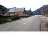 2
2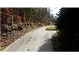 3
3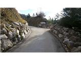 4
4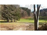 5
5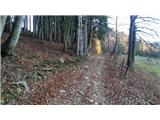 6
6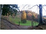 7
7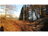 8
8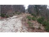 9
9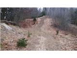 10
10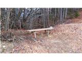 11
11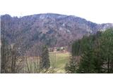 12
12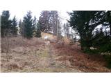 13
13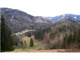 14
14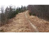 15
15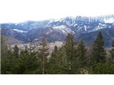 16
16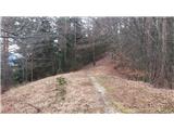 17
17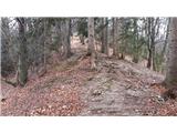 18
18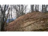 19
19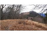 20
20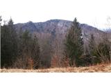 21
21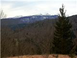 22
22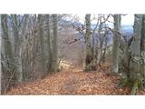 23
23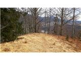 24
24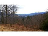 25
25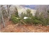 26
26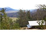 27
27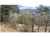 28
28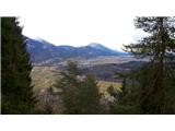 29
29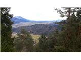 30
30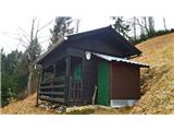 31
31
Discussion about the trip Kočna - Vrše (by ski slope)
|
| Jusk3. 01. 2020 |
Since there is no other description of this path, I'll write here..did a loop Blejska dobrava-Sv.Katarina-around Hom to the Gorjan side of Vintgar-on the "steep path", somewhere halfway on the "steep path" towards Bl.dobrava there is an unmarked turn-off towards Boršt and Vrše,go to Vrše and down towards Bl.dobrava on the path marked with yellow markers. Path around Hom muddy, on Vrše and towards Bl.dobrava mostly dry (usually muddy and wet). Pleasant hike and nice (too) warm day
|
|
|
To post a comment you must log in:
If you do not yet have a username, you must first
register.