Kočna - Vrše (čez senožeti)
Starting point: Kočna (660 m)
| Latitude/Longitude: | 46,41790°N 14,08310°E |
| |
Route name: čez senožeti
Walking time: 50 min
Difficulty: easy unmarked way
Elevation gain: 190 m
Elevation difference along the route: 190 m
Map: TNP 1:50.000
Recommended equipment (summer):
Recommended equipment (winter): ice axe, crampons
Views: 1.190
 | 4 people like this post |
Access to starting point:
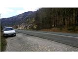
From the highway Ljubljana - Jesenice we go to the exit Lipce, where we turn left in the direction of Blejska Dobrava and Spodnje Gorje. Soon after we drive past the railway underpass, we are at the next crossroad, where we turn right - Bled, Kočna. At first, the serpentine road ascends straight towards the west and soon in the left turn reaches the top or settlement Kočna. Our starting point is located on the left side of the road, a few meters before the settlement sign. Because of the continuous line we drive ahead past the first houses, where on the right we notice a bus stop. Here we turn around and return, almost to the turn before we would descend back into the valley. We stop on a macadam parking lot.
Route description:
From the starting point, we go back on the road towards the settlement. After 250 m, a few meters before the bus stop from the right we turn onto a narrower side, asphalted road on our left, which takes us past a few houses uphill. When after the left turn the road flattens and loses the asphalt pavement, it brings us to a larger meadow. We continue on the cart track, which at first holds slightly to the left and ascends somewhat along the edge of the forest. When soon we arrive at the gate of the pasture, we leave the original cart track, turn right, and continue towards the south on the level cart track path across the pasture. The cart track soon brings us into the forest, and past the next gate of the pasture fence from the forest to the next meadow. Here we continue slightly to the left, uphill across the meadow. Still before on this section the path turns right, flattens and cuts into the slope, we leave it and continue in the same direction (or only slightly to the left) across the meadow, specifically another few tens of meters uphill, all the way to the forest slope. Here we encounter a path which upon crossing the stream turns right onto the slope, which during the further ascent it crosses briefly. A little higher the path turns sharply left, and the steepness eases somewhat. When we step out of the forest, the path turns right and leads us uphill along the slope through the hay meadow, past the remains of a small construction site on the left. Then the steepness eases somewhat, our path turns perpendicularly left (right path to Boršt), and after a short ascent brings us to the top of the 850 m high hill Vrše. Here, on the right side we notice a trail which descends to the eastern slope. When we descend a few elevation meters along it towards the valley, another trail joins us from the left (shortcut from the path "by the ski slope"), and we continue descending for a short time. We soon encounter a fence behind which the hunting cottage is located. A little lower, at the designated place we cross the fence. Near the pleasant cottage we can enjoy the view into the Ljubljana Basin, onto part of Blejska Dobrava, and onto the Brezniške villages (so-called) Dežele.

Along the route: Žerjavec (805m)
Photos:
 1
1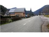 2
2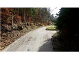 3
3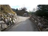 4
4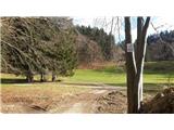 5
5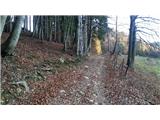 6
6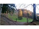 7
7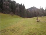 8
8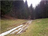 9
9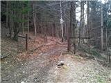 10
10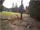 11
11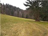 12
12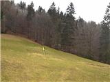 13
13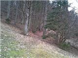 14
14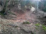 15
15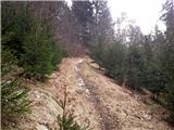 16
16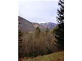 17
17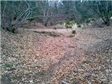 18
18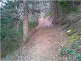 19
19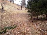 20
20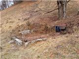 21
21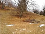 22
22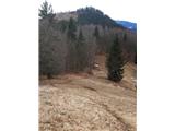 23
23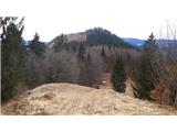 24
24 25
25 26
26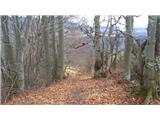 27
27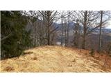 28
28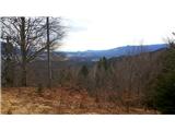 29
29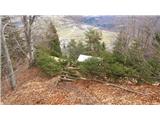 30
30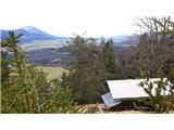 31
31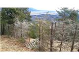 32
32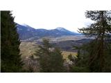 33
33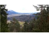 34
34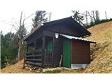 35
35
Discussion about the trip Kočna - Vrše (čez senožeti)
To post a comment you must log in:
If you do not yet have a username, you must first
register.