Kokarje (ŠRC Laze) - Vrhe (via Tajna)
Starting point: Kokarje (ŠRC Laze) (368 m)
| Latitude/Longitude: | 46,29830°N 14,93770°E |
| |
Route name: via Tajna
Walking time: 1 h 45 min
Difficulty: easy marked way, easy unmarked way
Elevation gain: 597 m
Elevation difference along the route: 610 m
Map: Kamniške in Savinjske Alpe 1:50.000
Recommended equipment (summer):
Recommended equipment (winter): ice axe, crampons
Views: 892
 | 1 person like this post |
Access to starting point:
A) First, we drive to Mozirje (to here from Šoštanj or highway Ljubljana - Maribor (exit Šentrupert)), from where, from the main roundabout, we continue driving towards Gornji Grad and Logarska dolina. A few kilometers ahead, after the Petrol gas station, we turn left in the direction of Nazarje. Further, we drive through Nazarje, where we follow the signs for settlements Dobletina and Šmartno ob Dreti. Soon after Dobletina and still before Lačja vas, we turn left in the direction of Kokarje. Further, we cross the bridge over the river Dreta, and then we quickly get to Kokarje, where at the marked crossroad we continue slightly right in the direction of sports field Laze, to which we drive after a few 100 meters of additional driving. We park on a parking lot by ŠRC Laze.
B) We drive to the settlement Šmartno ob Dreti (to here from Gornji Grad, Ljubno ob Savinji or Vransko over the mountain pass Lipa), and then we continue driving towards Nazarje. After Lačja vas we turn right in the direction of Kokarje. Further, we cross the bridge over the river Dreta, and then we quickly get to Kokarje, where at the marked crossroad we continue slightly right in the direction of sports field Laze, to which we drive after a few 100 meters of additional driving. We park on a parking lot by ŠRC Laze.
Route description:
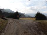
Near the starting point a marked junction is situated, from where we head to the upper road in the direction of Čreta over Tajna (slightly right Čreta past Dom na Farbanci). The road soon changes into a cart track, which then moderately ascends through the forest, and after a few minutes brings us to the spot, where a marked path also joins from the left, which leads from the center of the village Kokarje.
From the mentioned junction we continue right and still continue the path on the cart track. A little further there follow some junctions, where we follow the blazes, then we gradually transition to a footpath, which higher crosses one of the cart tracks, and higher again temporarily joins another. Higher we ascend on a wider path, which crosses slopes towards the right, while leading us over or under several fallen trees. There follows a short somewhat steeper ascent and we reach the macadam road, which we follow to the right. On the road we walk for a short time, then at the smaller crossroad we continue on the path, which ascends between the wider cart track on the left and the road on the right. Further we ascend on or slightly below the forested ridge, then the forest ends and the well-marked path ascends diagonally across the grassy slope. During the diagonal ascent the path leads us over several cart tracks, then the path turns a little more to the right and near the homestead Kraple reaches a macadam road.
We reach the road behind the homestead, which we follow to the right. There follows a somewhat steeper ascent on the road, which ascends on quite steep slopes of Krapletov vrh (905 m). After the sign (cross) we soon leave the road and continue right into the forest, where we first cross a small spring, then continue on the left upper cart track, which quickly brings us back to the road. This time too we follow the road to the right in the direction of Čreta, quickly leave the forest and with nice views arrive at the marked junction, which is located between the church of Holy Mother of God and the church of St. Katarina.
From the mentioned junction we continue sharply left in the direction of Čreta and Mozirje (straight Dom na Čreti, right sv. Jošt, sv. Katarina and Motnik) and continue the path on the cart track, which temporarily leads us through the forest. When the path running through the forest flattens, the path first leads us past a chapel, then also past the NOB monument. After the monument we step out of the forest and the path brings us to the church of Holy Mother of God, from where a nice view opens up, reaching all the way to the highest peaks of Kamniško Savinjskih Alp and eastern Karavanks.
From the church we continue straight, cross the grazing fence and the path brings us into the forest. In the forest the path splits into two parts, we choose the right one and in a few dozen steps of further walking step onto the indistinct peak.

Photos:
 1
1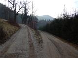 2
2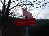 3
3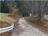 4
4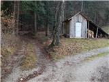 5
5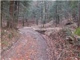 6
6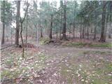 7
7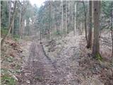 8
8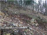 9
9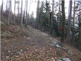 10
10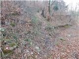 11
11 12
12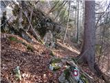 13
13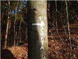 14
14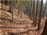 15
15 16
16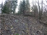 17
17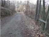 18
18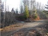 19
19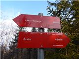 20
20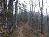 21
21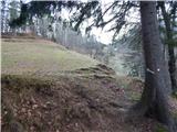 22
22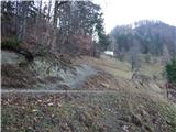 23
23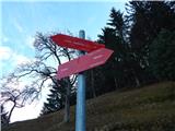 24
24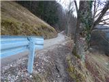 25
25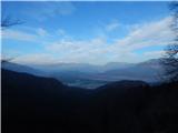 26
26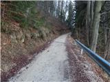 27
27 28
28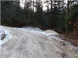 29
29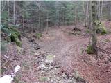 30
30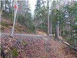 31
31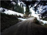 32
32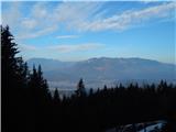 33
33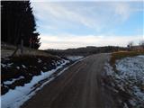 34
34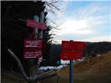 35
35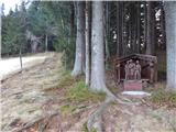 36
36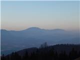 37
37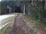 38
38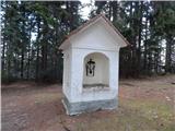 39
39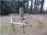 40
40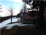 41
41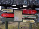 42
42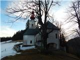 43
43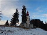 44
44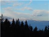 45
45 46
46 47
47 48
48 49
49 50
50
Discussion about the trip Kokarje (ŠRC Laze) - Vrhe (via Tajna)
To post a comment you must log in:
If you do not yet have a username, you must first
register.