Kolarica - Veliki Travnik (Turnovka)
Starting point: Kolarica (1328 m)
| Latitude/Longitude: | 46,41100°N 14,81190°E |
| |
Walking time: 1 h 5 min
Difficulty: easy marked way
Elevation gain: 309 m
Elevation difference along the route: 309 m
Map: Kamniške in Savinjske Alpe 1:50.000
Recommended equipment (summer):
Recommended equipment (winter): ice axe, crampons
Views: 123
 | 1 person like this post |
Access to starting point:
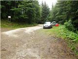
a) Drive to Ljubno ob Savinji, then follow the signs for Smrekovec. In Ljubenske Rastke turn left, then begin the ascent first along the slopes of Bezovca and later Komna. This is followed by traversing the slopes to the left, passing the parking lot for Komen (also possible to Koča na Travniku), but we continue in the same direction following the road past another parking lot for Koča na Travniku. Continue traversing the slopes, and at the next signs for Koča na Travniku park at a suitable spot.
b) Drive to Ljubno ob Savinji, then follow the signs for Logarska dolina. Shortly after the mentioned place we arrive at a junction, turn right onto the side road towards Primož pri Ljubnem, then follow the signs for Koča na Travniku. Up to an altitude of approximately 900 m we mostly ascend, then the path leads over a pass, from which a longer traverse to the right follows. Later the access variant from the center of the settlement Ljubno ob Savinji joins from the right. Higher we ascend over Pečko or Robnikova planina, where we cross the marked path from the valley of the Žep stream - Koča na Travniku, but we continue along the road which returns to the forest and for some time continues together with the marked path. When the marked path turns left, park at a suitable place by the road.
Route description:
From the starting point head onto the wide cart track towards Koča na Travniku and begin a moderate ascent along it. After a few minutes of walking an abandoned cart track branches off to the right, but continue straight ahead along the still wide cart track, which a bit higher leads to the next junction, where we join the path from the starting point at Ljubno ob Savinji.
Here the signs for Travnik direct us right, where with moderate traversing of the slopes we soon emerge from the forest onto the pasture areas of Široke trate. From here only an ascent along the gentle grassy slope to Koča na Travniku follows.
From the hut continue straight, and after one minute of further walking the path forks.
Continue straight (left Raduha, right Komen) towards the viewpoint tower on Veliki Travnik, or Turnovka, and continue ascending through the pasture areas of Široke trate. Higher the path enters a forest belt, and when leaving the forest continue the gentle to moderate ascent with occasional views, but no open view due to the nearby forest. Just below the summit cross a pasture fence once more, then in a few steps reach the viewpoint tower on Veliki Travnik.
Starting point - Koča na Travniku 0:40, Koča na Travniku - Veliki Travnik 0:25.

Photos:
 1
1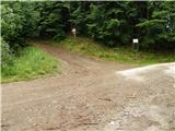 2
2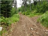 3
3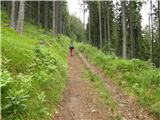 4
4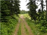 5
5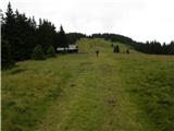 6
6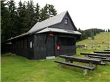 7
7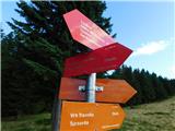 8
8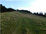 9
9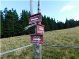 10
10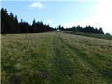 11
11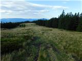 12
12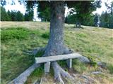 13
13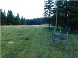 14
14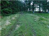 15
15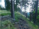 16
16 17
17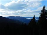 18
18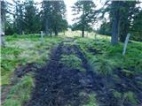 19
19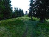 20
20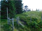 21
21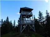 22
22 23
23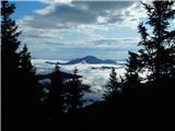 24
24 25
25
Discussion about the trip Kolarica - Veliki Travnik (Turnovka)
To post a comment you must log in:
If you do not yet have a username, you must first
register.