Kolnica - Planinski dom Goška ravan
Starting point: Kolnica (500 m)
| Latitude/Longitude: | 46,32170°N 14,15990°E |
| |
Walking time: 1 h 15 min
Difficulty: easy marked way
Elevation gain: 433 m
Elevation difference along the route: 440 m
Map: Karavanke - osrednji del 1:50.000
Recommended equipment (summer):
Recommended equipment (winter): crampons
Views: 10.338
 | 2 people like this post |
Access to starting point:
A) From the highway Ljubljana - Jesenice, we take the exit Naklo, Podtabor or Brezje, then we continue driving in the direction of Kropa. At the crossroad where the road continues straight towards Kropa, we turn right and further drive through Kamna Gorica. Further on, we drive for some time through Lipniška dolina, then we turn left in the direction of Spodnja Lipnica and hunting cottage Lovska koča na Taležu. After the hamlet Kolnica, the asphalt ends and the road takes us into the forest. We park at a suitable place by the road.
B) From the highway Jesenice - Ljubljana, we take the exit Lesce or Radovljica, then we continue driving in the direction of Radovljica and later the villages Lancovo, Lipnica and Kamna Gorica. Further, the road over a bridge crosses the river Sava and on the other side gradually starts to ascend. The path ahead leads us through Lancovo, then we descend into Lipniška dolina, where we soon turn right into Spodnja Lipnica. The road then leads us past the spring of Lipnica and the hamlet Kolnica, where the asphalt ends. We park at a suitable place by the road.
Route description:
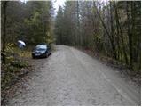
From the starting point, we continue on the macadam road, which first gently and then moderately ascends through the forest. We walk for some time on the road, then past the water catchment area we arrive at the spot where the marked path from the valley joins us from the right.
Here we leave the road and continue left into the forest, where we follow an otherwise visible but hard-to-follow footpath along which the blazes are rare and many already very faded. Further on, we ascend through the forest, first on still wider cart tracks, then the path becomes steeper and mostly continues on forest footpaths and old cart tracks. An orientationally quite difficult path, which is also poorly marked further on, brings us higher to a forest road, which we follow to the left to the nearby crossroad. From the crossroad, we do not continue on the left road nor on the right one, but straight ahead on the marked footpath, which continues on and beside the cart track. The path soon steeply ascends and brings us in a few minutes to a wider cart track, on which we ascend to the nearby forest road. When we step onto the road, we again continue left, and the road brings us in some 10 steps of further walking to the mountain pasture Goška ravan. Here we continue right and walk to the nearby mountain hut.

Photos:
 1
1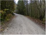 2
2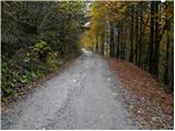 3
3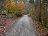 4
4 5
5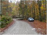 6
6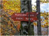 7
7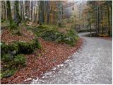 8
8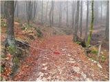 9
9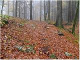 10
10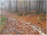 11
11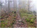 12
12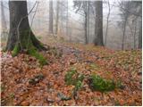 13
13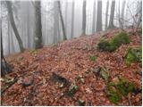 14
14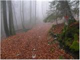 15
15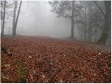 16
16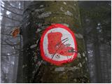 17
17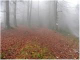 18
18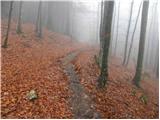 19
19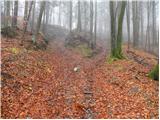 20
20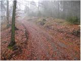 21
21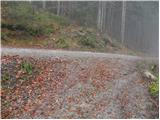 22
22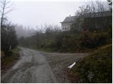 23
23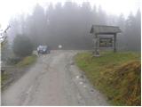 24
24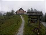 25
25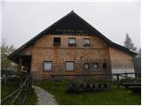 26
26
Discussion about the trip Kolnica - Planinski dom Goška ravan
|
| igorrogi14. 01. 2019 |
Please correct the elevation, Planinski dom Goška Ravan is at 933m a.s.l.
|
|
|
|
| Suriljana11. 04. 2020 |
There are no more (visible) signs and markers on the path. After approx. 2.4 km of macadam, a cart track branches off, which soon turns into a hiking trail, marked to the top with individual yellow paint spots.
|
|
|
To post a comment you must log in:
If you do not yet have a username, you must first
register.