Starting point: Kolovrat (455 m)
| Latitude/Longitude: | 46,16830°N 14,87320°E |
| |
Walking time: 1 h
Difficulty: easy marked way
Elevation gain: 423 m
Elevation difference along the route: 432 m
Map: Posavsko hribovje - zahodni del 1:50.000
Recommended equipment (summer):
Recommended equipment (winter):
Views: 7.464
 | 2 people like this post |
Access to starting point:
A) From the Ljubljana–Maribor highway, take the Trojane exit, then continue driving towards Zagorje ob Savi and Izlake. When we arrive in Izlake, just before the gas station, which is located next to the ETI factory, turn right towards Moravče. We then follow the main road towards Moravče past Valvasorjeva kolonija (dense settlement on the right side of the road) approximately 1 km further to the right turn-off towards Kolovrat. The road then brings us to the settlement Briše, where we drive past the church and the turn-off for Medija, past the Kamnolom Borovnik quarry to Kolovrat, where we park by the church.
B) From the Zasavje direction, we first drive to Izlake; there, immediately after the gas station, which is located next to the ETI factory, turn left towards Moravče. We then follow the main road towards Moravče past Valvasorjeva kolonija (dense settlement on the right side of the road) approximately 1 km further to the right turn-off towards Kolovrat. The road then brings us to the settlement Briše, where we drive past the church and the turn-off for Medija, past the Kamnolom Borovnik quarry to Kolovrat, where we park by the church.
C) From Moravče, drive towards the Izlake settlement through Mlinše. Approximately 2 km ahead from the end of the Mlinše sign, right at the road exit from the forest, there is a bus stop on the left side of the road and immediately behind it a left turn-off towards Kolovrat. The road then brings us to the settlement Briše, where we drive past the church and the turn-off for Medija, past the Kamnolom Borovnik quarry to Kolovrat, where we park by the church.
Route description:
From the parking lot, we head towards the fire station and continue on the path to the left past it. A few meters ahead, we reach a macadam road and a sign that directs us right upwards, at the junction towards Reber. We then follow the path past an old decaying house to the end of the "yard" into the forest, where we follow the path, which with a gentle ascent along the foot of the hill brings us to some hidden weekend cottages and a macadam road that joins our path from the Trojane side. The sign for Reber directs us up the hill, where we first ascend more steeply, then the path flattens again. Two more short ascents follow, and we are already at the stamping box.
Photos:
 1
1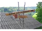 2
2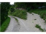 3
3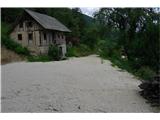 4
4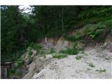 5
5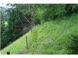 6
6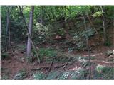 7
7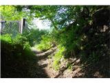 8
8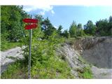 9
9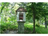 10
10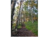 11
11 12
12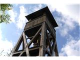 13
13 14
14 15
15 16
16 17
17
Discussion about the trip Kolovrat - Reber
To post a comment you must log in:
If you do not yet have a username, you must first
register.