Komenda - Planinski dom Milana Šinkovca
Starting point: Komenda (347 m)
| Latitude/Longitude: | 46,20770°N 14,53890°E |
| |
Walking time: 15 min
Difficulty: easy marked way
Elevation gain: -2 m
Elevation difference along the route: 5 m
Map:
Recommended equipment (summer):
Recommended equipment (winter):
Views: 6.852
 | 1 person like this post |
Access to starting point:
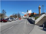
A) From the highway Ljubljana - Jesenice, take the exit Vodice, then continue driving towards Vodice and Kamnik. When we arrive at the settlement Moste, at the main traffic-light intersection cross the road Mengeš - Kranj, then immediately after the intersection turn left towards Komenda (straight Kamnik). Further, drive through Komenda to the roundabout, where to the right (first exit) the road branches off towards Križ and Gmajnica, we continue straight (second exit) in the direction of Klanec, where we quickly arrive at a smaller marked parking lot opposite the cemetery, a larger parking lot is a little further at the parish church.
B) From Trzin or Domžale drive to Mengeš, from there continue driving towards Kranj. At the main traffic-light intersection in Moste turn right towards Kamnik, then immediately left towards Komenda. Further, drive through Komenda to the roundabout, where to the right (first exit) the road branches off towards Križ and Gmajnica, we continue straight (second exit) in the direction of Klanec, where we quickly arrive at a smaller marked parking lot opposite the cemetery, a larger parking lot is a little further at the parish church.
C) First drive to Kamnik, then continue driving towards Kranj. When we arrive at Moste, just before the main traffic-light intersection turn right towards Komenda. Further, drive through Komenda to the roundabout, where to the right (first exit) the road branches off towards Križ and Gmajnica, we continue straight (second exit) in the direction of Klanec, where we quickly arrive at a smaller marked parking lot opposite the cemetery, a larger parking lot is a little further at the parish church.
Route description:
From the starting point, we return to the roundabout, from there we continue in the direction of Križ and Gmajnica. Initially we walk on the sidewalk, where the path past the bar and across Pšata quickly brings us to the settlement Gmajnica, there in the first roundabout we continue left towards the mountain hut (marked). We continue along the edge of the road, then we quickly arrive at the settlement Podboršt. On the part of the path through Podboršt a nice view opens up on the Kamnik and Savinja Alps, at the small intersection in the village, by which there is a wooden sign (cross), we again continue left in the direction of the mountain hut. Just a few dozen meters ahead we arrive at the next signs for the mountain hut, which again direct us left, now to the parking lot and the nearby mountain hut, which is located at the starting point of the path to Šenturška Gora, Ambrož pod Krvavcem and Krvavec.
Description and pictures refer to the condition in the year 2015 (April).

Photos:
 1
1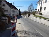 2
2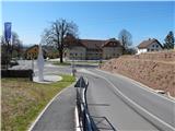 3
3 4
4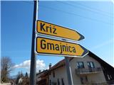 5
5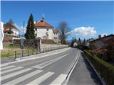 6
6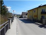 7
7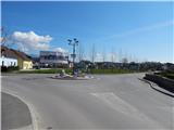 8
8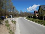 9
9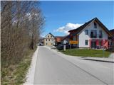 10
10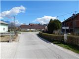 11
11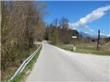 12
12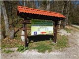 13
13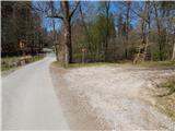 14
14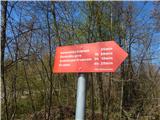 15
15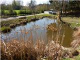 16
16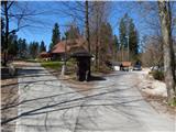 17
17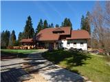 18
18
Discussion about the trip Komenda - Planinski dom Milana Šinkovca
To post a comment you must log in:
If you do not yet have a username, you must first
register.