Konjska raven (Pokljuka) - Galetovec
Starting point: Konjska raven (Pokljuka) (1220 m)
| Latitude/Longitude: | 46,33220°N 14,01670°E |
| |
Walking time: 50 min
Difficulty: easy marked way
Elevation gain: 45 m
Elevation difference along the route: 65 m
Map: TNP 1:50.000
Recommended equipment (summer):
Recommended equipment (winter):
Views: 13.990
 | 2 people like this post |
Access to starting point:
A) From Bled or Jesenice we drive to Pokljuka, then, once we are already on the plateau, we turn left in the direction of Bohinj. Further on, we drive along the road towards Gorjuše, between the road signs 3.5 and 4 km, then we turn left onto the forest road in the direction of Belska planina. We park at an appropriate place at the crossroads.
B) From Železniki or Podbrdo we drive to Bohinjska Bistrica, then we continue driving in the direction of Bled. Soon after the Petrol gas station, which is located just a little after Bohinjska Bistrica, we continue driving left in the direction of Pokljuka and Jereka. Further on, the road first ascends steeply, then after Korita it gradually flattens and brings us to the crossroads at the bus stop, where we continue right in the direction of Pokljuka, Koprivnik and Jereka (straight Srednja vas). Immediately after the crossroads we arrive in Jereka, but from the crossroads in front of the church we continue straight towards Pokljuka (left Podjelje). After Jereka the road again starts to ascend more steeply, higher up it flattens and continues along the Mrzli potok, where the road to Koprivnik v Bohinju branches off to the left, but we continue straight towards Pokljuka and Gorjuše. After Gorjuše the road enters the forest, and we drive along it to the road sign between 4 and 3.5 km, where we turn right onto the forest road in the direction of Belska planina. We park at an appropriate place at the crossroads.
Route description:
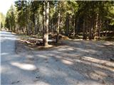
From the starting point, we continue on a macadam road in the direction of Belska planina. The road on which we walk ascends gently through the spruce forest, and when the forest starts to thin out, we arrive at the edge of Belska planina. Here we arrive at a smaller crossroads, and we continue on the slightly left road, which brings us to the heart of the mountain pasture, where several wooden huts stand.
On the other side of the mountain pasture we take the slightly right road, along which we continue through a small valley to a marked junction a few minutes away.
From the junction, we continue right in the direction of Galetovec and Bohinjska Bela (straight Turn and Bohinjska Bela).
The path ahead leads us along a pleasant cart track, which we leave after a few minutes, as the signs for Galetovec direct us left onto an at first barely noticeable footpath, which descends along the edge of the forest to a small valley, where it enters the forest. Through the forest we follow the blazes and the forest path, along which we ascend to the panoramic summit in a few minutes.
Description and pictures refer to the condition in 2017 (May).

Photos:
 1
1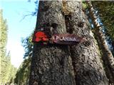 2
2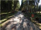 3
3 4
4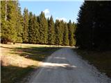 5
5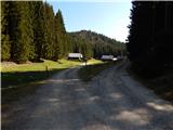 6
6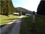 7
7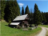 8
8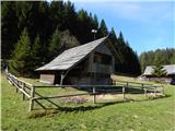 9
9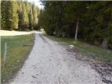 10
10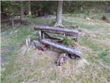 11
11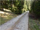 12
12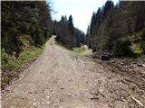 13
13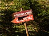 14
14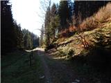 15
15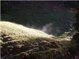 16
16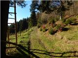 17
17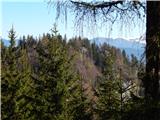 18
18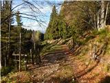 19
19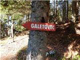 20
20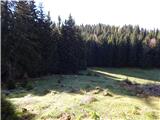 21
21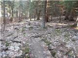 22
22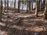 23
23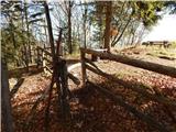 24
24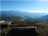 25
25 26
26
Discussion about the trip Konjska raven (Pokljuka) - Galetovec
|
| PrimožL31. 08. 2022 15:52:23 |
It doesn't matter at all if at Belska planina you stick to the main road and don't go through the pasture.
|
|
|
To post a comment you must log in:
If you do not yet have a username, you must first
register.