Starting point: Kopačnica (499 m)
| Latitude/Longitude: | 46,12380°N 14,07450°E |
| |
Walking time: 3 h 40 min
Difficulty: easy marked way
Elevation gain: 552 m
Elevation difference along the route: 800 m
Map: Škofjeloško in Cerkljansko hribovje 1:50.000
Recommended equipment (summer):
Recommended equipment (winter): ice axe, crampons
Views: 1.200
 | 1 person like this post |
Access to starting point:
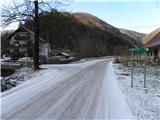
A) First, we drive to Gorenjo vas in Poljanska dolina (to here from Škofja Loka via the new bypass road which bypasses Škofja Loka, Horjula or Polhov Gradec), then we continue driving towards Žiri and Cerkno. When we arrive at Hotavelj we turn right in the direction of the village Leskovica and the Cerkno ski slopes. The road then soon brings us to Kopačnica, where we notice signs for Ermanovec, which direct us left over the bridge. Because there are no suitable parking spots at the starting point, it is better to drive a little further up the narrower road, which through the hamlet Kopačnica brings us into the ravine of the Podkovščica stream. We park above the village in a suitable place by the road.
B) We drive to Žiri (to here from Vrhnika or Logatec), then we continue driving towards Škofja Loka. When we arrive at Hotavelj we turn left in the direction of the village Leskovica and the Cerkno ski slopes. The road then soon brings us to Kopačnica, where we notice signs for Ermanovec, which direct us left over the bridge. Because there are no suitable parking spots at the starting point, it is better to drive a little further up the narrower road, which through the hamlet Kopačnica brings us into the ravine of the Podkovščica stream. We park above the village in a suitable place by the road.
Route description:
Above the village, the road by which we have parked gradually turns into a cart track, which moderately ascends alongside the Podkovščica stream. The cart track along which we walk crosses the mentioned stream several times, then at the partly overgrown end of the ravine turns sharply left, where it also ascends somewhat steeper. The path ahead ascends transversely for a few minutes, then brings us to a wide indistinct ridge, where it turns right again. Further on we follow the blazes, and the path in a moderate ascent through the forest brings us to the nearby forest road, which we follow to the right (at the place where we step onto the road there are no blazes).
We continue the ascent along the increasingly scenic road, which with nice views of Blegoš and the surrounding hills brings us to the Erženovše homestead. Above the farm macadam replaces asphalt, and we after 3 minutes of further walking arrive at the marked junction, by which we notice a larger chapel.
From the junction, which is located in the main ridge of the 1005 m high Štor, we continue right (left Koča na Ermanovcu - 5 minutes) along the fairly scenic asphalt road, along which in a few minutes we arrive at the information board of the Rapallo border and the renovated border stone from 1920.
A few steps further the signs for the Franja hospital direct us right onto the macadam road, which leads us through the yard of the nearby house. On the other side of the house we continue left onto the cart track, along which across the grassy slope we enter the forest. Through the forest at several junctions we follow the blazes, and the path behind the building from the time of the Rapallo border begins to descend visibly. Lower the path brings us out of the forest, from where a nice view of Škofje opens up. A few more steps lower, at the hamlet of a few houses, we step onto the asphalt road which leads from Koča na Ermanovcu towards the Kladje pass, which we follow to the right. Some 10 steps further a marked path to Škofje and the Franja hospital branches off right, and we continue along the road, which leads us alternately across scenic hay meadows, partly through the forest, passing some individual houses. Lower another path from Škofje and the Franja hospital joins from the right, and past a few houses we arrive at the marked junction at the Kladje pass, which is located in the Podlanišče settlement.
From the Kladje pass at Podlanišče we continue in the direction of the Lajše sanctuary, Bevkov vrh and Sivka, and initially continue along the asphalt road. We walk along the road briefly, then at the smaller junction, still before the road enters the forest, we continue onto the left road, from it immediately right onto the footpath, which climbs between both roads and enters the forest. Through the forest we first ascend along the cart track, then the blazes direct us slightly right onto the marked trail, which higher crosses several cart tracks. When higher at the woodpile we reach the wider cart track, we continue along it, and it without major changes in elevation brings us out of the forest, a few minutes further to the asphalt road, which we follow to the right. Along the road in a few steps we arrive at the smaller saddle, where there is a marked junction.
From the junction we continue left in the direction of Bevkov vrh and homemade cheese. At the following junctions we follow the signs for homemade cheese, and meanwhile the road descends approximately 50 elevation meters. Lower the road levels out, and from the right a marked path from Želin joins. Some 10 steps further we arrive at the Na Ravan farm, where it is possible to buy some dairy product, and here a few steps before the farm we continue left onto the cart track, which continues behind the houses. The cart track quickly turns into a trail, which then ascends up the pasture, and higher we reach a somewhat wider cart track, which ascends transversely to the right. At the entrance into the forest we notice a larger blaze reminiscent of a traffic sign, and the cart track here enters the forest and turns left. When we step out of the forest again we notice another larger blaze, which is helpful on the descent. Along the cart track we continue to the pasture fence, then alongside it to the chapel, which is located by the power line.
From the chapel, where there are the SPP stamp and the registration box, we continue left in the direction of Sovodenj. There follows less than 10 minutes of walking along the partly scenic ridge of Bevkov vrh. When the path enters the forest, only a few steps of walking separate us from the summit of Bevkov vrh.
Kopačnica - Kladje 2:10, Kladje - Bevkov vrh 1:30.

Along the route: Kladje (787m), Na Ravan (875m)
Photos:
 1
1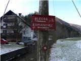 2
2 3
3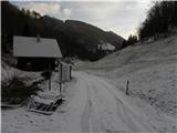 4
4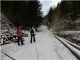 5
5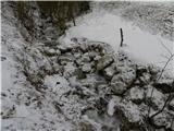 6
6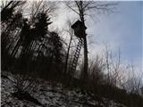 7
7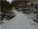 8
8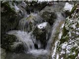 9
9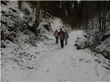 10
10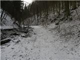 11
11 12
12 13
13 14
14 15
15 16
16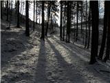 17
17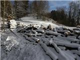 18
18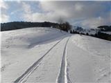 19
19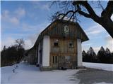 20
20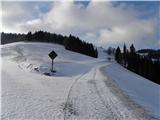 21
21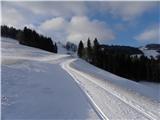 22
22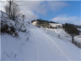 23
23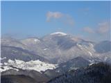 24
24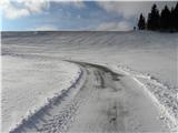 25
25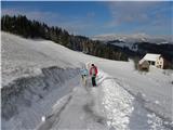 26
26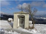 27
27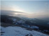 28
28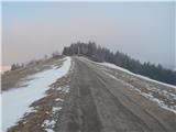 29
29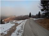 30
30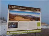 31
31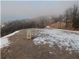 32
32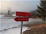 33
33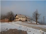 34
34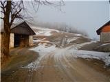 35
35 36
36 37
37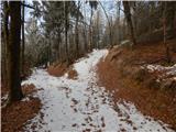 38
38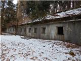 39
39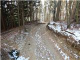 40
40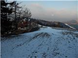 41
41 42
42 43
43 44
44 45
45 46
46 47
47 48
48 49
49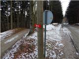 50
50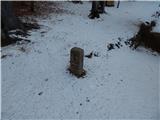 51
51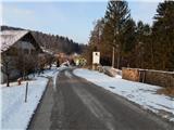 52
52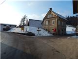 53
53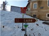 54
54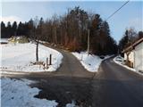 55
55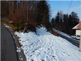 56
56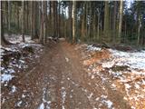 57
57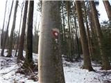 58
58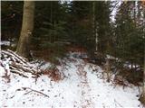 59
59 60
60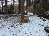 61
61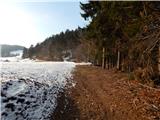 62
62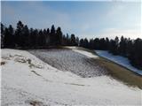 63
63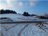 64
64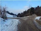 65
65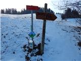 66
66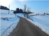 67
67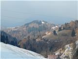 68
68 69
69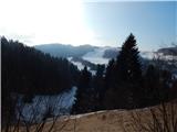 70
70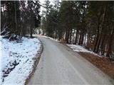 71
71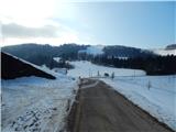 72
72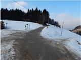 73
73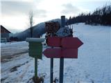 74
74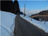 75
75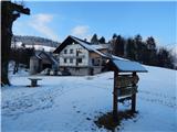 76
76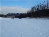 77
77 78
78 79
79 80
80 81
81 82
82 83
83 84
84 85
85 86
86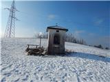 87
87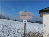 88
88 89
89 90
90 91
91 92
92 93
93 94
94 95
95
Discussion about the trip Kopačnica - Bevkov vrh
To post a comment you must log in:
If you do not yet have a username, you must first
register.