Kopišča - Konj (Martinj steza)
Starting point: Kopišča (540 m)
| Latitude/Longitude: | 46,31285°N 14,60539°E |
| |
Route name: Martinj steza
Walking time: 4 h
Difficulty: difficult unmarked way
Elevation gain: 1263 m
Elevation difference along the route: 1325 m
Map: Kamniške in Savinjske Alpe 1:50.000
Recommended equipment (summer):
Recommended equipment (winter): ice axe, crampons
Views: 17.152
 | 1 person like this post |
Access to starting point:
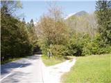
First, we drive to Kamnik, then we continue driving in the direction of Kamniška Bistrica and the cableway to Velika planina. In Stahovica we continue left (direction Kamniška Bistrica and cableway Velika planina) on the moderately ascending road, then we follow past the lower cableway station to Velika planina. Only a few 100 m ahead from the cableway to Velika planina, we reach a smaller hamlet named Kopišča. Here we turn right and then we park at an appropriate place by the road.
Route description:
From the starting point, we continue on a cart track which gently ascends through the forest. Higher the cart track becomes quite rough and gradually starts to ascend steeper and steeper. A bit higher, we will notice an old hunting path, which branches off from the cart track and then starts relatively steeply ascending. The path, which moderately to steeply ascends through the forest, higher brings us to old mining tunnels. The path ahead passes onto steep but still forest-covered grassy slopes. Further, the footpath for a short time flattens, then in zigzags starts steeply ascending through the forest. Higher, we come to the foot of very steep slopes, where with the help of a smaller wooden bridge we step into rocky terrain. Over a short very steep step a steel cable helps, and the path then passes onto steep and especially in wet slippery-dangerous grassy slopes. A little further, the path completely flattens, then for quite some time crosses the slopes towards the right.
The path ahead brings us to a nice viewpoint, after which the path soon passes onto a cart track and then past the hunting cottage brings us to a macadam road, on which in a few minutes we walk to the mountain pasture Dol, where there is a marked junction.
We continue left in the direction of Konj (right Velika planina) and continue the path across a gently sloping meadow, over which we ascend to the edge of the forest. The path ahead passes into the forest, where it turns right and gradually starts ascending steeper and steeper. Follows approximately 20 minutes of steep ascent through the forest, then the path brings us to a smaller viewpoint. Here the path turns left and also flattens somewhat. We continue on a moderately steep path, where from increasingly sparse forest we soon pass into the belt of dwarf pines. Follows a short ascent on a well-trodden path through dwarf pines and the path brings us to the mountain pasture Rzenik, on the edge of which we notice a shepherd's hut.
From the hut we continue on the marked path towards Konj (slightly left Rzenik via the western path, the path to Rzenik is not marked), which quickly brings us among dwarf pines. We continue the ascent on a moderately steep path, which still leads through dwarf pines. Higher the path brings us right by the main ridge, the path here turns right and continues ascending through dwarf pines. Only a few 10 steps of walking remain and the increasingly panoramic path quickly brings us to the summit of Konj.
The stamp box is located somewhat lower, namely in the direction towards Presedljaj. A short steep descent on a secured climbing path separates us from it.

Photos:
 1
1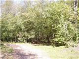 2
2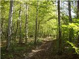 3
3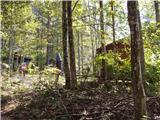 4
4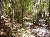 5
5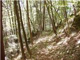 6
6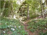 7
7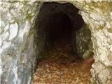 8
8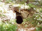 9
9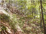 10
10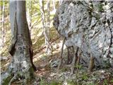 11
11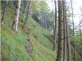 12
12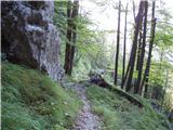 13
13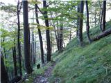 14
14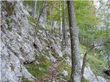 15
15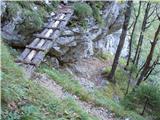 16
16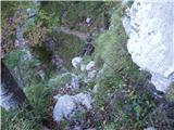 17
17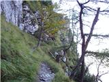 18
18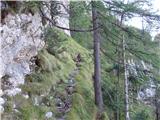 19
19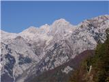 20
20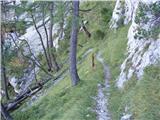 21
21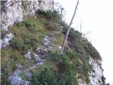 22
22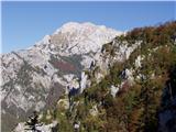 23
23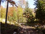 24
24 25
25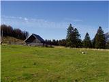 26
26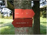 27
27 28
28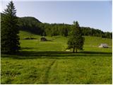 29
29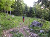 30
30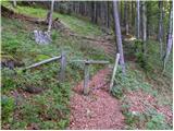 31
31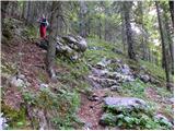 32
32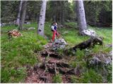 33
33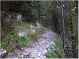 34
34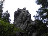 35
35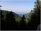 36
36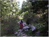 37
37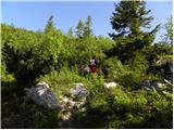 38
38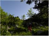 39
39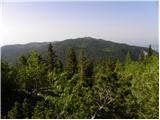 40
40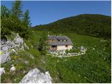 41
41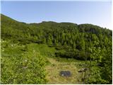 42
42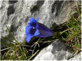 43
43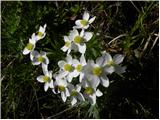 44
44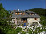 45
45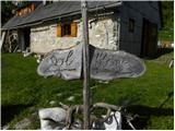 46
46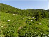 47
47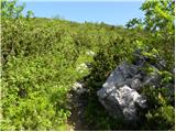 48
48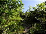 49
49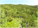 50
50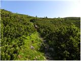 51
51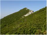 52
52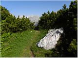 53
53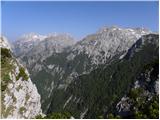 54
54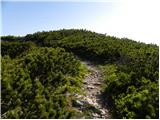 55
55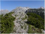 56
56 57
57
Discussion about the trip Kopišča - Konj (Martinj steza)
|
| pohodnik3813. 05. 2015 |
On Monday, May 11th, I took a day off and headed to Martinj steza which took me to planina Dol. Continued to Konj and later to Rzenik. Beautiful day, if only there were more like that. The path is OK too, especially Martinj steza impressed me even though I think it's not so easy to find, but I found it right away and even doubted it would be like that.
VIDEO
Best! Tone
|
|
|
|
| redbull13. 05. 2015 |
super. Me too
I have to hike it in the future. Last year I wanted to do it in the opposite direction but couldn't find it.
good luck
|
|
|
|
| pohodnik3814. 05. 2015 |
Thanks  I agree, in the opposite direction it's even harder to find if you haven't been before. At the bottom at the start it also looks completely different than described above. I just went up the cart track whatever happens I had time anyway and indeed when I reached the "saddle" as the description says there's a big rock opposite it and the path starts up the slope. I agree, in the opposite direction it's even harder to find if you haven't been before. At the bottom at the start it also looks completely different than described above. I just went up the cart track whatever happens I had time anyway and indeed when I reached the "saddle" as the description says there's a big rock opposite it and the path starts up the slope.
|
|
|
|
| nincokl9. 11. 2015 |
Hiked it on Saturday, it's really hard to find the start of the trail, a bit of leaves made searching harder, but once you find it, no more problems.. this will help someone... at this rock you turn right uphill, the trail is covered by some small fallen trees
|
|
|
|
| 11120. 11. 2015 |
The landscape and conditions change over time, and the description needs updates. After the glaze ice and bark beetle, the forested slope is no longer the same.
From the asphalt road at the end of Kopišča, a macadam forest road (logging track) branches off towards the slope, ascending ever steeper to the turning bay around the large rock. Here, find the path that starts on the right side of the incised "roundabout", among fallen trees and undergrowth. Later there are no issues, except for "detours" around fallen trees.
If approaching Martinj steza from above, follow the forest road continuing from Planina Dol past the last cabin westwards, past the hunting hut (on the left). After about a kilometer, when the road starts climbing steeper in the forest, notice the cart track branching left, which soon becomes a path harder to follow in autumn or winter due to leaf cover. Orientation issues end at the plateau edge, where the path descends amid ample views.
Otherwise, I advise against visiting Kopa, especially when wet, as the exposed path narrows, and the overgrown trail on very steep meadows is prone to slipping, where you can only grab grass blades. Even in dry conditions, crampons with ice axe would be advisable.
Bojan, 19.11.2015
|
|
|
|
| 75'er2. 08. 2016 |
The entrance from the forest road to Martinj steza was marked by someone with a large orange arrow, which appears a few more times along the path, although the path itself is well visible. I think a cairn for the visually impaired would be sufficient.
|
|
|
|
| Marx2. 08. 2016 |
It would be okay to mark the entrance to Martinj steza also from Planina Dol, where I searched for it but without success... They say the path is legendary and worth a walk along it...
|
|
|
|
| garmont2. 08. 2016 |
And that it gets marked too... 
|
|
|
|
| 75'er2. 08. 2016 |
It's nicer uphill. If anyone is interested, I can send them the GPX track. Let them send a private message.
|
|
|
|
| 75'er2. 08. 2016 |
I wasn't paying attention, given that they have trouble with the entrance. To me it didn't seem too hidden the first time.
|
|
|
|
| anak6. 10. 2018 |
Currently the gravel road (vlaka) from Kopišča is very overgrown, the path to the trenches is also harder to pass - further on the trail is without special features!
|
|
|
|
| trdi18. 08. 2019 |
Hiked today. Along the forest road to the end and then indeed at the big rock right up the hill, the path is clearly visible. But as the predecessor wrote, the lower part is very overgrown, at the exit to Planina Dol there are cairns at two spots, the path is also marked in Locus map. Recommend a helmet, because the upper part of the path runs under cliffs and above cliffs. In short, an interesting path.
|
|
|
|
| ljubitelj gora25. 04. 2022 00:43:51 |
Descended this path, the little bridge looks bad.
|
|
|
To post a comment you must log in:
If you do not yet have a username, you must first
register.