Kopišča - Kopa (Belska Kopa)
Starting point: Kopišča (550 m)
| Latitude/Longitude: | 46,30890°N 14,60820°E |
| |
Walking time: 2 h 30 min
Difficulty: partly demanding unmarked way
Elevation gain: 630 m
Elevation difference along the route: 630 m
Map: Grintovci
Recommended equipment (summer):
Recommended equipment (winter): ice axe, crampons
Views: 5.492
 | 5 people like this post |
Access to starting point:
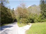
Through Kamnik we drive in the direction of Kamniška Bistrica and the cableway to Velika planina. Past the lower cableway station we drive a few hundred meters further to a larger clearing, where there is the hamlet Kopišča. At the end of the clearing on the right there is a passing place and a turn-off of the cart track, where we park.
Route description:
From the starting point, we continue on the cart track towards the east in a gentle ascent. Higher up the cart track turns towards the northeast and becomes increasingly rutted. Soon a well-beaten footpath branches off to the right from the cart track, which starts to ascend steeply on the slope of Kopa. Kopa is on our left side the whole time. Along the path we notice mine tunnels that remain from the extraction of bauxite in the 19th and the beginning of the 20th century. The path becomes narrower; it is still relatively easy to follow. We arrive in the gully between Martinj Turn and Kopa; the path turns to the right slope, where it ascends steeply in zigzags. When we arrive below the walls, we turn left into the steep slope to the grassy ridge. Here the path is poorly visible because of the grass. Be careful where a barely visible path branches off to the left through steep grass, while the current path continues to Martinj steza. We go on the small footpath to the left (north), first horizontally, then in zigzags to the saddle above the valley of Bela. Here left towards the summit of Kopa, because of the fallen burnt trees just make your own way up the southern slope of the ridge. After 15 minutes we reach the summit.

Photos:
 1
1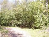 2
2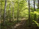 3
3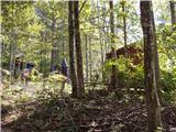 4
4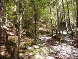 5
5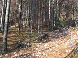 6
6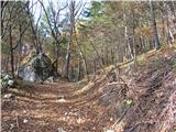 7
7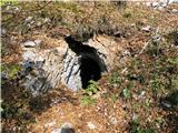 8
8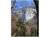 9
9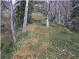 10
10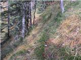 11
11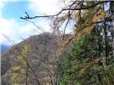 12
12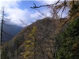 13
13 14
14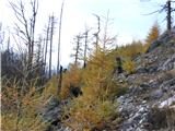 15
15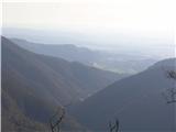 16
16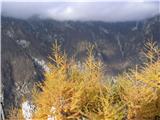 17
17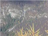 18
18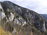 19
19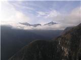 20
20 21
21
Discussion about the trip Kopišča - Kopa (Belska Kopa)
|
| franca23. 06. 2014 |
Right from the starting point, new clearings have been made due to this year's ice storm, we have to go east to the end. For now, the lower part, all the way to the mine tunnels, is still full of fallen trees. It's impossible to follow the path, best to climb up to the ridge above the path, as it's at least somewhat passable there, with some climbing over trees and detours. Probably this condition will last for quite some time.
|
|
|
|
| simon1625. 09. 2022 11:14:41 |
Yesterday I climbed this summit on the way when returning from Konj via Martinj trail. The junction is barely noticeable and the path to the top is poorly trodden. A small cairn is placed at the junction from Martinj trail and I placed a few new ones further on.
|
|
|
|
| ločanka31. 05. 2023 15:22:36 |
Yesterday on this path. The junction from Martinj steza is barely noticeable, no cairn was visible. So we initially missed it and continued past the junction. Otherwise, still a very narrow path on very steep terrain. At the mentioned saddle, you have to go a bit lower under it to the left and reach another saddle, then continue along the ridge.
The return is worth considering whether you really want to repeat that annoying traverse again. If you don't intend to continue along Martinj steza, it's best to descend directly down the gully from the saddle and reach the marked path again near the supported boulder. Otherwise, great peak and tour!
|
|
|
|
| garmont31. 05. 2023 17:05:57 |
I notice that someone is diligently knocking down cairns in these parts. 
|
|
|
To post a comment you must log in:
If you do not yet have a username, you must first
register.