Koprivna (Kumer) - Šoparjev vrh
Starting point: Koprivna (Kumer) (1172 m)
| Latitude/Longitude: | 46,49030°N 14,72840°E |
| |
Walking time: 1 h 10 min
Difficulty: easy unmarked way
Elevation gain: 352 m
Elevation difference along the route: 352 m
Map: Koroška 1:50.000
Recommended equipment (summer):
Recommended equipment (winter):
Views: 1.550
 | 1 person like this post |
Access to starting point:
A) First, we drive to Luče (to here from Kamnik over the mountain pass Volovjek (Kranjski Rak) or from the Štajerska highway and past Mozirje and through Ljubno ob Savinji), then we continue driving in the direction of Logarska dolina. When we arrive in Solčava, we leave the main road and continue driving right towards Črna na Koroškem. Further, we drive on an ascending road, which we follow at the crossroads in the direction of Črna na Koroškem and the mountain pass Spodnje Sleme. From the pass onwards, the road starts descending, and we follow it to the spot where we join the road Črna na Koroškem - Koprivna. Here we continue left, then at the next crossroad approximately 1 km ahead right towards the mountain hut on the farm Kumer. Further, we ascend along the Koprivna stream, and we follow the road to the crossroad where the road branches off sharply to the left towards the previously mentioned hut, straight ahead the road continues towards the mountain pasture Luža, and to the right a marked mountain path branches off to Peca (this one also initially follows the road). We park in an appropriate place by the road.
B) From Koroška, we first drive to Črna na Koroškem, then we continue driving towards Podpeca and Koprivna. At the crossroad where the road towards Podpeca branches off to the right, we continue slightly left, and likewise at the next crossroad where the road branches off to the right into the Topla valley. Further, we drive along the Meža river for some time, then we first arrive at the crossroad where the road branches off to the left towards the mountain pass Spodnje Sleme and further towards Logarska dolina. Here we continue straight, then at the next crossroad approximately 1 km ahead right towards the mountain hut on the farm Kumer. Further, we ascend along the Koprivna stream, and we follow the road to the crossroad where the road branches off sharply to the left towards the previously mentioned hut, straight ahead the road continues towards the mountain pasture Luža, and to the right a marked mountain path branches off to Peca (this one also initially follows the road). We park in an appropriate place by the road.
C) First, we drive to Šoštanj, then we continue driving on a winding road towards Črna na Koroškem. In Črna na Koroškem, we continue left in the direction of Podpeca and Koprivna. At the crossroad where the road towards Podpeca branches off to the right, we continue slightly left, and likewise at the next crossroad where the road branches off to the right into the Topla valley. Further, we drive along the Meža river for some time, then we first arrive at the crossroad where the road branches off to the left towards the mountain pass Spodnje Sleme and further towards Logarska dolina. Here we continue straight, then at the next crossroad approximately 1 km ahead right towards the mountain hut on the farm Kumer. Further, we ascend along the Koprivna stream, and we follow the road to the crossroad where the road branches off sharply to the left towards the previously mentioned hut, straight ahead the road continues towards the mountain pasture Luža, and to the right a marked mountain path branches off to Peca (this one also initially follows the road). We park in an appropriate place by the road.
Route description:
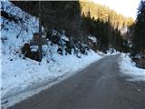
From the starting point in Koprivna we continue on the right road in the direction of Šopar, Ledrovec, Topla and the marked path to Peca (straight and then after a few meters sharply left Kumer). The road on which we continue quickly splits, and we choose the slightly left road (right Šopar and Debelak), from which after approximately 10 minutes a marked footpath branches off to the left to Peca.
We continue further on the macadam road, which brings us past a chapel out of the forest, where with nice views we reach the homestead Ledrovec. Above the homestead the road makes a few hairpin turns, then returns into the forest. When we return to the forest, the road gradually flattens, then for some time in a gentle ascent it crosses the slopes to the left.
When the road starts to descend lightly, we reach the saddle between the valleys Koprivna and Topla, and by the snow gauge we continue right onto a cart track. The cart track quickly enters dense forest, and we then follow the unmarked path to the nearby Šoparjev vrh, from which a nice view opens towards Peca and Topla.
Description and pictures refer to the condition in 2017 (November).

Along the route: Ledrovec (1305m), Preval (1413m)
Photos:
 1
1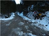 2
2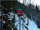 3
3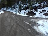 4
4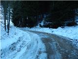 5
5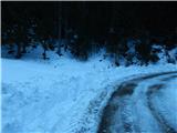 6
6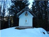 7
7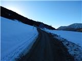 8
8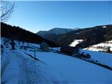 9
9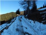 10
10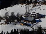 11
11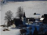 12
12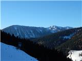 13
13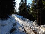 14
14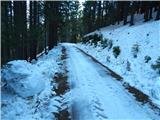 15
15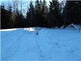 16
16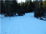 17
17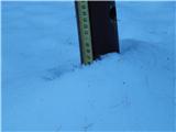 18
18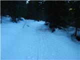 19
19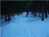 20
20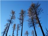 21
21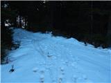 22
22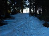 23
23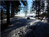 24
24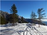 25
25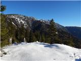 26
26 27
27
Discussion about the trip Koprivna (Kumer) - Šoparjev vrh
To post a comment you must log in:
If you do not yet have a username, you must first
register.