Korensko sedlo - Ofen/Peč
Starting point: Korensko sedlo (1072 m)
| Latitude/Longitude: | 46,51720°N 13,75140°E |
| |
Walking time: 2 h
Difficulty: easy marked way
Elevation gain: 436 m
Elevation difference along the route: 500 m
Map: Kranjska Gora 1:30.000
Recommended equipment (summer):
Recommended equipment (winter):
Views: 19.190
 | 2 people like this post |
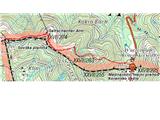
Access to starting point:
Kranjska Gora - Podkoren. We drive to the border crossing Korensko sedlo (Wurzenpass). We park at the border crossing (Slovenian or Austrian side).
The entire excursion takes place on the Austrian side.
Route description:
We look for the blazes in the forest immediately after the inn on the Austrian side of the border crossing (sign for path 603). First, the path goes through the forest on a quite flat section (back towards the Slovenian border), then it steeply ascends and winds on a forest clearing (which is visible also from the border crossing). After approx. 350 meters of elevation we come to a macadam forest road and follow the blazes, which direct us to the left. At the next junction we go right slightly uphill and follow the main macadam road and the blazes.
Later the blazes direct us onto a forest footpath and after a few 10 meters we come out of the forest onto pastures, where in the distance we already see the final station of the chairlift. From there we descend to the hut (Dreilandereck hutte) and ascend to the final destination Peč - Tromeja.
We return by the same path.
Photos:
 1
1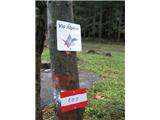 2
2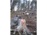 3
3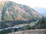 4
4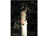 5
5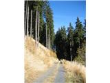 6
6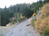 7
7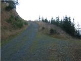 8
8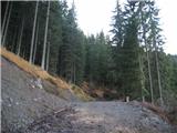 9
9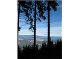 10
10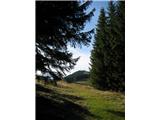 11
11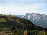 12
12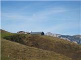 13
13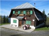 14
14 15
15
Discussion about the trip Korensko sedlo - Ofen/Peč
|
| darh24. 09. 2010 |
The day before this year's traditional three-country meeting at Peč, we also climbed up to it along this described path. On the way, we visited the neighboring Petelinjek. In beautiful weather, the wonderful views thrilled us. More about our impressions here.
|
|
|
|
| mad matheuss5. 06. 2014 |
Has anyone hiked here recently? Is there any fallen timber?
|
|
|
|
| Janezs6. 06. 2014 |
14 days ago the path was OK. At three places a bit to step over trees lying across the path. Descent to Rateče without obstacles. Lp.
|
|
|
To post a comment you must log in:
If you do not yet have a username, you must first
register.