Starting point: Koroška Bela (600 m)
| Latitude/Longitude: | 46,42640°N 14,10310°E |
| |
Walking time: 40 min
Difficulty: easy unmarked way
Elevation gain: 246 m
Elevation difference along the route: 246 m
Map: Karavanke - osrednji del 1:50.000
Recommended equipment (summer):
Recommended equipment (winter): ice axe, crampons
Views: 8.856
 | 3 people like this post |
Access to starting point:
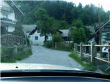
From the Ljubljana - Jesenice highway, take the Lipce exit and drive right towards Jesenice. At the first traffic-light intersection (Javornik), drive right in the direction of Lj. Next follows the second intersection with traffic lights, where we turn left and drive under the railway underpass, and in the next smaller intersection we turn right towards Koroška Bela. We drive into the village, which runs towards the northeast, where we park at an appropriate place (e.g., apartment complex near the fire station). We can also continue driving.
Route description:
(On foot or by car) we look for the intersection in the center of the village, where a church landmark stands. From here we head along the main road through the village, which goes barely noticeably uphill towards the northeast. After approx. 100 m on the right we cross the bridge over the Bela stream, where nearby (Stranska pot street) we can notice blazes marking the path to Valvazorjev dom. We continue on the asphalt road between two houses (courtyard-like appearance), which here turns right, slightly uphill.
After some 10 m we step off the road to the left onto a cart track, along which we begin ascending eastwards, towards the forest. Soon, when the cart track (path) turns left, a path joins it from the right at the streamlet, but we continue left on the cart track, which then turns right uphill. Soon we encounter a path branching off to the right, where we continue left on the cart track, then also one to the left, where we continue right, which basically means that we always stick to the main, most trodden and rutted cart track. This later turns left, quite steeply uphill, towards the north. When the steepness begins to ease, we encounter an apparently triple fork, where we continue left, soon also crossing a streamlet. From here onwards we look for the well-trodden path along the left side of the cart track, which we follow to a wooden hut standing on the edge of a smaller dell. Here we turn perpendicularly left onto the forest ridge of Malnež, along which a nice path quickly brings us to the western edge, where it turns slightly left and along a (less necessary, thinner and loose) steel cable brings us to the viewpoint with a bench and a large cross.

Photos:
 1
1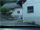 2
2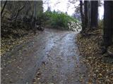 3
3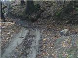 4
4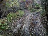 5
5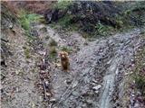 6
6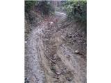 7
7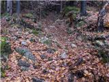 8
8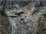 9
9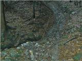 10
10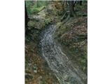 11
11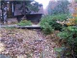 12
12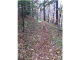 13
13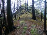 14
14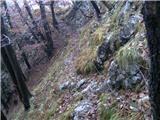 15
15 16
16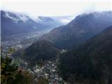 17
17
Discussion about the trip Koroška Bela - Malnež
|
| Sandrca4. 03. 2016 |
There is no wooden hut anymore. (or maybe I didn't take the right path  ) )
|
|
|
|
| heinz5. 03. 2016 |
Yes, the hut burned down a while ago
|
|
|
To post a comment you must log in:
If you do not yet have a username, you must first
register.